
The Guadalupe River mainstem is an urban, northward flowing 14 miles (23 km) river in California whose much longer headwater creeks originate in the Santa Cruz Mountains. The river mainstem now begins on the Santa Clara Valley floor when Los Alamitos Creek exits Lake Almaden and joins Guadalupe Creek just downstream of Coleman Road in San Jose, California. From here it flows north through San Jose, where it receives Los Gatos Creek, a major tributary. The Guadalupe River serves as the eastern boundary of the City of Santa Clara and the western boundary of Alviso, and after coursing through San José, it empties into south San Francisco Bay at the Alviso Slough.

Coyote Creek is a river that flows through the Santa Clara Valley in Northern California. Its source is on Mount Sizer, in the mountains east of Morgan Hill. It eventually flows into Anderson Lake in Morgan Hill and then northwards through Coyote Valley to San Jose, where it empties into San Francisco Bay.

Castaic Dam is an embankment dam in northwestern Los Angeles County, California, in the unincorporated area of Castaic. Although located on Castaic Creek, a major tributary of the Santa Clara River, Castaic Creek provides little of its water. The lake is the terminus of the West Branch of the California Aqueduct, part of the State Water Project. The dam was built by the California Department of Water Resources and construction was completed in 1973. The lake has a capacity of 325,000 acre-feet (401,000,000 m3) and stores drinking water for the western portion of the Greater Los Angeles Area.

Vasona Lake County Park is a park located in Los Gatos, California and part of the Santa Clara County Parks system. Vasona Park surrounds the Vasona Reservoir. Adjacent to the park are the Billy Jones Wildcat Railroad, a ridable miniature railway, and the W.E. "Bill" Mason Carousel at the Oak Meadow Park.

The San Luis Reservoir is an artificial lake on San Luis Creek in the eastern slopes of the Diablo Range of Merced County, California, approximately 12 mi (19 km) west of Los Banos on State Route 152, which crosses Pacheco Pass and runs along its north shore. It is the fifth largest reservoir in California. The reservoir stores water taken from the San Joaquin-Sacramento River Delta. Water is pumped uphill into the reservoir from the O'Neill Forebay which is fed by the California Aqueduct and is released back into the forebay to continue downstream along the aqueduct as needed for farm irrigation and other uses. Depending on water levels, the reservoir is approximately nine miles (14 km) long from north to south at its longest point, and five miles (8 km) wide. At the eastern end of the reservoir is the San Luis Dam, the fourth largest embankment dam in the United States, which allows for a total capacity of 2,041,000 acre-feet (2,518,000 dam3). Pacheco State Park lies along its western shores.
Piru Creek is a major stream, about 71 miles (114 km) long, in northern Los Angeles County and eastern Ventura County, California. It is a tributary of the Santa Clara River, the largest stream system in Southern California that is still relatively natural.

Bouquet Reservoir is an artificial lake in the Angeles National Forest of Los Angeles County, California about 15 miles (24 km) west from Palmdale.

Redwood Estates is a rural unincorporated community along State Route 17 in the coastal Santa Cruz Mountains in Los Gatos, California, United States. The Census Bureau includes it in a census-designated place named Lexington Hills. It lies inside the confines of Santa Clara County. The area is about eight miles from downtown Los Gatos and nine miles from the Santa Cruz County community of Scotts Valley.

The Los Gatos Creek runs 24 miles (39 km) in California through Santa Clara Valley Water District's Guadalupe Watershed from the Santa Cruz Mountains northward through the Santa Clara Valley until its confluence with the Guadalupe River in downtown San Jose. The Guadalupe River then continues onward into San Francisco Bay.
The Santa Clara Valley Water District provides stream stewardship, wholesale water supply and flood protection for Santa Clara County, California, in the southern San Francisco Bay Area. The district encompasses all of the county's 1,300 square miles (3,400 km2) and serves the area's 15 cities, 2 million residents and more than 200,000 commuters. In terms of acres, the district includes 138,000 acres, and 120,700 of those acres are lands that people have built cities, roads or cultivate farms on. Almost 2,000 pumping wells supply the districts fields, houses and businesses with a clean reliable source of water. The water district has about 150 miles of pipelines and operates 10 dams and reservoirs, three treatment plants, many groundwater recharge basins, three pump stations and an advanced water purification plant. The district's three water treatment plants can produce as much as 210,000,000 US gallons (800,000 m3) of drinking water a day.

The Guadalupe River watershed consists of 170 square miles (400 km2) of land within northern California's Santa Clara County. The surface runoff from this area drains into the Guadalupe River, its tributary streams, reservoirs or other bodies of water which all eventually gets carried into the San Francisco Bay. Essentially, all the water from the creeks and rivers that make up the Guadalupe watershed, including water from storm drains, flows into the Guadalupe River, and then flows downstream into the San Francisco Bay at the Alviso Slough in Alviso. The Guadalupe watershed's main tributaries include Los Gatos Creek, Trout Creek, Hendrys Creek, Ross Creek, Pheasant Creek, Rincon Creek, Herbert Creek, and Golf Creek. Six major reservoirs exist in the watershed: Calero Reservoir on Arroyo Calero, Guadalupe Reservoir on Guadalupe Creek, Almaden Reservoir on Los Alamitos Creek, Vasona Reservoir, Lexington Reservoir, and Lake Elsman on Los Gatos Creek.

Lexington Reservoir is an artificial lake on the Los Gatos Creek near Los Gatos, California. The James J. Lenihan Dam, a 195 ft (59 m) high, 1,000 ft (300 m) thick earthen dam, forms the third-largest reservoir in Santa Clara County.

Coyote Lake is an artificial lake in Santa Clara County, California, between Morgan Hill and Gilroy.

Alma is a ghost town and drowned town in Santa Clara County in California, United States. It lies beneath the waters of the Lexington Reservoir above Los Gatos. The location is latitude 37.18N and longitude 121.98W. It was 551 feet above sea level.

Anderson Lake, also known as Anderson Reservoir, is an artificial lake in Morgan Hill, located in southern Santa Clara County, California. The reservoir is formed by the damming of Coyote Creek just below its confluence with Las Animas Creek. A 4,275-acre (1,730 ha) county park surrounds the reservoir and provides limited fishing, picnicking, and hiking activities. Although swimming is prohibited, boating, water-skiing, and jet-skiing are permitted in the reservoir.
Calero Reservoir, also called Calero Lake, is a reservoir in San Jose, California, located in the Calero neighborhood of Almaden Valley in South San Jose. It is the site of Calero County Park, which also includes a large area covering the lake and hundreds of acres of hills around it.
Pacheco Reservoir is a man-made reservoir in the Diablo Range in California, U.S.A. The lake is formed by a dam on the north fork of Pacheco Creek, whose waters reach Monterey Bay by way of the Pajaro River. The Pacheco Pass Water District is currently responsible for operation and maintenance of the Pacheco Reservoir. Located north of State Route 152 in eastern Santa Clara County, the lake is about an hour's drive from downtown San Jose.
Vasona Reservoir is an artificial lake located in Los Gatos, California, United States. A 152-acre (62 ha) county park surrounds the reservoir and provides limited fishing, picnicking, and informal play activities. Although swimming is not allowed, human-powered boating is permitted in the reservoir.
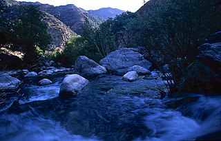
Trout Creek is a 1.8-mile-long (2.9 km) southeastward-flowing stream originating in the Santa Cruz Mountains, a tributary of Los Gatos Creek in Santa Clara County, California. From its confluence with Los Gatos Creek, its waters flow to the Guadalupe River and thence through San Jose, California to south San Francisco Bay.
