Clearwater is a river of southern Alberta, Canada. Situated entirely in the Canadian Rockies and the Rocky Mountain foothills of Alberta, it is a glacier fed upper reach tributary of the North Saskatchewan River. The upper reach of the Clearwater has become popular for equestrian travelers due to the natural setting along the river.

Carvel is a hamlet in Alberta, Canada within Parkland County. It is located on Highway 770, approximately 35 kilometres (22 mi) west of Edmonton. The hamlet's name is derived from the novel Richard Carvel by the American writer Winston Churchill.

Cherhill is a hamlet in Alberta, Canada within Lac Ste. Anne County. It is located along Highway 43, approximately 35 kilometres (22 mi) east of Mayerthorpe and 82 kilometres (51 mi) northwest of Edmonton.
Rocky Rapids is a hamlet in central Alberta, Canada within Brazeau County. It is located 1.6 km (0.99 mi) east of Highway 22, approximately 7 km (4.3 mi) north of Drayton Valley.
Duffield is a hamlet in central Alberta, Canada within Parkland County. It is located 5 kilometres (3.1 mi) south of Highway 16, approximately 30 kilometres (19 mi) west of Spruce Grove.
Fallis is a hamlet in central Alberta, Canada within Parkland County. It is located on Highway 16, approximately 49 kilometres (30 mi) west of Spruce Grove.
Flatbush is a hamlet in northern Alberta, Canada within the Municipal District of Lesser Slave River No. 124. It is located 3 kilometres (1.9 mi) south of Highway 44, approximately 135 kilometres (84 mi) northwest of Edmonton.
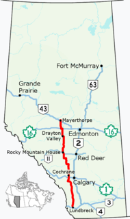
Glenevis is a hamlet in central Alberta, Canada within Lac Ste. Anne County. It is located on Highway 43, approximately 71 kilometres (44 mi) northwest of Edmonton.
Jean Cote, or Jean Côté, is a hamlet in northern Alberta, Canada within the Municipal District of Smoky River No. 130. It is located approximately 11 kilometres (6.8 mi) west of Highway 2 and 123 kilometres (76 mi) northeast of Grande Prairie.
Keephills is a hamlet in central Alberta, Canada within Parkland County. It is located approximately 19 kilometres (12 mi) south of Highway 16 and 64 kilometres (40 mi) southwest of Edmonton. A nearby employer is the Keephills Generating Station.
Leedale is a hamlet in central Alberta, Canada within Ponoka County. It is located 6 kilometres (3.7 mi) south of Highway 53, approximately 59 kilometres (37 mi) northwest of Red Deer.
Manola is a hamlet in central Alberta within the County of Barrhead No. 11, located 6 kilometres (3.7 mi) south of Highway 18, approximately 65 kilometres (40 mi) northwest of St. Albert.
Pine Sands is a hamlet in central Alberta, Canada within Sturgeon County. It is located approximately 13 kilometres (8.1 mi) west of Highway 44 and 29 kilometres (18 mi) northwest of Edmonton's city limits.
Rich Valley is a hamlet in central Alberta, Canada within Lac Ste. Anne County. It is located on Highway 33, approximately 70 kilometres (43 mi) northwest of Edmonton.
Smith is a hamlet in northern Alberta, Canada within the Municipal District of Lesser Slave River No. 124. It is located on Highway 2A, approximately 182 kilometres (113 mi) northwest of Edmonton, at the confluence of the Lesser Slave River and the Athabasca River.
Sunnybrook is a hamlet in central Alberta, Canada within Leduc County. It is located on Highway 39, approximately 43 kilometres (27 mi) west of Leduc.
Telfordville is a hamlet in central Alberta, Canada within Leduc County. It is located just off Highway 622, approximately 41 kilometres (25 mi) west of Leduc.
Thunder Lake is a hamlet in central Alberta within the County of Barrhead No. 11. It is located on the eastern shore of Thunder Lake, just south of Thunder Lake Provincial Park, and is about 5 kilometres (3.1 mi) west of Highway 18 and approximately 21 kilometres (13 mi) west of Barrhead.
Wagner is a hamlet in northern Alberta, Canada within the Municipal District of Lesser Slave River No. 124. It is located 0.5 kilometres (0.3 mi) north of Highway 2, approximately 223 kilometres (139 mi) northwest of Edmonton. It has an elevation of 585 m (1,919 ft).
Marten Beach is a hamlet in northern Alberta, Canada within the Municipal District of Lesser Slave River No. 124. It is located on the northeast shore of Lesser Slave Lake, 2 kilometres (1.2 mi) west of Highway 88. It is approximately 36 kilometres (22 mi) north of the Town of Slave Lake and 238 kilometres (148 mi) northwest of the City of Edmonton.