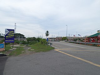
Jasin Square | |
---|---|
Dataran Jasin | |
General information | |
Type | Town square |
Location | Jasin, Melaka, Malaysia |
The Jasin Square (Malay : Dataran Jasin) is a town square in Jasin Town, Jasin District, Melaka, Malaysia. [1] [2] [3]
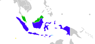
Malay is a major language of the Austronesian family spoken in Brunei, Indonesia, Malaysia and Singapore, as well as parts of Thailand. A language of the Malays, it is spoken by 290 million people across the Strait of Malacca, including the coasts of the Malay Peninsula of Malaysia and the eastern coast of Sumatra in Indonesia and has been established as a native language of part of western coastal Sarawak and West Kalimantan in Borneo. It is also used as a trading language in the southern Philippines, including the southern parts of the Zamboanga Peninsula, the Sulu Archipelago and the southern predominantly Muslim-inhabited municipalities of Bataraza and Balabac in Palawan.
A town square is an open public space commonly found in the heart of a traditional town used for community gatherings. Other names for town square are civic center, city square, urban square, market square, public square, piazza, plaza, and town green.
The Jasin District is a district in Melaka, Malaysia. Jasin District is the southernmost of districts in Melaka and borders the State of Johor. The district capital is Jasin Town.
The square features facilities such as reflection place, playground, stage, rest hut and extreme sport area.
Bukit Beruang is an area in Central Melaka District, Melaka, Malaysia. The most famous landmark in Bukit Beruang is the Multimedia University, a private university owned by Telekom Malaysia, a Malaysian telecommunication company.
Pajam is a small town in Negeri Sembilan, Malaysia.
The National Circuit Grand Prix Finals is a tournament organized by the Badminton Association of Malaysia to crown the best badminton players in Malaysia. The tournament started in the 1980s and is held annually.
Pulau Sebang is a mukim in Alor Gajah District, Melaka, Malaysia.
FELDA Kemendor or FELDA Tun Ghafar Baba Kemendor is a FELDA settlement in Melaka, Malaysia.
The Chitty Museum is a museum in Melaka City, Melaka, Malaysia. The museum is about the minority Chitty community which are found in Malaysia and Singapore. The museum is located within Chitty Village area.
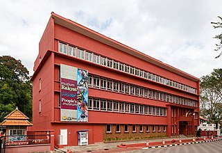
The People's Museum is a museum in Malacca City, Malacca, Malaysia. The museum records and preserves the achievements of Malacca in the development sector. The museum building receives around 2,000 visitors every month.
The Melaka Planetarium is a planetarium in Ayer Keroh, Central Melaka District, Melaka, Malaysia.
The Kite Museum is a museum in Melaka City, Melaka, Malaysia. The museum building receives around 2,000 visitors every month.
The Governor's Museum is a museum in St. Paul's Hill, Malacca City, Malacca, Malaysia.
The Mahkota Parade is a shopping mall in Melaka City, Melaka, Malaysia.
The Macau Gallery Melaka is a gallery about Macao in Bukit Peringgit, Melaka, Malaysia. Both Malacca and Macao were Portuguese colonies.
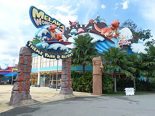
The Melaka Wonderland is a water theme park and resort in Ayer Keroh, Melaka, Malaysia.
The Malacca Crocodile Farm is a crocodile farm in Ayer Keroh, Malacca, Malaysia. The farm is the largest crocodile farm in Malaysia.
The Alor Gajah Square or Keris Square is a town square in Alor Gajah Town, Alor Gajah, Melaka, Malaysia.
The Agricultural Museum is a museum about agriculture in Jasin Town, Jasin District, Melaka, Malaysia.
The Melaka House is a gallery in Bukit Katil, Melaka, Malaysia to promote wooden handmade products by the local people.
The Melaka Butterfly and Reptile Sanctuary is a zoo in Ayer Keroh, Melaka, Malaysia.
The Demang Abdul Ghani Gallery is a gallery about Demang Abdul Ghani in Merlimau, Jasin, Melaka, Malaysia. The gallery building is sometimes called the Merlimau Palace.
The Bastion Middleburg is a bastion in Melaka City, Melaka, Malaysia located at the mouth of Melaka River.
This article about a Malaysian building or structure is a stub. You can help Wikipedia by expanding it. |
Coordinates: 2°18′18.6″N102°25′20.2″E / 2.305167°N 102.422278°E
A geographic coordinate system is a coordinate system that enables every location on Earth to be specified by a set of numbers, letters or symbols. The coordinates are often chosen such that one of the numbers represents a vertical position and two or three of the numbers represent a horizontal position; alternatively, a geographic position may be expressed in a combined three-dimensional Cartesian vector. A common choice of coordinates is latitude, longitude and elevation. To specify a location on a plane requires a map projection.