Womenswold is a village and civil parish centred 7 miles (11 km) south-east of Canterbury, Kent, England, 1 mile to the east of the A2 road. The parish consists of three hamlets: Womenswold, Woolage Village and Woolage Green.

Rosice is a village in Pardubice Region of the Czech Republic. It has around 1,300 inhabitants.

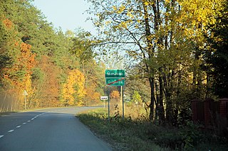
Mroczkowice is a village in the administrative district of Gmina Mirsk, within Lwówek Śląski County, Lower Silesian Voivodeship, in south-western Poland, close to the Czech border. Prior to 1945 it was in Germany.
Monkswood is a village in Monmouthshire, south east Wales, United Kingdom.

Kanclerzowice is a village in the administrative district of Gmina Żmigród, within Trzebnica County, Lower Silesian Voivodeship, in south-western Poland. Prior to 1945 it was in Germany.

Wiewiórka is a village in the administrative district of Gmina Bolesławiec, within Wieruszów County, Łódź Voivodeship, in central Poland. It lies approximately 4 kilometres (2 mi) north-east of Bolesławiec, 12 km (7 mi) south-east of Wieruszów, and 107 km (66 mi) south-west of the regional capital Łódź.

Mianówek is a village in the administrative district of Gmina Szulborze Wielkie, within Ostrów Mazowiecka County, Masovian Voivodeship, in east-central Poland. It lies approximately 2 kilometres (1 mi) west of Szulborze Wielkie, 22 km (14 mi) east of Ostrów Mazowiecka, and 102 km (63 mi) north-east of Warsaw.
Julianów is a village in the administrative district of Gmina Góra Kalwaria, within Piaseczno County, Masovian Voivodeship, in east-central Poland.

Białka is a village in the administrative district of Gmina Iłża, within Radom County, Masovian Voivodeship, in east-central Poland. It lies approximately 5 kilometres (3 mi) south-west of Iłża, 30 km (19 mi) south of Radom, and 121 km (75 mi) south of Warsaw.
Sosna-Korabie is a village in the administrative district of Gmina Suchożebry, within Siedlce County, Masovian Voivodeship, in east-central Poland.

Kościerzyn Wielki is a village in the administrative district of Gmina Wyrzysk, within Piła County, Greater Poland Voivodeship, in west-central Poland. It lies approximately 7 kilometres (4 mi) north of Wyrzysk, 36 km (22 mi) east of Piła, and 93 km (58 mi) north of the regional capital Poznań.

Drużyna is a village in the administrative district of Gmina Mosina, within Poznań County, Greater Poland Voivodeship, in west-central Poland. It lies approximately 5 kilometres (3 mi) south of Mosina and 22 km (14 mi) south of the regional capital Poznań.

Pypkowo is a village in the administrative district of Gmina Stężyca, within Kartuzy County, Pomeranian Voivodeship, in northern Poland. It lies approximately 2 kilometres (1 mi) south of Stężyca, 23 km (14 mi) south-west of Kartuzy, and 49 km (30 mi) south-west of the regional capital Gdańsk.
Saka parish is an administrative unit of the Pāvilosta Municipality, Latvia. The parish has a population of 626 and covers an area of 318.292 km2.

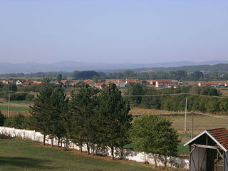
Rudare is a village in the municipality of Leskovac, Serbia. According to the 2002 census, the village has a population of 551 people.
Santovi is a village in Järva Parish, Järva County in northern-central Estonia.
Läti is a village in Märjamaa Parish, Rapla County in western Estonia.

Plopi is a village in the Rîbnița District of Transnistria, Moldova. It is currently under the administration of the breakaway government of the Transnistrian Moldovan Republic.

Đurevići is a village in the municipality of Višegrad, Bosnia and Herzegovina.

Lääne-Nigula Parish is a rural municipality of Estonia, in Lääne County. It has a population of 3,861 and an area of 507 km².


