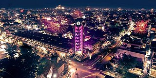
Jalgaon is one of the largest cities in the state of Maharashtra, India. The city is located in North Maharashtra in the subregion of Khandesh, and serves as the administrative headquarters of its namesake district, the Jalgaon district. In the subregion of Khandesh, Jalgaon is the second largest city behind Nashik. Situated on Asian Highway 53 and 76.3 Km from 'Ajanta Caves'. The Girna river flows from the western part of the city. Jalgaon is colloquially known as the "Banana city of India" as the region's farmers grow approximately two-thirds of Maharashtra's banana production.

The Purna River is a river of Central and Western India. It is one of the chief tributaries of the Tapti river and empties into it at Changdev in Jalgaon, Maharashtra.
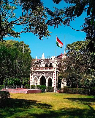
Jalgaon district is a district in Maharashtra, India. Its headquarters is the Jalgaon city.
Muktainagar is a town in Jalgaon district, Maharashtra, India. It is the administrative headquarter of its eponymous taluka. It is located in North Maharashtra region.
Yawal is a taluka, city and a municipal council in Jalgaon, Maharashtra, India.
Jalgaon Jamod is a town in Buldhana district of Indian state of Maharashtra.
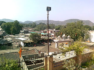
Raver, is a city and municipal council in Jalgaon district,renowned for its agricultural significance, particularly as a major banana-producing area. Often referred to as part of the "banana belt" of Jalgaon, Raver contributes significantly to the district's economy through banana exports, reaching markets across India and abroad. The town is characterized by its beautiful old architecture and ancient temples, reflecting a rich cultural heritage. It is also known for its scenic surroundings, with the nearby Pal Hill Station offering a retreat into nature with its diverse flora and fauna. As a hub of agricultural production and cultural history, Raver plays a crucial role in the region's development..Raver is famous for the Bhagvan Dattatreya-temple which is 200 years old and was founded by Sachidanand Swami Maharaj. Built in the old wooden tradition, it also has some ancient photos of Bhagvan Dattatreya in form of Malaang Fakir, Bhagwan Dattreyay's Charan Paduka...!
Gadhali is a village in Jalgaon district of Maharashtra, India. It is located in the Amalner taluka. In 2001, it had a population of 2640.
Jalgaon Rural Assembly constituency is one of the eleven constituencies of the Maharashtra Vidhan Sabha located in the Jalgaon district.
Bhadgaon Is A City And Tehsil Located In The Jalgaon District Of The Indian State Of Maharashtra. Its Population Is Approximately 45,000-50,000 People. Pachora-Bhadgaon Known As The Twin City. Nagerdeola Railway Station Serves Bhadgaon City. Bhadgaon City Urban Area 48.27 km2, Consist Of Four Suburbs Bhadgaon, Tongaon, Karab, Wadhade. City Located On One Nashik-Jalgaon National Highway 753J And One Nashik-Jalgaon State Highway 25. Jalgaon City Which Is The Administrative Headquarters Of The District In Nashik Division Of Maharashtra State. Bhadgaon City Is Located 367 Km From Capital Mumbai And 354 Km From Cultural Capital Pune.

Jalgaon (Jamod) is a constituency of Maharashtra Vidhan Sabha. It located in the Buldhana district. It is a part of the Buldhana Lok Sabha constituency.

Jalgaon City Assembly constituency is one of the 288 Vidhan Sabha constituencies in the Khandesh subregion of Maharashtra state in western India.
Asoda is a village in Jalgaon District, Maharashtra state in western India, located on the northern Deccan Plateau. It is 5 kilometres (3.1 mi) from Jalgaon, located within the irrigated agricultural region of Khandesh. The main occupation of people in Asoda is farming of cotton, black gram, green gram.

Padmalaya is a village in Erandol taluka of Jalgaon district, Maharashtra, India. It lies 10 km from Erandol and 31.5 km from the district headquarters of Jalgaon. The village is known for the Ganesha temple. A pond is located near this temple.
Amadade, is located in Bhadgaon Taluka, Jalgaon district, Maharashtra, India. It is one of big villages in Jalgaon district with political influence. It belongs to Khandesh region. It belongs to Nashik Division. It is located 51 km towards west from District headquarters Jalgaon; 7 km from Bhadgaon; 366 km from State capital Mumbai.
Amadade Pin code is 424105 and postal head office is Bhadgaon. In Amadade, there is very fertile soil due to River Girna.
Pal is a village situated in Satpura range on the bank of the Suki River in Raver tehsil in Jalgaon district of Maharashtra state of India.
Kingaon is a village in Yawal taluka of Jalgaon district, Maharashtra, India. It is located between the foot hill of Satpura mountain and the bank of Tapti River. Kingaon is 25 km from the city of Jalgaon. Majority of the population consisting of farmers with banana & onion as the major product.
Pilode is a village located in Amalner Tehsil of Jalgaon district in Maharashtra, India. It is situated 10 km away from sub-district headquarter Amalner and 65 km away from district headquarter Jalgaon.
Ghodasgaon is a village in Muktainagar taluka of Jalgaon district in Maharashtra. It is located near the Purna River in Muktainagar.
North Maharashtra is a geographical region of Maharashtra State, India. The region is composed of Nashik, Dhule, Nandurbar, and Jalgaon districts. It borders the state of Gujarat to the northwest, Paschim Maharashtra to the south, Konkan to the west, and the Vidarbha and Marathwada regions of Maharashtra to the east.

