The Adirondack Mountains are a massif of mountains in Northeastern New York which form a circular dome approximately 160 miles (260 km) wide and covering about 5,000 square miles (13,000 km2). The region contains more than 100 peaks, including Mount Marcy, which is the highest point in New York at 5,344 feet (1,629 m). The Adirondack High Peaks, a traditional list of 46 peaks over 4,000 feet (1,200 m), are popular hiking destinations. There are over 200 named lakes with the number of smaller lakes, ponds, and other bodies of water reaching over 3,000. Among the named lakes around the mountains are Lake George, Lake Placid, and Lake Tear of the Clouds. The region has over 1,200 miles (1,900 km) of river.

Keene is a town in central Essex County, New York, United States. It includes the hamlets of Keene, Keene Valley, and St. Huberts, with a total population of 1,144 as of the 2020 census

The Adirondack Park is a park in northeastern New York protecting the Adirondack Mountains. The park was established in 1892 for "the free use of all the people for their health and pleasure", and for watershed protection. At 6.1 million acres, it is the largest park in the contiguous United States.

The Catskill Park is in the Catskill Mountains in the U.S. state of New York. It consists of 700,000 acres of land inside a Blue Line in four counties: Delaware, Greene, Sullivan, and Ulster. As of 2005, 287,500 acres (116,300 ha) or 41 percent of the land within, is owned by the state as part of the Forest Preserve; it is managed by the Department of Environmental Conservation (DEC). Another 5% is owned by New York City to protect four of the city's reservoirs in the region that lie partially within the park and their respective watersheds.

Mount Marcy is the highest point in the U.S. state of New York, with an elevation of 5,343.1 feet (1,628.6 m). It is located in the town of Keene in Essex County. The mountain is in the heart of the High Peaks Wilderness Area in Adirondack Park. Like the surrounding Adirondack Mountains, Marcy was heavily affected by large glaciers during recent ice ages, which deposited boulders on the mountain slopes and carved valleys and depressions on the mountain. One such depression is today filled by Lake Tear of the Clouds, which is often cited as the highest source of the Hudson River. The majority of the mountain is covered by hardwood and spruce-fir forests, although the highest few hundred feet are above the tree line. The peak is dominated by rocky outcrops, lichens, and alpine plants. The mountain supports a diverse number of woodland mammals and birds.
The Adirondack High Peaks are a set of 46 mountain peaks in the Adirondack Mountains of New York state. They have been popular hiking destinations since the late 1920s, when the list of peaks was published in Russell Carson's book Peaks and Peoples of the Adirondacks. Those who have climbed all 46 High Peaks are eligible to join the Adirondack Forty-Sixers club.

Algonquin Peak is a mountain in the MacIntyre Range of the Adirondacks in the U.S. state of New York. It is the second-highest mountain in New York, with an elevation of 5,114 feet (1,559 m), and one of the 46 Adirondack High Peaks. It is located in the town of North Elba in Essex County and in the High Peaks Wilderness Area of Adirondack Park. The first recorded ascent of the mountain was made on August 8, 1837, by a party led by New York state geologist Ebenezer Emmons. It was originally named Mount McIntyre, after Archibald McIntyre, but this name was eventually applied to the entire range. Surveyor Verplanck Colvin added the name "Algonquin" in 1880. This name came from the peak reputedly being on the Algonquian side of a nearby informal boundary between the Algonquian and their Iroquois neighbors, although no such boundary existed in reality.

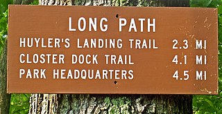
The Long Path is a 357-mile (575 km) long-distance hiking trail beginning in New York City, at the West 175th Street subway station near the George Washington Bridge and ending at Altamont, New York, in the Albany area. While not yet a continuous trail, relying on road walks in some areas, it nevertheless takes in many of the popular hiking attractions west of the Hudson River, such as the New Jersey Palisades, Harriman State Park, the Shawangunk Ridge and the Catskill Mountains. It offers hikers a diversity of environments to pass through, from suburbia and sea-level salt marshes along the Hudson to wilderness and boreal forest on Catskill summits 4,000 feet (1,220 m) in elevation.

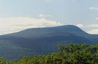
Slide Mountain is the highest peak in the Catskill Mountains of the U.S. state of New York. It is located in the town of Shandaken in Ulster County. While the 4,180-foot (1,270 m) contour line on topographic maps is generally accepted as its height, the exact elevation of the summit has never been officially determined by the U.S. National Geodetic Survey or its predecessors, and many informal surveys suggest the mountain may actually top 4,200 feet (1,280 m) above sea level. Geographically, it is the highest natural point within the New York Metropolitan Area.

New York's Forest Preserve comprises almost all the lands owned by the state of New York within the Adirondack and Catskill parks. It is managed by the state Department of Environmental Conservation (DEC).

Giant Mountain, also known as Giant of the Valley, is a mountain in the Adirondacks in the U.S. state of New York. It is the twelfth-highest peak in New York, with an elevation of 4,627 feet (1,410 m), and one of the 46 High Peaks in Adirondack Park. It is located in the Giant Mountain Wilderness Area, in the town of Keene in Essex County. The mountain is named for its towering appearance from the nearby Pleasant Valley to the east, which sits at a low elevation.
The Giant Mountain Wilderness Area (GMWA) is a protected area of the New York Forest Preserve in Adirondack Park, located in the towns of Elizabethtown and Keene in Essex County. It is roughly bounded by NY 9N on the north, NY 73 on the west and south and US 9 on the east. It contains two prominent Adirondack peaks, Giant Mountain and Rocky Peak Ridge, as well as two bodies of water covering 7 acres, 33 miles (53 km) of hiking trails, and a single lean-to. The land was first designated as a wilderness area in 1972.
The High Peaks Wilderness Area is the largest wilderness area of the Forest Preserve in the U.S. state of New York. It is located in three counties and six towns in the Adirondack Park: Harrietstown in Franklin County, North Elba, Keene, North Hudson and Newcomb in Essex County and Long Lake in Hamilton County.

Basin Mountain is a mountain in the Great Range of the Adirondacks in the U.S. state of New York. It is the ninth-highest peak in New York, with an elevation of 4,827 feet (1,471 m), and one of the 46 High Peaks in Adirondack Park. It is located in the town of Keene in Essex County. The peak was named either for the basins formed between knobs on its slopes or the large basin to its southeast formed by it and the surrounding mountains. The name Basin was most likely coined by Orson Schofield Phelps and Frederick W. Perkins in 1857 during an ascent of Mount Marcy. The earliest appearance of the name in writing was made by surveyor Verplanck Colvin in 1873.

Nippletop is a mountain in the Colvin Range of the Adirondack Mountains in New York. With an elevation of 4,620 feet (1,410 m), it is the 13th-highest peak in New York and one of the 46 Adirondack High Peaks. It is located near the southern border of the town of Keene in Essex County, in the High Peaks Wilderness Area of Adirondack Park.
Mount Marshall is a mountain in the MacIntyre Range of the Adirondacks in the U.S. state of New York. With an elevation of 4,360 feet (1,330 m), it is the 25th highest mountain in the Adirondacks and one of the 46 High Peaks in Adirondack Park. It is located in the town of Newcomb in Essex County, flanked to the northeast by Cold Brook Pass and Iroquois Peak. Originally named for Governor DeWitt Clinton, and then for mountain guide Herbert Clark, it was renamed for wilderness activist Bob Marshall after his death. The summit can be accessed by hikers on an unmarked trail.

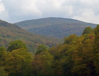
Balsam Mountain is one of the High Peaks of the Catskill Mountains in the U.S. state of New York. Its exact height has not been determined, so the highest contour line, 3,600 feet (1,100 m), is usually given as its elevation. It is located in western Ulster County, on the divide between the Hudson and Delaware watersheds. The summit and western slopes of the peak are within the Town of Hardenburgh and its eastern slopes are in Shandaken. The small community of Oliverea is near its base on that side. Most of the mountain is publicly owned, managed by the New York State Department of Environmental Conservation as part of the state Forest Preserve, part of the Big Indian-Beaverkill Range Wilderness Area in the Catskill Park. The summit is on a small corner of private land.

Balsam Lake Mountain is one of the Catskill Mountains, located in the Town of Hardenburgh, New York, United States. It is the westernmost of the range's 35 High Peaks. Its exact height has not been determined, but the highest contour line on topographic maps, 3,720 feet (1,130 m), is usually given as its elevation.

The Balsam Lake Mountain Fire Observation Station is located at the summit of the mountain of that name in the Town of Hardenburgh, New York, United States. It comprises a steel frame fire lookout tower, the observer's cabin and privy and the jeep road to the complex.

Jay Mountain is the 79th highest peak of the Adirondack Mountains. It is located in Essex County, New York, in the Jay Mountain Wilderness Area, within the towns of Jay and Lewis.


