Podkarpackie Voivodeship or Podkarpackie Province, also known as Subcarpathian Voivodeship or Subcarpathia Province, is a voivodeship, or province, in extreme-southeastern Poland. Its administrative capital and largest city is Rzeszów..
Gmina Leżajsk is a rural gmina in Leżajsk County, Subcarpathian Voivodeship, in south-eastern Poland. Its seat is the town of Leżajsk, although the town is not part of the territory of the gmina.

Gmina Krzeszów is a rural gmina in Nisko County, Subcarpathian Voivodeship, in south-eastern Poland. Its seat is the village of Krzeszów, which lies approximately 21 kilometres (13 mi) south-east of Nisko and 48 km (30 mi) north-east of the regional capital Rzeszów.
Gmina Sokołów Małopolski is an urban-rural gmina in Rzeszów County, Subcarpathian Voivodeship, in south-eastern Poland. Its seat is the town of Sokołów Małopolski, which lies approximately 24 kilometres (15 mi) north of the regional capital Rzeszów.

Zrąb-Kolonia is a village in the administrative district of Gmina Skierbieszów, within Zamość County, Lublin Voivodeship, in eastern Poland. It lies approximately 7 kilometres (4 mi) south-west of Skierbieszów, 11 km (7 mi) north-east of Zamość, and 72 km (45 mi) south-east of the regional capital Lublin.
Słoboda is a village in the administrative district of Gmina Kuryłówka, within Leżajsk County, Subcarpathian Voivodeship, in south-eastern Poland. It lies approximately 11 kilometres (7 mi) east of Kuryłówka, 13 km (8 mi) east of Leżajsk, and 53 km (33 mi) north-east of the regional capital Rzeszów.
Przychojec is a village in the administrative district of Gmina Leżajsk, within Leżajsk County, Subcarpathian Voivodeship, in south-eastern Poland. It lies approximately 5 kilometres (3 mi) north-west of Leżajsk and 41 km (25 mi) north-east of the regional capital Rzeszów.

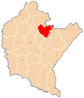
Jelna is a village in the administrative district of Gmina Nowa Sarzyna, within Leżajsk County, Subcarpathian Voivodeship, in south-eastern Poland. It lies approximately 4 kilometres (2 mi) south-east of Nowa Sarzyna, 7 km (4 mi) north-west of Leżajsk, and 39 km (24 mi) north-east of the regional capital Rzeszów.
Łętownia is a village in the administrative district of Gmina Nowa Sarzyna, within Leżajsk County, Subcarpathian Voivodeship, in south-eastern Poland. It lies approximately 7 kilometres (4 mi) west of Nowa Sarzyna, 16 km (10 mi) north-west of Leżajsk, and 37 km (23 mi) north-east of the regional capital Rzeszów.
Łętownia-Gościniec is a village in the administrative district of Gmina Nowa Sarzyna, within Leżajsk County, Podkarpackie Voivodeship, in south-eastern Poland.
Łukowa is a village in the administrative district of Gmina Nowa Sarzyna, within Leżajsk County, Subcarpathian Voivodeship, in south-eastern Poland. It lies approximately 4 kilometres (2 mi) east of Nowa Sarzyna, 8 km (5 mi) north-west of Leżajsk, and 42 km (26 mi) north-east of the regional capital Rzeszów.
Majdan Łętowski is a village in the administrative district of Gmina Nowa Sarzyna, within Leżajsk County, Subcarpathian Voivodeship, in south-eastern Poland. It lies approximately 5 kilometres (3 mi) west of Nowa Sarzyna, 15 km (9 mi) north-west of Leżajsk, and 39 km (24 mi) north-east of the regional capital Rzeszów.
Ruda Łańcucka is a village in the administrative district of Gmina Nowa Sarzyna, within Leżajsk County, Subcarpathian Voivodeship, in south-eastern Poland. It lies approximately 3 kilometres (2 mi) east of Nowa Sarzyna, 9 km (6 mi) north-west of Leżajsk, and 41 km (25 mi) north-east of the regional capital Rzeszów.
Sarzyna is a village in the administrative district of Gmina Nowa Sarzyna, within Leżajsk County, Subcarpathian Voivodeship, in south-eastern Poland. It lies approximately 4 kilometres (2 mi) north-east of Nowa Sarzyna, 11 km (7 mi) north-west of Leżajsk, and 43 km (27 mi) north-east of the regional capital Rzeszów.
Tarnogóra is a village in the administrative district of Gmina Nowa Sarzyna, within Leżajsk County, Subcarpathian Voivodeship, in south-eastern Poland. It lies approximately 5 kilometres (3 mi) north of Nowa Sarzyna, 14 km (9 mi) north-west of Leżajsk, and 43 km (27 mi) north-east of the regional capital Rzeszów.
Wola Żarczycka is a village in the administrative district of Gmina Nowa Sarzyna, within Leżajsk County, Subcarpathian Voivodeship, in south-eastern Poland. It lies approximately 6 kilometres (4 mi) south-west of Nowa Sarzyna, 14 km (9 mi) west of Leżajsk, and 35 km (22 mi) north-east of the regional capital Rzeszów.
Wólka Łętowska is a village in the administrative district of Gmina Nowa Sarzyna, within Leżajsk County, Subcarpathian Voivodeship, in south-eastern Poland. It lies approximately 9 kilometres (6 mi) west of Nowa Sarzyna, 18 km (11 mi) west of Leżajsk, and 35 km (22 mi) north-east of the regional capital Rzeszów.
Nowa Łęknica is a settlement in the administrative district of Gmina Barwice, within Szczecinek County, West Pomeranian Voivodeship, in north-western Poland. It lies approximately 6 kilometres (4 mi) north-west of Barwice, 26 km (16 mi) west of Szczecinek, and 121 km (75 mi) east of the regional capital Szczecin.