
Putnam County is a county located in the U.S. state of Ohio. As of the 2010 census, the population was 34,499. Its county seat is Ottawa. The county was created in 1820 and later organized in 1834. Its name is in honor of Israel Putnam, who was a hero in the French and Indian War and a general in the American Revolutionary War.

The Ottawa River is a tributary of the Auglaize River, approximately 50 miles (80 km) long, in northwestern Ohio in the United States. The river is named for the Ottawa tribe of Native Americans who inhabited the area in the 18th century. It shares its name with another river in northwestern Ohio, the Ottawa River in Toledo, as well as the Ottawa river in Ontario & Quebec Canada.
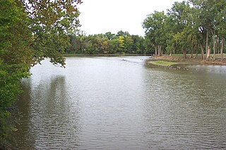
The Blanchard River is a 103-mile-long (166 km) tributary of the Auglaize River in northwestern Ohio in the United States. It drains a primarily rural farming area in the watershed of Lake Erie.
Loramie Creek is a 40.0-mile-long (64.4 km) tributary of the Great Miami River in western Ohio in the United States. Via the Great Miami and Ohio rivers, it is part of the watershed of the Mississippi River, draining an area of 265 square miles (690 km2). According to the Geographic Names Information System, the stream has also been known historically as "Laramie Creek," "Loramie Ditch," "Loramies Creek," and "Lonamie Creek." It is named after Louis Lorimier, a French-Canadian fur trader who had a trading post in the area in the 18th century.

Rimer is an unincorporated community in western Sugar Creek Township, Putnam County, Ohio, United States. It lies along State Route 189 between Fort Jennings and Vaughnsville.
North Creek is an unincorporated community in Putnam County, in the U.S. state of Ohio.
Muntanna is an unincorporated community in Putnam County, in the U.S. state of Ohio.
Sugar Creek is a stream in the U.S. state of Ohio. It is a tributary of the Ottawa River.
Deer Creek is a stream in Putnam County, Ohio. The 2.4-mile (3.9 km) long stream is a tributary of Blanchard River.
Plum Creek is a stream in the U.S. state of Ohio. This 14.4-mile (23.2 km) long stream is a tributary of the Ottawa River.
Cranberry Creek is a stream in the U.S. state of Ohio. This 19.4-mile (31.2 km) long stream is a tributary of the Blanchard River.
Leatherwood Creek is a stream in the U.S. state of Ohio. The 10.6-mile (17.1 km) long stream is a tributary of Tawana Creek.
Mosquito Creek is a stream in the U.S. state of Ohio. The 11.5-mile (18.5 km) long stream is a tributary of Tawana Creek.
Pusheta Creek is a stream located entirely within Auglaize County, Ohio. The 13.7-mile (22.0 km) long stream is a tributary of the Auglaize River.
Blackhoof Creek is a stream located entirely within Auglaize County, Ohio. The 6-mile (9.7 km) long stream is a tributary of the Auglaize River.
Spring Creek is a stream in the U.S. state of Ohio. The 12.4-mile (20.0 km) stream is a tributary of the Great Miami River.
Ludlow Creek is a stream in the U.S. state of Ohio. The 13.5-mile (21.7 km) long stream is a tributary of the Stillwater River.
Dry Creek is a stream in Lincoln and Warren counties of the U.S. state of Missouri. It is a tributary of Big Creek. A variant name was "Dry Branch".
Baker Creek is a stream in the U.S. state of Ohio. It is a tributary to the Little Miami River.


