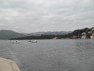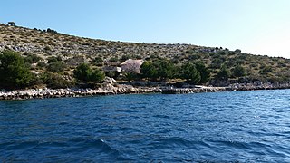
Hvar is a Croatian island in the Adriatic Sea, located off the Dalmatian coast, lying between the islands of Brač, Vis and Korčula. Approximately 68 km (42.25 mi) long, with a high east–west ridge of Mesozoic limestone and dolomite, the island of Hvar is unusual in the area for having a large fertile coastal plain, and fresh water springs. Its hillsides are covered in pine forests, with vineyards, olive groves, fruit orchards and lavender fields in the agricultural areas. The climate is characterized by mild winters, and warm summers with many hours of sunshine. The island has 10,678 residents according to the 2021 census, making it the 4th most populated of the Croatian islands.

The island of Koločep is one of the three inhabited Elaphiti Islands situated near the city of Dubrovnik with an area of 2.44 square kilometres. Koločep is the southernmost inhabited island in Croatia. According to the 2021 census, its population was 231. In the 2011 census, the population of the island was 163.
Rivanj is an Adriatic Sea island in the Zadar Archipelago, between the islands of Sestrunj and Ugljan, with an area of 4.4 square kilometres (1.7 sq mi) ; population 31 (2011); highest peak Lukocina. The only village is Rivanj, located in the interior of the island; below it, on the south-western coast, is a small harbour with a hamlet. The island is largely covered with underbrush and thicket. Rivanj has a daily ferry and ship line with Zadar. The present village was allegedly founded by the inhabitants of the island of Ugljan. Rivanj is frequented by boaters. There are only 2 family surnames in Rivanj, Radulić and Fatović, and there is a church of St. Jelena on the island.

Rava is an island in the Croatian part of the Adriatic Sea. It is situated in the Zadar Archipelago, between Iž and Dugi Otok, 16 nautical miles (30 km) from Zadar. Its area is 3.6 km2, and it has a population of 117. The only settlements on the island are Vela Rava and Mala Rava. The coast of the island is very indented with 13 bays and 15.45 kilometres of coastline. The island is composed of dolomite. The primary industries are agriculture and fishing.

Drvenik Mali (also called Ploča by local population; is an island in Croatian part of Adriatic Sea. It is situated in middle-Dalmatian archipelago, west of Drvenik Veliki, 8 nautical miles from Trogir. Its area is 3.43 square kilometres. The only settlement on the island is the eponymous village with a population of 87. The coast is well indented and sea around the island is shallow, thus convenient for fishing. The highest peak is 79 metres high. Main industries are agriculture, fishing and tourism.
Šćedro is an island in the Adriatic Sea with an area of 8.36 km2, 2.7 kilometres (1.7 mi) off the south coast of the island of Hvar, Croatia, opposite the settlement of Zavala. The name comes from štedri, meaning charitable in old Slavonic, because the island offers two deep, well-protected coves. The Latin name of Šćedro was Tauris from which derived the Italian Tauricola or Torcola.
Olipa is an uninhabited islet in Croatia, part of the Elaphiti Islands archipelago off the coast of southern Dalmatia. It is the westernmost isle in the Elaphites. Olipa is mostly rocky and partially covered in forest. A stone square tower is located on the south side of the isle, which serves as a lighthouse. The lighthouse is used for maritime routes passing through the passages of Veliki Vratnik and Mali Vratnik.
Kornat is an island in the Croatian part of the Adriatic Sea, in central Dalmatia. With an area of 32.44 km2 it is the 16th largest island in Croatia and the largest island in the eponymous Kornati islands archipelago. It is part of the Kornati National Park, which is composed of a total of 89 islands, islets and rocks.

Žut is an uninhabited island in the Croatian part of the Adriatic Sea, in central Dalmatia. With an area of 14.83 km2 (5.73 sq mi) it is the 28th largest island in Croatia and the second largest island in the Kornati archipelago, after Kornat. Although most of the archipelago, composed of 89 islands, islets and rocks, is included in the Kornati National Park, the island of Žut is not.

Sveti Klement is an island in the Croatian part of the Adriatic Sea. Its area is 5.28 km2 and it is the largest of the Paklinski islands, a group of small islands located in central Dalmatia just south of Hvar. Its coastline is 29.89 km long.

Lavsa is an uninhabited Croatian island in the Adriatic Sea located southwest of Kornat. Its area is 1.78 km2 (0.69 sq mi).
Lavdara is an uninhabited Croatian island in the Adriatic Sea located east of Dugi Otok. Its area is 2.27 km2 (0.88 sq mi).

Levrnaka is an uninhabited Croatian island in the Adriatic Sea located southwest of Kornat. Its area is 1.84 km2 (0.71 sq mi).

Sit is an uninhabited Croatian island in the Adriatic Sea located between Žut and Pašman. Its area is 1.77 km2 (0.68 sq mi).

Vele Orjule is an uninhabited Croatian island in the Adriatic Sea located southeast of Lošinj. Its area is 1.06 km2 (0.41 sq mi).
Kurba Vela is an uninhabited Croatian island in the Adriatic Sea located southeast of Kornat. Its area is 1.74 km2 (0.67 sq mi).
Tun Veli is an uninhabited Croatian island in the Adriatic Sea located southeast of Molat. Its area is 2.21 km2 (0.85 sq mi).

Zeča is an uninhabited Croatian island in the Adriatic Sea located southwest of Cres. Its area is 2.55 km2 (0.98 sq mi).


