Hamilton is a port city in the Canadian province of Ontario. Hamilton has a population of 569,353 (2021), and its census metropolitan area, which encompasses Burlington and Grimsby, has a population of 785,184. The city is situated approximately 45 kilometres (28 mi) southwest of Toronto in the Greater Toronto and Hamilton Area (GTHA).

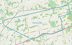
Jerseyville is the largest city in and the county seat of Jersey County, Illinois, United States. At the 2020 census, the city had a total population of 8,337.
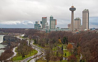
Niagara Falls is a city in Ontario, Canada, adjacent to, and named after, Niagara Falls. As of the 2021 census, the city had a population of 94,415. The city is located on the Niagara Peninsula along the western bank of the Niagara River, which forms part of the Canada–United States border, with the other side being the twin city of Niagara Falls, New York. Niagara Falls is within the Regional Municipality of Niagara and a part of the St. Catharines - Niagara Census Metropolitan Area (CMA).
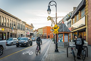
St. Catharines is the most populous city in Canada's Niagara Region, the eighth largest urban area in the province of Ontario. As of 2017, St. Catharines has an area of 96.13 square kilometres (37.12 sq mi) and 140,370 residents. It lies in Southern Ontario, 51 kilometres (32 mi) south of Toronto across Lake Ontario, and is 19 kilometres (12 mi) inland from the international boundary with the United States along the Niagara River. It is the northern entrance of the Welland Canal. Residents of St. Catharines are known as St. Catharinites. St. Catharines carries the official nickname "The Garden City" due to its 1,000 acres (4 km2) of parks, gardens, and trails.

The Regional Municipality of York, also called York Region, is a regional municipality in Southern Ontario, Canada, between Lake Simcoe and Toronto. The region was established after the passing of then Bill 102, An Act to Establish The Regional Municipality of York, in 1970. It replaced the former York County in 1971, and is part of the Greater Toronto Area and the inner ring of the Golden Horseshoe. The regional government is headquartered in Newmarket.

The Greater Toronto Area, commonly referred to as the GTA, includes the City of Toronto and the regional municipalities of Durham, Halton, Peel, and York. In total, the region contains 25 urban, suburban, and rural municipalities. The Greater Toronto Area begins in Burlington in Halton Region to the west, and extends along Lake Ontario past downtown Toronto eastward to Clarington in Durham Region.

Harbourfront is a neighbourhood on the northern shore of Lake Ontario within downtown Toronto, Ontario, Canada. Part of the Toronto waterfront, Harbourfront extends from Bathurst Street in the west, along Queens Quay, with its ill-defined eastern boundary being either Yonge Street or York Street. Its northern boundary is the Gardiner Expressway. Much of the district was former water lots filled in during the early 1900s to create a larger harbour district. After shipping patterns changed and the use of the Toronto Harbour declined, the area was converted from industrial uses to a mixed-use district that is mostly residential and leisure.

Bowmanville is a town of approximately 40,000 people located in the Municipality of Clarington, Durham Region, Ontario, Canada. It is approximately 75 km (47 mi) east of Toronto, and 15 km (9.3 mi) east of Oshawa along Highway 2. Bowmanville was first incorporated as a town in 1858, but later incorporated with the neighbouring townships of Clarke and Darlington in 1974 forming the Town of Newcastle, which was renamed in 1994 to the Municipality of Clarington. Bowmanville is part of the Greater Toronto Area.

Malvern is a neighbourhood in the city of Toronto, Ontario, Canada, with a population of 44,315. It is located in the northeast corner of the city.

The Quebec City–Windsor Corridor is the most densely populated and heavily industrialized region of Canada. As its name suggests, the 1,150 km (710 mi)-long region extends from Quebec City in the northeast and Windsor, Ontario in the southwest. With more than 18 million people, it contains about half of the country's population and seven of Canada's 12 largest metropolitan areas, 3 of which are in the top 4. Its relative importance to Canada's economic and political infrastructure renders it akin to the Northeast megalopolis in the United States. The name was first popularized by Via Rail, which runs frequent passenger rail service in the region in its service area known as "The Corridor".

The Toronto, Hamilton and Buffalo Railway was a railway based in Hamilton that ran in Southern Ontario from 1892 to 1987. It never reached the other two cities in its name although it had branch lines extending to Dunnville and Port Maitland.
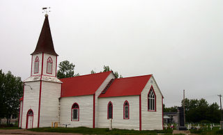
Moose Factory is a community in the Cochrane District, Ontario, Canada. It is located on Moose Factory Island, near the mouth of the Moose River, which is at the southern end of James Bay. It was the first English-speaking settlement in lands now making up Ontario and the second Hudson's Bay Company post to be set up in North America after Fort Rupert. On the mainland, across the Moose River, is the nearby community of Moosonee, which is accessible by water taxi in the summer, ice road in the winter, and chartered helicopter in the off-season.

The Westfield Heritage Village is a heritage centre located just west of Rockton, Ontario, Canada. The village contains over 30 historic buildings on a 3.4-square-kilometre (840-acre) site. It is operated by the Hamilton Conservation Authority.

The geography of Toronto, Ontario, covers an area of 630 km2 (240 sq mi) and is bounded by Lake Ontario to the south; Etobicoke Creek, Eglinton Avenue, and Highway 427 to the west; Steeles Avenue to the north; and the Rouge River and the Scarborough–Pickering Townline to the east. In addition to Etobicoke Creek and the Rouge River, the city is trisected by two minor rivers and their tributaries, the Humber River in the west end and the Don River east of downtown. Both flow southward to Lake Ontario at Humber Bay and Toronto Harbour respectively, which are part of the longer Waterfront, as well as Etobicoke Creek and the Rouge River.
Peawanuck is an isolated Cree community in the Kenora District, Ontario, Canada. It is located near the confluence of the Winisk and Shamattawa rivers, about 35 km from the Winisk River's end in Hudson Bay. Its population is 237.
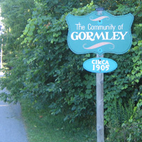
Gormley is a hamlet in York Region, Ontario, Canada that overlaps parts of Richmond Hill, and Whitchurch–Stouffville, two municipalities within the Greater Toronto Area. It was divided into two parts due to the construction of Highway 404. A portion of Gormley situated within Richmond Hill's political boundaries is subject to "Heritage Conservation District" controls. A post office in Gormley (East) serves as the mailing address for the Whitchurch–Stouffville communities of Bethesda, Gormley, Preston Lake, Vandorf, and Wesley Corners.
Copetown is a rural neighbourhood of the city of Hamilton, Ontario, Canada, located northeast of Brantford. William Cope, a United Empire Loyalist from the U.S. state of New York settled here in 1794. The community was renamed after his son Conradt in 1851. The current population of this community is approximately 130 residents.
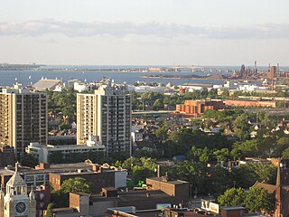
Hamilton is located on the western end of the Niagara Peninsula and wraps around the westernmost part of the Lake Ontario. Most of the city including the downtown section lies along the south shore. Situated in the geographic centre of the Golden Horseshoe, it lies roughly midway between Toronto and Buffalo. The two major physical features are Hamilton Harbour marking the northern limit of the city and the Niagara Escarpment running through the middle of the city across its entire breadth, bisecting the city into 'upper' and 'lower' parts.
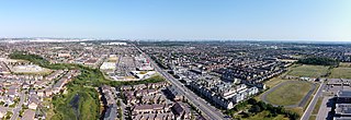
Springdale is a large suburban district in Brampton, Ontario, Canada covering 4,000 acres (1,600 ha) in the northern part of the city. It is generally bounded by Countryside Drive to the north, Bovaird Drive to the south, Heart Lake Road to the west, and Airport Road to the east. Springdale is sometimes jocularly referred to as Singhdale due to its large population of Sikh Canadians, who make up 39.6% of the community's population and often have the last name Singh.
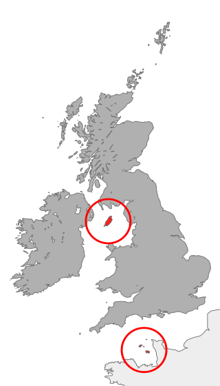
A number of places in the world, like the places named after places in other parts of Britain, were named after the Channel Islands, or some place therein. Not all are named directly for one of the islands, but are often named indirectly, such as for another place on the list.

