Punjab is a province of Pakistan. With a population of over 127 million, it is the most populous province in Pakistan and second most populous subnational polity in the world. Located in the central-eastern region of the country, it has the largest economy, contributing the most to national GDP, in Pakistan. Lahore is the capital and largest city. Other major cities include Faisalabad, Rawalpindi, Gujranwala and Multan.

Segovia is a province of central/northern Spain, in the southern part of the autonomous community of Castile and León. It is bordered by the province of Burgos in the north, Soria in the northeast, Guadalajara in the east, Madrid in the south, Ávila in the west and southwest, and Valladolid in the northwest. The average temperature ranges from 10 °C to 20 °C.

Transhumance is a type of pastoralism or nomadism, a seasonal movement of livestock between fixed summer and winter pastures. In montane regions, it implies movement between higher pastures in summer and lower valleys in winter. Herders have a permanent home, typically in valleys. Generally only the herds travel, with a certain number of people necessary to tend them, while the main population stays at the base. In contrast, movement in plains or plateaus (horizontal transhumance) is more susceptible to disruption by climatic, economic, or political change.

Namli Mera is a residential town and a mountainous rural area located in Abbottabad District, Khyber Pakhtunkhwa province, Pakistan. Many outstanding families also belongs to Namli Mera. More over the kpk's No1 physics teacher for the year (2024), Dr. Yaseen Akhtar also belongs to Namli Mera.

Bahawalpur District is a district of Punjab, Pakistan, with capital the city of Bahawalpur. According to the 1998 Census it had a population of 2,433,091, of which 27.01% were urban. Bahawalpur district covers 24,830 km2. Approximately two-thirds of the district (16,000 km2) is covered by the Cholistan Desert, which extends into the Thar Desert of India. The district is a major producer of cotton.

Greyton is a small town in the Overberg area in the Western Cape, South Africa.

Safdarabad, is a city in Sheikhupura District in the Punjab province of Pakistan. The city of Safdar Abad is the capital of Safdarabad Tehsil. Its Postal code or ZIP code is 39540. Its urban area is approximately 600 acres. Until 2005 it was a tehsil of Sheikhupura District, but in that year Sheikhpura was bifurcated and the district of Nankana Sahib was created. - with Safdarabad as one of its tehsils. Now at present, once again Safdarabad has been rejoined with Sheikhupura as a Tehsil of it. The city of Safdarabad lies 95 km from Lahore the provincial capital of Punjab. The area has a population of more than 40,000 the majority of whom are Muslims. There are many engineering and medical students from Safdarabad admitted to different universities across Pakistan, including UET, Lahore. Safdarabad is now developing and has changed a lot in the past few years.

Kamunting is a town in Larut, Matang and Selama District, Perak, Malaysia. It is the biggest satellite town of Taiping.
The Khangura is a gotra of Jat community from the Punjab region in India.

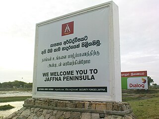
The Jaffna Peninsula is a region in the Northern Province of Sri Lanka. It is home to the capital city of the province, Jaffna, and comprises much of the former land mass of the medieval Jaffna Kingdom.
Warburton city also known as Mandi Warburton is a large town situated in Nankana Sahib District in the Punjab province of Pakistan. It is about 20 kilometres (12 mi) north of Nankana Sahib and 30 km southeast of Sheikhupura.The newly constructed Karachi-Lahore Motorway has reduced the cities travel time from Lahore greatly.

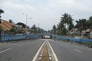
Puttenahalli is a suburban area in Bangalore, Karnataka State in India.

Safdarabad, is an administrative subdivision (Tehsil) of Sheikhupura District in the Punjab province of Pakistan. The city of Safdar Abad is the headquarters of the tehsil, until 2005 it was a tehsil of Sheikhupura District, but in that year Sheikhpura was bifurcated and the district of Nankana Sahib was created. - with Safdarabad as one of its tehsils. Now at present, once again Safdarabad has been rejoined with Sheikhupura as a Tehsil. The city of Safdarabad lies 95 km from Lahore the provincial capital of Punjab. The tehsil has a population of more than 270,000 the majority of whom are Muslims.
Baddomalhi is a town located 35 miles northeast of Lahore, Pakistan in Narowal District. It is located at 31°58'60 North 74°40'0 East with an altitude of 217 metres (715 feet). The boundary of Baddomalhi post office is extended to cheenay kay dograa village and this is the last village of District Narowal and village is small but violent areas.
Chakori Bhilowal is a town and union council of Gujrat District, in the Punjab province of Pakistan. It is part of Kharian Tehsil and is located at 32°36'0N 73°54'0E with an altitude of 226 metres.

Vácrátót is a village and commune in the comitatus of Pest in Hungary.
The Rai Sikh is a Sikh community, mainly found in the states of Punjab, Rajasthan, Uttar Pradesh, Uttrakhand, Delhi and Haryana in India.
Khayerkhal is a village situated under the Maynaguri block at "Padamati I Gram Panchayat" in Jalpaiguri District, West Bengal, India. Its length round covers around 4-4.5km. Its total population is 2471 of which 1315 are male and 1156 female, occupying 560 households. The total families are 282 and BPL families are 237.{all data in 2006*)
Ghullah Wattwan is a town located to the east of Feroze Wattwan in Sheikhupura District, Pakistan. The town has a population of 10,000, mostly farmers and constructors.
Herder–farmer conflicts in Nigeria are a series of disputes over arable land resources across Nigeria between the mostly-Muslim Fulani herders and the mostly-Christian non-Fulani farmers. The conflicts have been especially prominent in the Middle Belt since the return of democracy in 1999. More recently, they have deteriorated into attacks on farmers by Fulani herdsmen.


