Related Research Articles

A cloudburst is an extreme amount of precipitation in a short period of time, sometimes accompanied by hail and thunder, which is capable of creating flood conditions. Cloudbursts can quickly dump large amounts of water, e.g. 25 mm of precipitation corresponds to 25,000 metric tons per square kilometre. However, cloudbursts are infrequent as they occur only via orographic lift or occasionally when a warm air parcel mixes with cooler air, resulting in sudden condensation. At times, a large amount of runoff from higher elevations is mistakenly conflated with a cloudburst. The term "cloudburst" arose from the notion that clouds were akin to water balloons and could burst, resulting in rapid precipitation. Though this idea has since been disproven, the term remains in use.

Chamoli district is a district of the Uttarakhand state of India. It is bounded by the Tibet region to the north, and by the Uttarakhand districts of Pithoragarh and Bageshwar to the east, Almora to the south, Pauri Garhwal to the southwest, Rudraprayag to the west, and Uttarkashi to the northwest. The administrative headquarters of Chamoli district is in Gopeshwar.

The Alaknanda is a Himalayan river in the Indian state of Uttarakhand and one of the two headstreams of the Ganges, the major river of Northern India and the holy river of Hinduism. In hydrology, the Alaknanda is considered the source stream of the Ganges on account of its greater length and discharge; however, in Hindu tradition and culture, the other headstream, the Bhagirathi, is considered the source stream.
Gairsain is a town in Chamoli district of the Indian state of Uttarakhand near state's summer capital Bhararisain. A town and Nagar Panchayat, Gairsain is situated at the eastern edge of the vast Dudhatoli mountain range, and is located in Chamoli district almost at the centre of the state, at a distance of approximately 250 kilometres from Dehradun. It is easily accessible from both the Garhwal and the Kumaon divisions, and in a way, acts as the bridge between the two regions. It is being considered as the future Permanent capital of Uttarakhand.

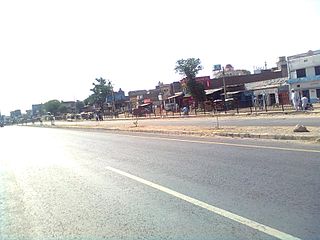
Gauchar is a Hill Town sort of a valley town located in Karnaprayag tehsil within Chamoli district of Uttarakhand state in India. Gauchar is situated on the left bank of river Alaknanda and is en route to the celebrated holy destination of Badrinath. It is well known for being one of the cleanest place in country. It has previously topped Swachta sarvekshan best ganga town award. Situated at an altitude of 800 metres (2,620 ft) above the sea level, Gauchar is surrounded by seven mountains. Gauchar is well known for its historic trade fair and airstrip. Gauchar town known for its great work to curb loss of lives in 2013 flood disaster of Uttarakhand. This town is unique in terms of its geographical location and topography. Gauchar is located on one of the largest pieces of flatland in this mountainous region of Uttarakhand. Education institution in Gauchar includes a beautiful Kendriya Vidyalaya adjacent to the main playground.

Karnaprayag is a town and municipal board in the Chamoli District in the Indian state of Uttarakhand. Karnaprayag is one of the Panch Prayag of Alaknanda River, situated at the confluence of the Alaknanda and Pindar River.

Nandaprayag is a town and a nagar panchayat in Chamoli district in the Indian state of Uttarakhand. Nandaprayag is one of the Panch Prayag of Alaknanda River and lies at the confluence of the Alaknanda River and Nandakini River. Nandaprayag was once the capital of the Yadu kingdom.

Sapta Badri constitutes a group of seven sacred Hindu temples, dedicated to god Vishnu, located in Garhwal Himalayas in the Indian state of Uttarakhand. The Badrinath temple, called the Badri Vishal is the primary temple among the seven shrines. The other six being Adi Badri, Bhavishya Badri, Yogadhayan Badri, Vriddha Badri, Ardha Badri and Dhyan Badri. The Panch Badri temple circuit consisted of only five temples, omitting Ardha Badri and usually Dhyan Badri. Rarely, Narasingh Badri, is included in the Sapta Badri or Panch Badri list.
Sohawa is a town in the Punjab province of Pakistan, and is the capital of the Sohawa Tehsil, which is an administrative subdivision of Jhelum District in Punjab. Sohawa has grown from a small village in 1947 to a large town in 2014, with major developments in transport, education and health.
Thalisain is a town and tehsil of Pauri Garhwal district in the North Indian state of Uttarakhand. At an elevation of 1690 metres from sea level, it is situated on a gentle slope above the right bank of Nayaar (East) river. It is in the southwestern foothills of Dudhatoli Range and at a distance of 83 kilometers from Pauri town and 95 kilometers from Gairsain, the future capital of Uttarakhand.
Mehalchauri is a village in Gairsain Tehsil located in Chamoli district in the Indian state of Uttarakhand. It is situated in Garhwal mandal nearby the center of the Garhwal and Kumaon mandal.
Saikot is a village in the Chamoli district of Uttarakhand state in India. Situated on the banks of Alaknanda River, it is a proposed y-forked railway junction on Chota Char Dham Railway for two different railways going to Kedarnath and Badrinath.
The Rishikesh–Karnaprayag line is an under-construction railway line, which will run from Yog Nagari Rishikesh railway station in Rishikesh to Karnaprayag. It is Indian Railways' proposed route for the Char Dham Railway to connect the Char Dham pilgrimage of Uttarakhand. The line is also part of an Indian geostrategic initiative to build infrastructure along the India-China border to discourage Chinese expansion. The project is considered to be of national strategic importance and is being tracked on the Central Government’s PRAGATI portal. When ready, it will help improve connectivity to the Char Dham shrines of Yamunotri, Gangotri, Badrinath and Kedarnath in the Garhwal region of the Himalayas in Uttarakhand.

Dudhatoli is a middle Himalayan mountain range/forest running approximately 25 km in a north–south direction, starting near Thalisain tehsil of Pauri Garhwal district in Uttarakhand, with Gairsain in Chamoli district being its western limit and Syoli-Khand region in Pauri its northernmost spur.
Narbal is a tehsil in central Kashmir's Beerwah sub-district. It is also a block in Budgam district in the Indian administered union territory of Jammu and Kashmir. It is 18 km (11 mi) away from sub-district headquarter Beerwah and 13 km (8.1 mi) away from Srinagar, the summer capital of Jammu and Kashmir.
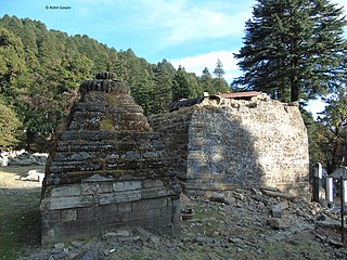
Adi Badri (Chandpurgadhi) is a tehsil, or administrative division, located in the Chamoli district of the Indian state of Uttarakhand. The tehsil is located in the Garhwal region of the state and is known for its natural beauty and cultural significance. The tehsil headquarters is also known in revenue records as Helisera and has the beautiful Benital lake nearby.
Ghat is a tehsil, or administrative division, located in the Chamoli district of the Indian state of Uttarakhand. The tehsil is located in the south central part of the district and is connected to Nandaprayag on the Badrinath Highway by a road.
Pokhri tehsil is a tehsil in the Chamoli district of the Indian state of Uttarakhand. The tehsil is located in the eastern part of the district, and is bordered by Gopeshwar, Nandaprayag and Karnaprayag tehsils. The tehsil had a population of around 36,000 people in 2011 census. However, since then, the area of tehsil has shrunk due to creation of new tehsils. The current population is not exactly known but expected to be around 20,000.
Tharali is a tehsil in the Chamoli district of the Indian state of Uttarakhand. It is located on the banks of Pinder river and is known for its picturesque location and scenic beauty.
References
- ↑ "Tehsil | Chamoli District Website | India". Chamoli.gov.in. 2022-12-17. Retrieved 2022-12-25.
- ↑ "Google Maps". Google.com. Retrieved 2022-12-25.
- ↑ Chamoli Updated Tue, 11 Feb 2014 05:43 AM IST (2014-02-11). "जिलासू तहसील के विरोध में ग्रामीणों का प्रदर्शन - - Amar Ujala Hindi News Live". Amarujala.com. Retrieved 2022-12-25.
- ↑ "Full list of villages of Jilasu sub-district in Chamoli district". Viewvillage.in. Retrieved 2022-12-25.
- ↑ Letter
- ↑ Letter
- ↑ Letter