
Thurston Island is an ice-covered, glacially dissected island, 215 km (134 mi) long, 90 km (56 mi) wide and 15,700 km2 (6,062 sq mi) in area, lying a short way off the northwest end of Ellsworth Land, Antarctica. It is the third largest island of Antarctica, after Alexander Island and Berkner Island.
Martin Glacier is a glacier, 3 nautical miles (6 km) wide and 9 nautical miles (17 km) long, which flows west and then northwest from the south side of Mount Lupa to the southeast corner of Rymill Bay where it joins Bertrand Ice Piedmont, on the west coast of Graham Land, Antarctica. It was first surveyed in 1936 by the British Graham Land Expedition (BGLE) under John Riddoch Rymill, and was resurveyed in 1948–1949 by the Falkland Islands Dependencies Survey. The glacier was named for James H. Martin, a member of the British Australian and New Zealand Antarctic Research Expedition (1929–1931) under Sir Douglas Mawson, and first mate of the Penola during the BGLE.

Garwood Glacier is a glacier occupying the northwest part of Garwood Valley, in Victoria Land, Antarctica. It was first mapped by the British National Antarctic Expedition (1901–04), but was not named until 1911, when Thomas Griffith Taylor of the British Antarctic Expedition, 1910–13, named it for Edmund J. Garwood, professor of geology and mineralogy at the University of London.
Astrolabe Island, located at 63°17′S58°40′W, is an island 5 km (3 mi) long, lying in the Bransfield Strait 23 km (14 mi) northwest of Cape Ducorps, Trinity Peninsula in Antarctica. It was discovered by the French expedition, 1837–40, under Captain Jules Dumont d'Urville, and named by him for his chief expedition ship, the Astrolabe. The island was photographed from the air and triangulated by FIDASE, 1956-57.

The Argentine Islands are a group of islands in the Wilhelm Archipelago of Antarctica, situated 5 nautical miles (9 km) southwest of Petermann Island, and 4 nautical miles (7 km) northwest of Cape Tuxen on Kiev Peninsula in Graham Land. They were discovered by the French Antarctic Expedition, 1903–05, under Jean-Baptiste Charcot, and named by him for the Argentine Republic in appreciation of that government's support of to his expedition.

Bulnes Island is a small island lying 4 kilometres (2 nmi) northwest of Cape Legoupil, Trinity Peninsula. It was charted by the Chilean Antarctic Expedition of 1947–48 under Capitan de Fragata Ernesto Gonzalez Navarrete, and named by him for Manuel Bulnes Sanfuentes, Minister of National Defense during the preceding Chilean Antarctic Expedition of 1947.
Kubbestolen Peak is a bare rock peak, 2,070 metres (6,800 ft) high, at the northwest end of Vinten-Johansen Ridge in the Kurze Mountains of Queen Maud Land, Antarctica. It was mapped from surveys and air photos by the Sixth Norwegian Antarctic Expedition (1956–60) and named Kubbestolen.
The Donovan Islands are a chain of about 8 islands lying well offshore, about 9 kilometres (5 nmi) northwest of Clark Peninsula in the eastern part of Vincennes Bay. First mapped from air photos taken by U.S. Navy Operation Highjump, 1946–47, they were photographed from the air by the Australian National Antarctic Research Expeditions in January 1956, and were named after J. Donovan, Administrative Officer of the Antarctic Division, Melbourne, and leader of a number of relief expeditions to Heard Island and Macquarie Island.
The Double Islands are two small rocky islands lying close east of the tip of Zélée Glacier Tongue and 0.7 kilometres (0.4 nmi) north-northwest of the Triple Islands. They were photographed from the air by U.S. Navy Operation Highjump, 1946–47, and were charted and named by the French Antarctic Expedition, 1949–51.
Evans Peninsula is an ice-covered peninsula about 30 nautical miles (60 km) long, between Koether Inlet and Cadwalader Inlet in the northeast part of Thurston Island. Cape Braathen is an ice-covered cape at the northwest termination of Evans Peninsula. It was discovered in flights from the USS Burton Island and USS Glacier by personnel of the U.S. Navy Bellingshausen Sea Expedition in February 1960, and was named by the Advisory Committee on Antarctic Names (US-ACAN) for Commander Griffith Evans, Jr., commander of the icebreaker Burton Island during this expedition.
The Fram Islands are a small group of rocky islands and rocks in the western portion of the Geologie Archipelago, 4 kilometres (2 nmi) north-northwest of Cape Geodesie. They were photographed from the air by U.S. Navy Operation Highjump, 1946–47, charted by the French Antarctic Expedition, 1949–51, and named by them for the Norwegian polar ship Fram, used by Fridtjof Nansen in the Arctic and Roald Amundsen in the Antarctic.

Français Glacier is a glacier 4 nautical miles (7 km) wide and 12 nautical miles (22 km) long, flowing north-northeast from the continental ice to the Antarctic coast close west of Ravin Bay. Though no glaciers were noted on Captain Jules Dumont d'Urville's chart of this coast, the close correlation of his "Baie des Ravins" feature and narrative description with the indentation of the coast near the mouth of this glacier suggests first sighting of this feature by the French Antarctic Expedition, 1837–40. During December 1912 members of the Main Base Party of the Australasian Antarctic Expedition (AAE) camped on the upland slopes close east of the glacier, but no reference was made to the glacier in the AAE reports, though a clear view and unpublished sketch were obtained of the distant coast to the northwest.
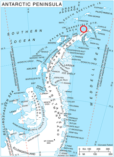
Gibbs Glacier is a glacier, 15 nautical miles (28 km) long, flowing southeast into the northern part of Mercator Ice Piedmont on the east side of the Antarctic Peninsula. This feature together with Neny Glacier, which flows northwest, occupy a transverse depression between Mercator Ice Piedmont and Neny Fjord on the west side of the Antarctic Peninsula. Gibbs Glacier was photographed from the air and first mapped by the United States Antarctic Service, 1939–41, and the Ronne Antarctic Research Expedition, 1947–48. It was named by the UK Antarctic Place-Names Committee for Peter M. Gibbs of the Falkland Islands Dependencies Survey, a surveyor at Horseshoe Island, 1957, and leader at Stonington Island, 1958, who was responsible for the first ground survey of the glacier.
Hariot Glacier is a glacier flowing northwest along the south side of Morgan Upland before turning west into the northern portion of the Wordie Ice Shelf, along the west coast of the Antarctic Peninsula. It was roughly surveyed by the British Graham Land Expedition, 1936–37, and the upper reaches were photographed from the air by the Ronne Antarctic Research Expedition, 1947. The glacier was surveyed from the ground by members of the Falkland Islands Dependencies Survey who travelled along it in December 1958, and it was named by the UK Antarctic Place-Names Committee after Thomas Hariot, an English mathematician who pioneered new methods of navigation under the patronage of Sir Walter Raleigh.
The Lippmann Islands are a group of small islands 4 kilometres (2 nmi) in extent, lying close northwest of Lahille Island off the west coast of Graham Land, Antarctica. They were originally mapped as a single island by the French Antarctic Expedition, 1903–05, under Jean-Baptiste Charcot, and named by him for French physicist and Nobel Prize winner Gabriel Lippmann.
Meinardus Glacier is an extensive glacier in Palmer Land, Antarctica. It flows in an east-northeast direction to a point immediately east of Mount Barkow, where it is joined from the northwest by Haines Glacier, and then flows east to enter New Bedford Inlet close west of Court Nunatak, on the east coast of Palmer Land. The glacier was discovered and photographed from the air in December 1940 by the United States Antarctic Service. During 1947 it was photographed from the air by the Ronne Antarctic Research Expedition under Finn Ronne, who in conjunction with the Falkland Islands Dependencies Survey (FIDS) charted it from the ground. It was named by the FIDS for Wilhelm Meinardus, a German meteorologist and climatologist and author of many publications including the meteorological results of the German Antarctic Expedition under Drygalski, 1901–03.
Hélène Island is a small rocky island 370 metres (0.2 nmi) northwest of Ifo Island marking the west end of the Géologie Archipelago in Antarctica. It was photographed from the air by U.S. Navy Operation Highjump, 1946–47, was charted by the French Antarctic Expedition, 1949–51, and named by them for one of the expedition's dogs.

Hobbs Glacier is a glacier situated in a steep, rock-walled cirque at the northwest side of Hamilton Point, and flowing southeast into the southern part of Markham Bay on the east coast of James Ross Island, Antarctica. It was first seen and surveyed by the Swedish Antarctic Expedition, 1901–04, under Otto Nordenskiöld, who named it for Professor William H. Hobbs, an American geologist and glaciologist.
Marguerite Island is a rocky island 1.3 kilometres (0.7 nmi) northwest of Empereur Island and 3.2 kilometres (1.75 nmi) north-northwest of Cape Margerie, Antarctica. It was charted in 1951 by the French Antarctic Expedition and named by them for Marguerite, a character in Goethe's Faust.


