Johnson Draw

Last updated
Johnson Draw
Country United States
Physical characteristics
Main source Texas
River mouth 1,673 ft (510 m)

Johnson Draw, also formerly known as Johnsons Run and Johnson Creek is a tributary of the Devils River in Val Verde County, Texas. It has its source in Crockett County, Texas at 30°56′03″N101°17′31″W / 30.93417°N 101.29194°W / 30.93417; -101.29194 , 17.0 miles north northwest of Ozona, Texas. [1]

Devils River (Texas) river in United States of America

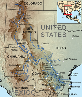
The Devils River in southwestern Texas, part of the Rio Grande drainage basin, has limited areas of whitewater along its length. It begins in northwest Sutton County, at 30°19′40″N100°56′31″W, where six watercourses come together, Dry Devils River, Granger Draw, House Draw, Jackson, Flat Rock Draw, and Rough Canyon. It flows southwest for 94 miles (151 km) through Val Verde County and empties into the northeastern shore of the Amistad Reservoir, an impoundment of the Rio Grande near Del Rio, Texas on the Texas/Mexico border, 29°27′33″N101°3′34″W. The discharge of the Devils River, as measured at IBWC gaging station 08-4494.00 near the river's mouth, averages 362 cubic feet per second (10.3 m3/s), with a maximum of 122,895 cubic feet per second (3,480 m3/s) and a minimum of 54 cubic feet per second (1.53 m3/s). Its drainage basin above that point is 10,259 square kilometres (3,961 sq mi).

Val Verde County, Texas County in the United States

Val Verde County is a county located on the southern Edwards Plateau in the U.S. state of Texas. The 2014 population is 51,047. Its county seat is Del Rio. In 1936, Val Verde County received Recorded Texas Historic Landmark number 5625 to commemorate its founding.

Crockett County, Texas County in the United States

Crockett County is a county located on the Edwards Plateau in the U.S. state of Texas. As of the 2010 census, its population was 3,719. The county seat is Ozona. The county was founded in 1875 and later organized in 1891. It is named in honor of Davy Crockett, the legendary frontiersman who died at the Battle of the Alamo.

See also

Related Research Articles

Lafayette Township, Michigan Township in Michigan, United States

Lafayette Township is a civil township of Gratiot County in the U.S. state of Michigan. The population was 656 at the 2000 census.

Stanton, Texas City in Texas, United States

Stanton is a city in and the county seat of Martin County, Texas, United States. The population was 2,492 at the 2010 census.

Shedd Brook is an 11.3-mile-long (18.2 km) stream located in southern New Hampshire in the United States. It is a tributary of Beards Brook, part of the Contoocook River and Merrimack River watersheds.

There are several lakes named Mud Lake within the U.S. state of Georgia.

The Beaver River is the historic name for an intermittent river in Oklahoma that drains most of the Oklahoma Panhandle. It is also known as the North Canadian River; both names are in common use. The Beaver River flows from Union County, New Mexico, entering the Oklahoma Panhandle in Cimarron County, then flowing out of state through Sherman County in the Texas Panhandle for about 15 miles (24 km), then back to the Oklahoma panhandle in Texas County, where it is impounded in Optima Lake near Guymon. Downstream of the dam, it continues through the Oklahoma counties of Beaver and Harper before ending in Woodward County.

South Yuba, California Unincorporated community in California, United States

South Yuba is an unincorporated community in Yuba County, California. It is located on the Sacramento Northern Railroad 1.5 miles (2.4 km) south of Marysville, at an elevation of 66 feet.

Cyców-Kolonia Pierwsza Village in Lublin, Poland

Cyców-Kolonia Pierwsza is a village in the administrative district of Gmina Cyców, within Łęczna County, Lublin Voivodeship, in eastern Poland. It lies approximately 2 kilometres (1 mi) south-west of Cyców, 18 km (11 mi) east of Łęczna, and 40 km (25 mi) east of the regional capital Lublin.

Białki, Siedlce County Village in Masovian, Poland

Białki is a village in the administrative district of Gmina Siedlce, within Siedlce County, Masovian Voivodeship, in east-central Poland. It lies approximately 5 kilometres (3 mi) south of Siedlce and 89 km (55 mi) east of Warsaw.

Junction House, Butte County, California Unincorporated community in California, United States

Junction House is an unincorporated community in Butte County, California. It lies at an elevation of 3517 feet.

Sand Creek is a 43.3-mile-long (69.7 km) tributary of the St. Croix River in Pine County, eastern Minnesota, United States.

Howard Draw is a valley that heads in the extreme south of Reagan County, Texas at an elevation of 2720 feet at 30°05′09″N101°22′27″W, and runs through Crockett County to its foot on the Pecos River in Val Verde County, elevation 1575 feet.

Tunas Creek formerly known as Arroyo Escondido, is a Stream tributary to the Pecos River, in Pecos County, Texas. Its source is at 30°52′53″N102°34′59″W on the southwestern side of Big Mesa.

Okapilco Creek is a 63-mile-long (101 km) tributary of the Withlacoochee River in the U.S. state of Georgia. Via the Withlacoochee and the Suwannee River, the waters of Okapilco Creek flow to the Gulf of Mexico.

Government Canyon, a valley that heads at an elevation of 2483 feet at 30°35′30″N101°16′25″W, and runs southwest to its mouth on Howard Draw in Crockett County, elevation 2014 feet.

Pecos Canyon, is a tributary of the Devils River in Val Verde County, Texas. It has its source at 30°16′17″N101°09′13″W, 8.6 miles north northwest of Juno, Texas.

Seney, Iowa Unincorporated community in Iowa, United States

Seney is an unincorporated community in Plymouth County, in the U.S. state of Iowa.

Ridgeway is an unincorporated community in Harlan County, in the U.S. state of Kentucky.

Dirty Womans Creek is a stream in the U.S. state of South Dakota.

Loafers Station, Indiana Unincorporated community in Indiana, United States

Loafers Station is an unincorporated community in Pigeon Township, Warrick County, in the U.S. state of Indiana.

References

Coordinates: 30°07′51″N101°07′32″W / 30.13083°N 101.12556°W / 30.13083; -101.12556

Geographic coordinate system Coordinate system

A geographic coordinate system is a coordinate system that enables every location on Earth to be specified by a set of numbers, letters or symbols. The coordinates are often chosen such that one of the numbers represents a vertical position and two or three of the numbers represent a horizontal position; alternatively, a geographic position may be expressed in a combined three-dimensional Cartesian vector. A common choice of coordinates is latitude, longitude and elevation. To specify a location on a plane requires a map projection.