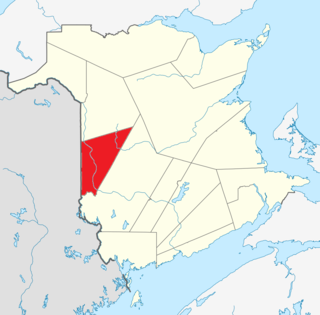
Johnville is a community in the Canadian province of New Brunswick. [1] It is situated in Kent, a parish of Carleton County. [2]
Johnville is a community in the Canadian province of New Brunswick. [1] It is situated in Kent, a parish of Carleton County. [2]
In the mid-19th century, New Brunswick's Catholic Bishop, John Sweeney, lobbied the colonial government for land for Irish emigrants. [3] In the early-to-mid 1860s, people began to move to the land granted to Johnville. (Maps indicate that some of the land in the area had been allocated to individuals prior to the establishment of the settlement.) Some residents came from Saint John, while others moved directly from Ireland. For some people, it was their first foray into farming. The Bishop, and successive Priests, worked alongside settlers to clear land, plant crops, and build dwellings. The Hall family built the first frame house, which was used as the church and rectory until the community erected these structures between 1867 and 1884. [4]

Carleton County is located in west-central New Brunswick, Canada.

York County is located in west-central New Brunswick, Canada. The county contains the provincial capital, Fredericton. Outside the city, farming and forestry are two major industries in the county, which is bisected by the Saint John River. The Southwest Miramichi River flows through the northern section of the county.

Hartland is a town in Carleton County, New Brunswick, Canada.
Juniper is a hamlet in Carleton County, New Brunswick, Canada. Juniper is located in Aberdeen Parish. It is situated on Route 107, which runs from Route 105 at Bristol, northeast to Juniper, and then bends southeast towards Napadogan and Deersdale. Geographic coordinates: 46° 33' North, 67° 13' West; elevation 899 ft.

Woodstock is a town in Carleton County, New Brunswick, Canada on the Saint John River, 103 km upriver from Fredericton at the mouth of the Meduxnekeag River. It is near the Canada–United States border and Houlton, Maine and the intersection of Interstate 95 and the Trans-Canada Highway making it a transportation hub. It is also a service centre for the potato industry and for more than 26,000 people in the nearby communities of Hartland, Florenceville-Bristol, Centreville, Bath, Meductic, and Canterbury for shopping, employment and entertainment.

Irish Canadians are Canadian citizens who have full or partial Irish heritage including descendants who trace their ancestry to immigrants who originated in Ireland. 1.2 million Irish immigrants arrived from 1825 to 1970, and at least half of those in the period from 1831 to 1850. By 1867, they were the second largest ethnic group, and comprised 24% of Canada's population. The 1931 national census counted 1,230,000 Canadians of Irish descent, half of whom lived in Ontario. About one-third were Catholic in 1931 and two-thirds Protestant.

Chatham is an urban neighbourhood in the city of Miramichi, New Brunswick, Canada.

The history of New Brunswick covers the period from the arrival of the Paleo-Indians thousands of years ago to the present day. Prior to European colonization, the lands encompassing present-day New Brunswick were inhabited for millennia by the several First Nations groups, most notably the Maliseet, Mi'kmaq, and the Passamaquoddy.
Peel is a Canadian rural community in Carleton County, New Brunswick. It is located on the east side of the Saint John River, 5.71 km NNW of Hartland, on the road to Stickney. It is part of Peel Parish.

John Sweeny was an Irish born, Canadian Roman Catholic priest and Bishop of Saint John in New Brunswick from 1859 to 1901.
Grafton is a community just outside Woodstock in the Canadian province of New Brunswick. It is situated in Northampton, a parish of Carleton County.

Northampton is a civil parish in Carleton County, New Brunswick, Canada, sitting across the Saint John River from Woodstock. It comprises two local service districts, both of which are members of the Western Valley Regional Service Commission (WVRSC).

Wicklow is a civil parish in Carleton County, New Brunswick, Canada, forming the northwestern corner of Carleton County. It comprises a single local service district and parts of one town and one village, all of which are members of the Western Valley Regional Service Commission (WVRSC).

Kent is a civil parish in the northeastern corner of Carleton County, New Brunswick, Canada. It comprises one village, two local service districts, and part of one town, all of which are members of the Western Valley Regional Service Commission (WVRSC).

Peel is a civil parish in Carleton County, New Brunswick, Canada, situated on the eastern bank of the Saint John River. It comprises one local service district and part of one town, both of which are members of the Western Valley Regional Service Commission (WVRSC).

Simonds is a civil parish in Carleton County, New Brunswick, Canada, located north of Woodstock on the western bank of the Saint John River. It comprises one local service district and part of one town, both of which are members of the Western Valley Regional Service Commission (WVRSC).
Knowlesville is a small community in Carleton County in the Canadian province of New Brunswick. Knowlesville is in Aberdeen Parish, with a population in the 2011 Census of 981. It is located approximately 20 km east of Florenceville-Bristol, New Brunswick, along the Knowlesville Road.

Bedell Settlement, often shortened to Bedell, is a settlement in Carleton County, New Brunswick.
Victoria Corner, New Brunswick is a community in Carleton County, New Brunswick, Canada located on the west side of the Saint John River, 3.71 km north of Wakefield, 10 miles from Woodstock, on the road to Somerville.
The Becaguimec Stream is a minor tributary of the Saint John River in the Canadian Province of New Brunswick. It rises in the hilly woods along the county line dividing Carleton County, Canada from York County, Canada in the western region of the province. Its watershed is adjacent to the South Branch of the Southwest Miramichi River, the Nashwaak River, the Keswick River and the Nackawic Stream.
Coordinates: 46°33′57.2″N67°33′19.9″W / 46.565889°N 67.555528°W