Transport in Bhutan uses about 8,000 kilometres (5,000 mi) of roads and four airports, three of which are operational and interconnected. Paro Airport is the only airport which accommodates international flights. As part of Bhutan's infrastructure modernization programs, its road system has been under development since the 1960s. There are no railways and, since Bhutan is a landlocked country without major waterways, there are no ports.

Trashigang District is Bhutan's easternmost dzongkhag (district).

Samdrup Jongkhar District is one of the 20 dzongkhags (districts) comprising Bhutan. The dominant languages of the district are Tshangla (Sharchopkha) in the north and west, and Nepali in the east. It covers a total area of 1878 sq km. Samdrup dzongkhag comprises two dungkhags: Jhomotsangkha and Samdrupchhoeling, and 11 gewogs.
Samdrup Jongkhar (Dzongkha:བསམ་གྲུབ་ལྗོངས་མཁར་) is a town and seat of Samdrup Jongkhar District in Bhutan.

Assam is the main and oldest state in the North-East Region of India and as the gateway to the rest of the Seven Sister States. The land of red river and blue hills, Assam comprises three main geographical areas: the Brahmaputra Valley which stretching along the length of the Brahmaputra river, the Barak Valley extending like a tail, and the intervening Karbi Plateau and North Cachar Hills. Assam shares its border with Meghalaya, Arunachal Pradesh, Nagaland, Manipur, Tripura, Mizoram and West Bengal; and there are National Highways leading to their capital cities. It also shares international borders with Bhutan and Bangladesh and is very close to Myanmar. In ancient times Assam was known as Pragjyotisha or Pragjyotishpura, and Kamarupa.
Gelephu, also spelled as Gelyephug, Gelegphu, Gaylegphug or Gaylephug, is a town or Thromde in Sarpang District in Bhutan. It is located on the Indian border, about 30 km to the east of Sarpang, the Dzongkhag (District) headquarters, and has a population of 9,858 as per the 2017 census. It is one of the road entry points into Bhutan from India. Phuntsholing to its west and Samdrup Jongkhar to its east are two other road entry points into Bhutan.
Panbang is a settlement in the south of Bhutan. It is located in Zhemgang District, close to the border with India.
Bhairabkunda is a popular picnic spot in Udalguri district in the State of Assam, India. It is situated on the border of Bhutan and Arunachal Pradesh, near the Bhutanese town of Daifam.

Udalguri district (Pron:ˌʊdʌlˈgʊəri), also known as Odalguri, is a district in the Bodoland Territorial Region of the state of Assam in Northeastern India. Udalguri town is the headquarters of the district.
Deothang, also known as Dewathang, is a town in south-eastern Bhutan which falls under Samdrup Jongkhar District. In 2010 it became part of Samdrup Jongkhar municipality (thromde).

Lauri Gewog is a gewog of Samdrup Jongkhar District, Bhutan. It was also part of Jomotsangkha Dungkhag (sub-district), together with Serthi Gewog.

Orong Gewog is a gewog of Samdrup Jongkhar District, Bhutan. It is situated north of Samdrup Jongkhar town. The Gewog is about 45 km from Samdrup Jongkhar with a 12 km Gewog Center (GC) road bifurcating from the national highway at Shekpashing which connects Samdrup Jongkhar and Trashigang District.

Sakteng Wildlife Sanctuary is a wildlife sanctuary in Bhutan, located in Merak and Sakteng Gewogs of Trashigang District and just crossing the border into Samdrup Jongkhar District. It is one of the country's protected areas and is listed as a tentative site in Bhutan's Tentative List for UNESCO inclusion.

Jomotsangkha Wildlife Sanctuary is the smallest protected area of Bhutan covering 334.73 square kilometres (129.24 sq mi) in Samdrup Jongkhar District along the southern border with Assam. Its elevations range between 400 metres (1,300 ft) and 2,200 metres (7,200 ft). Khaling Wildlife Sanctuary is, despite its small acreage, an important habitat for elephants, gaur, and other tropical wildlife. It may also contain the rare pygmy hog and hispid hare known to inhabit the adjacent Khaling Reserve in Assam, with which Khaling Wildlife Sanctuary forms a trans-border reserve.

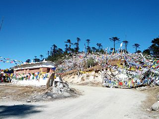
Thrumshing La, also called Thrumshingla Pass and Donga Pass,, is the second-highest mountain pass in Bhutan, connecting its central and eastern regions across the otherwise impregnable Donga range that has separated populations for centuries. It is located on a bend of the Lateral Road at the border of Bumthang District and Mongar District, along the border with Lhuntse District to the east. The Lateral Road bisects Thrumshingla National Park, named after the pass. The World Wildlife Fund also maintains operations in the park.
Arunachal Frontier Highway, also Mago-Thingbu–Vijaynagar Border Highway, is a planned border highway in the Indian state of Arunachal Pradesh. The 2,000-kilometre-long (1,200 mi) road follows the McMahon Line, the international border between India and China. The Government of India estimates the cost at ₹40,000 crore.

Dasho Tshering Wangchuk is a Bhutanese jurist who served as the Chief Justice of the Supreme Court of Bhutan from 2014 to 2019. In 2018, Wanghuck served as the interim Head of Government of Bhutan, when serving as the Chief Advisor of the Interim Government, following the dissolution of the Bhutanese National Assembly in preparation of elections.

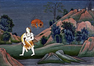
Bhairabkunda Shiva Mandir or Daifam Shiv Mandir is one of the most important Hindu temples in Bhutan. It is located in the south east corner of Bhutan near the town of Jomotsangkha (Daifam) in and about 24km from the town of Udalguri in Assam.
Dantak, also known as Project DANTAK, is an overseas project of the Border Roads Organisation under the Ministry of Defence of India. Project DANTAK was established on 24 April 1961 as a result of an agreement between Jigme Dorji Wangchuck, the third king of Bhutan and then Prime Minister of India Jawahar Lal Nehru. Colonel T.V. Jaganathan was appointed as the first Chief Engineer of DANTAK. The project is involved in identifying the most important aspects of connectivity and in spurring the socio-economic development and growth of Bhutan, It is tasked to construct and maintain roads suitable for motorised transportation in Bhutan. and was established under the provision of the Indo-Bhutan Treaty of Peace and Friendship, 1949.


