McDowell County is a county located in the U.S. state of North Carolina. As of the 2010 census, the population was 44,996. Its county seat is Marion.

Shelby is a city in and the county seat of Cleveland County, North Carolina, United States. It lies near the western edge of the Charlotte combined statistical area. The population was 20,323 at the 2010 census. Shelby is located in between Charlotte and Asheville, and has become a noted tourism and wedding destination in Western North Carolina. A moderate climate, affordable living, and growing need for industrial employees attract relocators to the area.

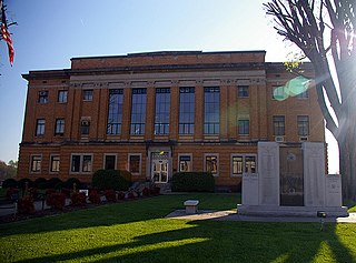
Marion is a city in McDowell County, North Carolina, United States. It is the county seat of McDowell County. Founded in 1844, the city was named in honor of Brigadier General Francis Marion, the American Revolutionary War Hero whose talent in guerrilla warfare earned him the name "Swamp Fox". Marion's Main Street Historic District is listed on the National Register of Historic Places. The population was 7,838 at the 2010 Census.

Old Fort is a town in McDowell County, North Carolina, United States. The population was 908 at the 2010 Census.

Rock Hill is the largest city in York County, South Carolina, United States and the fifth-largest city in the state. It is also the fourth-largest city of the Charlotte metropolitan area, behind Charlotte, Concord, and Gastonia. As of the 2010 Census, the population was 66,154. In 2019, the population had increased to 75,048. As of 2017, the total population of the Rock Hill Census County Division was estimated at 117,375 people.

Elizabethton is a city in, and the county seat of Carter County, Tennessee, United States. Elizabethton is the historical site of the first independent American government located west of both the Eastern Continental Divide and the original Thirteen Colonies.

The Battle of Kings Mountain was a military engagement between Patriot and Loyalist militias in South Carolina during the Southern Campaign of the American Revolutionary War, resulting in a decisive victory for the Patriots. The battle took place on October 7, 1780, 9 miles (14 km) south of the present-day town of Kings Mountain, North Carolina in what is now rural Cherokee County, South Carolina, where the Patriot militia defeated the Loyalist militia commanded by British Major Patrick Ferguson of the 71st Foot. The battle has been described as "the war’s largest all-American fight".
John Brown (1738–1812) was a teacher, farmer, and statesman from Wilkes County, North Carolina. He was a Captain in the Wilkes County Regiment of the North Carolina militia during the Revolutionary War, served as one of the state Treasurers (1782–1784), and served in the North Carolina state legislature (1784–1787).
Kings Mountain National Military Park is a National Military Park near Blacksburg, South Carolina, along the North Carolina/South Carolina border. The park commemorates the Battle of Kings Mountain, a pivotal and significant victory by American Patriots over American Loyalists during the Southern Campaign of the Revolutionary War. It was listed on the National Register of Historic Places in 1996. Thomas Jefferson considered the battle "The turn of the tide of success."

The Overmountain Victory National Historic Trail (OVHT) is part of the U.S. National Trails System, and N.C. State Trail System. It recognizes the Revolutionary War Overmountain Men, Patriots from what is now East Tennessee who crossed the Unaka Mountains and then fought in the Battle of Kings Mountain in South Carolina.

The Overmountain Men were American frontiersmen from west of the Appalachian Mountains who took part in the American Revolutionary War. While they were present at multiple engagements in the war's southern campaign, they are best known for their role in the American victory at the Battle of Kings Mountain in 1780. The term "overmountain" arose because their settlements were west of, or "over", the Appalachians, which was the primary geographical boundary dividing the 13 American colonies from the western frontier. The Overmountain Men hailed from parts of Virginia, North Carolina, and what is now Tennessee and Kentucky.
The Battle of Mobley's Meeting House was an engagement that occurred during the American Revolutionary War in the Mobley Settlement, Fairfield County, South Carolina during the southern campaign of Lord Cornwallis.

Lake James is a large reservoir in the mountains of Western North Carolina which straddles the border between Burke and McDowell Counties. It is named for tobacco tycoon and benefactor of Duke University, James Buchanan Duke. The lake, with surface elevation of 1200 ft, lies behind a series of 4 earthen dams. It was created by Duke Power between 1916-1923 as a hydro-electric project. It still generates power today and is the uppermost lake on the Catawba River system.

The Battle of Musgrove Mill, August 19, 1780, occurred near a ford of the Enoree River, near the present-day border between Spartanburg, Laurens and Union Counties in South Carolina. During the course of the battle, 200 Patriot militiamen defeated a combined force of approximately 300 Loyalist militiamen and 200 provincial regulars.

The Carson House is a historic house and museum located in Marion, North Carolina that was the home of Col. John Carson, and served as the McDowell County courthouse at the county's inception in 1842.
Colonel David Vance was an American soldier during the Revolutionary War.

Little Sugar Creek Greenway is a linear park and stream restoration project in Mecklenburg County, North Carolina. When completed it will consist of twenty miles of trails and paved walkways running from Cordelia Park just north of uptown Charlotte, then south through midtown Charlotte, and continuing all the way to the South Carolina state line. The Little Sugar Creek Greenway will be a key part of the Carolina Thread Trail, a regionwide network of trails that will ultimately pass through 15 counties.
The Fonta Flora State Trail is a unit of the North Carolina state park system in Buncombe, McDowell, and Burke Counties, North Carolina in the United States, and it consists of 90 acres (36 ha) of conservation land and 19 miles (31 km) designated multi-use trail. The State Trail is planned as a continuous route for hikers and cyclists from Asheville to Morganton, with a loop around Lake James. The trail is a collaboration between local governments, local land conservancies the US Forest Service, and the state, with development coordinated by the North Carolina Division of Parks and Recreation (NCDPR).
The Wilderness Gateway State Trail is a unit of the North Carolina state park system in Burke, Catawba, McDowell and Rutherford Counties, North Carolina in the United States. The State Trail is planned as a hiking trail connecting the Town of Valdese, the City of Hickory, the Overmountain Victory National Historic Trail, South Mountains State Park and Chimney Rock State Park The trail is a collaboration between local governments and the state, with development coordinated by the North Carolina Division of Parks and Recreation (NCDPR).
Pleasant Gardens was the plantation in Rowan County, North Carolina occupied by Joseph "Pleasant Gardens" McDowell (1758–1799). Remains of the Pleasant Gardens house are located near Marion, North Carolina.

