Joseph Snake

Last updated

Joseph Snake was an Ojibwe chief belonging to the Chippewas of Lakes Huron and Simcoe from sometime before 1842 until his death in 1861.

Ojibwe group of indigenous peoples in North America

The Ojibwe, Ojibwa, Chippewa, or Saulteaux are an Anishinaabe people of Canada and the United States. They are one of the most numerous indigenous peoples north of the Rio Grande. In Canada, they are the second-largest First Nations population, surpassed only by the Cree. In the United States, they have the fifth-largest population among Native American peoples, surpassed in number only by the Navajo, Cherokee, Choctaw and Sioux.

Having relinquished virtually all of their territory west of Lake Simcoe to the government of Upper Canada in the Lake Simcoe–Lake Huron Purchase of 1815 [1] and the Lake Simcoe–Nottawasaga Purchase of 1818, [2] these Ojibwe converted to Methodism in 1828 and were persuaded by Lieutenant Governor John Colborne to settle permanently in 1830 in purpose-built villages at Coldwater and Atherley Narrows between Lakes Simcoe and Couchiching. [3] . At the same time, Colborne set aside Georgina Island, Snake Island, and Fox Island in Lake Simcoe as a reservation for the Ojibwe.

Upper Canada 19th century British colony in present-day Ontario

The Province of Upper Canada was a part of British Canada established in 1791 by the Kingdom of Great Britain, to govern the central third of the lands in British North America, formerly part of the Province of Quebec since 1763. Upper Canada included all of modern-day Southern Ontario and all those areas of Northern Ontario in the Pays d'en Haut which had formed part of New France, essentially the watersheds of the Ottawa River or Lakes Huron and Superior, excluding any lands within the watershed of Hudson Bay. The "upper" prefix in the name reflects its geographic position along the Great Lakes, mostly above the headwaters of the Saint Lawrence River, contrasted with Lower Canada to the northeast.

The Lake Simcoe–Lake Huron Purchase, registered as Crown Treaty Number Sixteen, was signed November 18, 1815 between the Ojibwa and the government of Upper Canada. It purchased a large portion of the lands between Lake Simcoe and Lake Huron, including all of the territory upon which the Penetanguishene Road had recently been cut.

Methodism Group of historically related denominations of Protestant Christianity

Methodism, also known as the Methodist movement, is a group of historically related denominations of Protestant Christianity which derive their inspiration from the life and teachings of John Wesley. George Whitefield and John's brother Charles Wesley were also significant early leaders in the movement. It originated as a revival movement within the 18th-century Church of England and became a separate denomination after Wesley's death. The movement spread throughout the British Empire, the United States, and beyond because of vigorous missionary work, today claiming approximately 80 million adherents worldwide.

A change of government in 1836, with Francis Bond Head replacing Colborne as Lieutenant Governor, soon brought this "civilising" experiment to an end. Bond Head persuaded the Ojibwe to leave the Narrows-Coldwater corridor (which remained Crown land) in return for one-third of the proceeds of the anticipated sales of lots there to future European settlers. [4] In 1842, their leading chiefs, Musquakie (otherwise known as William Yellowhead), head chief and leader of the Narrows settlement, and John Aisance, leader of the Coldwater settlement, wrote to Governor General Charles Bagot protesting that Bond Head had not fully explained this purchase agreement, and had, in particular, not made it clear that it did not involve an upfront, lump-sum payment, nor that the Ojibwe would receive only one-third of the sale proceeds. [5] One of the four other chiefs who subscribed to this letter was Joseph Snake, whose signature occurs immediately after that of Musquakie, and before that of Aisance in the list.

Francis Bond Head British soldier and Lieutenant-Governor of Upper Canada

Sir Francis Bond Head, 1st Baronet KCH PC, known as "Galloping Head", was Lieutenant-Governor of Upper Canada during the rebellion of 1837.

William Yellowhead, or "Musquakie" or "Misquuckkey", as he was known in his own Ojibwe language was the "head chief" of the Chippaweans of Lakes Huron and Simcoe and leader of the Deer clan of that people from 1817 until his death in 1864. He led his people in taking arms in defence of Upper Canada in the Upper Canada Rebellion, oversaw the sale of the bulk of their territory to the provincial government, and led them in their first attempts to adopt an agrarian way of life. Although the claims of several other persons have been advanced, it is generally believed that Musquakie is the origin of the name of the District Municipality of Muskoka.

John Aisance was a chief among the Chippewas of Lakes Huron and Simcoe and leader of the Otter clan of that people from at least 1815 until his death in 1847. He participated in the Lake Simcoe–Lake Huron Purchase in 1815, served the provincial government during the Upper Canada Rebellion, and was the first and founding chief of the Beausoleil First Nation.

As a result of the 1836 agreement, the Ojibwe were obliged to abandon their villages at the Narrows and Coldwater and make homes elsewhere. Whereas Musquakie led the Narrows band to a new settlement at nearby Rama in 1838, and Aisance led the Coldwater band to Beausoleil Island in Georgian Bay in 1842, it seems that the Ojibwe who had settled after 1830 on Snake Island and the other islands of Lake Simcoe remained in place with Joseph Snake as their chief. They sustained themselves by hunting and fishing, although a certain amount of farming was also taking place. [6] By 1858 this "Snake Island band" was regarded by the government as a distinct community from the Rama band (now the Chippewas of Rama First Nation) and the Beausoleil band (now the Beausoleil First Nation), [7] but they retained close links to Rama, whose Methodist preacher ministered to them. The band was the historical antecedent of the Chippewas of Georgina Island First Nation.

Mnjikaning First Nation 32 Indian reserve in Ontario, Canada

Mnjikaning First Nation 32 is an Anishinaabe reserve in Simcoe County, Ontario. It is the main reserve of the Chippewas of Rama First Nation.

Beausoleil Island island in Muskoka District, Ontario, Canada

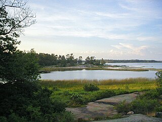
Beausoleil Island is an 8-kilometre (5.0 mi) long island in the municipality of Georgian Bay, District Municipality of Muskoka in Central Ontario, Canada. Located in the Thirty Thousand Islands in Georgian Bay on Lake Huron near Port Severn, it is the largest island in Georgian Bay Islands National Park and is the only place in the park where camping is allowed. Beausoleil Island is also part of the Georgian Bay Littoral UNESCO Biosphere reserve.

Georgian Bay large bay of Lake Huron, Canada

Georgian Bay is a large bay of Lake Huron, located entirely within Ontario, Canada. The main body of the bay lies east of the Bruce Peninsula and Manitoulin Island. To its northwest is the North Channel.

Chief Joseph Snake died in 1861. [8] Chief Joseph Snake Road on Georgina Island was named for him.

Related Research Articles

District Municipality of Muskoka Regional municipality in Ontario, Canada

The District Municipality of Muskoka, more generally referred to as the District of Muskoka or Muskoka, is a regional municipality in Central Ontario, Canada. Muskoka extends from Georgian Bay in the west, to the northern tip of Lake Couchiching in the south, to the western border of Algonquin Provincial Park in the east. A two-hour drive north of Toronto, Muskoka spans 6,475 km2 (2,500 sq mi). Muskoka has some 1,600 lakes, making it a popular cottaging destination.

Severn, Ontario Township in Ontario, Canada

Severn is a township in south-central Ontario, Canada, located between Lake Couchiching, and the Severn River in Simcoe County.

Wahta Mohawks Indian reserve in Ontario, Canada

The Wahta Mohawks are a Mohawk First Nation in Ontario. The Wahta Mohawk Territory is their territory (reserve) in the District Municipality of Muskoka, Ontario, Canada near Bala. It is bounded on the west by Highway 400, a major north-south artery in the province. About one-third of the 831 citizens of Wahta Mohawk Territory live in the community of Wahta, along District Road 38, another third live within 100 km, and the remainder live elsewhere.

The Lac du Flambeau Band of Lake Superior Chippewa are a federally recognized Ojibwa Native American tribe, with an Indian reservation lying mostly in the Town of Lac du Flambeau in south-western Vilas County, and in the Town of Sherman in south-eastern Iron County in the U.S. state of Wisconsin. The Lac du Flambeau Indian Reservation, located at 45°59′05″N89°52′38″W, has a land area of 108.065 sq mi (279.887 km²) and a 2000 census resident population of 2,995 persons. Its major settlement is the unincorporated Lac du Flambeau, which had a population of 1,646 persons.

Chippewas of Georgina Island First Nation Indian reserve in Ontario, Canada

The Chippewas of Georgina Island First Nation are an Ojibwa people located on Georgina Island in Lake Simcoe, Ontario, Canada. Of the First Nation's registered population of 666 people, 181 live on, and 485 live outside, their reserve. They are one of a handful of First Nations in the Toronto Census Metropolitan Area.

Christian Island island in Canada

Christian Island is a large island in Georgian Bay close to the communities of Penetanguishene and Midland, Ontario. The island, with its neighbours Hope Island and Beckwith Island, is a 5,428.1 hectares Ojibwa reserve, known as Christian Island Indian Reserve No. 30. Together with the 7.5 hectares Christian Island Indian Reserve No. 30A located at Cedar Point, Ontario and the 3.1 hectares Chippewa Island Indian Reserve located in Twelve Mile Sound, 27.5 kilometres (17.1 mi) north of Christian Island, it forms the land base for the Beausoleil First Nation. Christian Islands' highest elevation is 209 metres above sea level.

Mississippi River Band of Chippewa Indians or simply the Mississippi Chippewa, are a historical Ojibwa Band inhabiting the headwaters of the Mississippi River and its tributaries in present-day Minnesota.

Snake Island (Lake Simcoe) island in Ontario, Canada

Snake Island is a lake island located in Lake Simcoe, Ontario, Canada. After the War of 1812, these islands, along with Fox Island and Georgina Island were purchased by Chief Joseph Snake from the British. It is unclear if the islands were named after him.

The Lake Superior Chippewa were a large historical band of Ojibwe (Anishinaabe) Indians living around Lake Superior; this territory is considered part of northern Michigan, Wisconsin, and Minnesota in the United States. They migrated into the area by the seventeenth century, encroaching on the Eastern Dakota people who historically occupied the area. The Ojibwe defeated the Eastern Dakota and had their last battle in 1745, after which the Dakota Sioux migrated west into the Great Plains. While sharing a common culture and Anishinaabe language, this group of Ojibwe was highly decentralized, with at least twelve independent bands in this region.

Chippewas of Rama First Nation human settlement in Ontario, Canada

Chippewas of Rama First Nation, also known as Chippewas of Mnjikaning and Chippewas of Rama Mnjikaning First Nation, is an Anishinaabe (Ojibway) First Nation located in the province of Ontario in Canada. The name Mnjikaning, or fully vocalized as Minjikaning, refers to the fishing weirs at Atherley Narrows between Lake Simcoe and Lake Couchiching and it means "in/on/at or near the fence".

Georgina Island island in Canada

Georgina Island is the largest of the lake islands of Lake Simcoe, located in southern Ontario, Canada. The island is a Native reserve populated by the Chippewas of Georgina Island First Nation, a band of Ojibwa people. It is also within the Town of Georgina and in the Regional Municipality of York.

Beausoleil First Nation Indian reserve in Ontario, Canada

Beausoleil First Nation is an Ojibwe First Nation band government located in Simcoe County, Ontario, Canada. The main settlement of the Beausoleil First Nation is on Christian Island, Ontario, Canada in southern Georgian Bay. As of 2018, the total number of status Indians registered with the First Nation is 2,587. The on-reserve population is 614.

Caldwell First Nation Indian reserve in Ontario, Canada

The Caldwell First Nation is a First Nations band government whose land base is located in Leamington, Ontario, Canada. They are an Anishinaabe group, part of the Three Fires Confederacy, comprising the bands Potawatomi, Odawa, and Ojibwa, whose members are originally of the Mikinaak (Turtle) and the Makwa (Bear) dodems. The Caldwell First Nation are a distinct and federally recognized Indian band and used to be referred to by such names as: the "Chippewas of Pelee", "Point Pelee Indians" and "Caldwell's band of Indians."

The 2015–16 GMHL season was the tenth season of the Greater Metro Junior A Hockey League (GMHL). The thirty-two teams of the GMHL played 42-game schedules.

Yellow Head, "Chief of Lake Simcoe", was the "head chief" of the Chippewas of Lakes Huron and Simcoe from sometime before 1797 until 1817. Evidently he was already exercising that office when, in the late summer of 1797, he led a contingent of some 140 of his Ojibwe to York and Niagara, the administrative centres of Upper Canada, seeking redress of grievances concerning absence of government contact and non-receipt of customary "annual Presents". Yellow Head was instrumental in persuading the Ojibwe of the Home District of Upper Canada to take up arms in support of the British during the War of 1812, and personally saw action at the Battle of York in April 1813, where he sustained wounds that appear to have curtailed his subsequent career. His son Musquakie, similarly known as Yellow Head, and as William Yellowhead, seems to have assumed Yellow Head's chiefly duties by 1815, and in 1817 he formally replaced his father as head chief. The date and circumstances of Yellow Head's death are not known.

References

  1. http://www.aadnc-aandc.gc.ca/eng/1370372152585/1370372222012#ucls15 (Treaty 16)
  2. http://www.aadnc-aandc.gc.ca/eng/1370372152585/1370372222012#ucls15 (Treaty 18)
  3. Murray (ed.), Muskoka and Haliburton, 109
  4. Indian Treaties and Surrenders, Vol. 1, 117 (Treaty 48)
  5. Murray (ed.), Muskoka and Haliburton, 115-16
  6. Murray (ed.), Muskoka and Haliburton, 122-23
  7. Murray (ed.), Muskoka and Haliburton, 119
  8. Murray (ed.), Muskoka and Haliburton, 116