Joulter Cays

Last updated
Joulter Cays
Bahamas location map.svg
Red pog.svg
Joulter Cays
The location of Joulter Cays within the Bahamas
Geography
Location Atlantic Ocean
Coordinates 25°16′N78°07′W / 25.267°N 78.117°W / 25.267; -78.117 Coordinates: 25°16′N78°07′W / 25.267°N 78.117°W / 25.267; -78.117
Type Cay
Archipelago Lucayan Archipelago
Administration
Demographics
Population0
Joulter Cays 7S41000501056.jpg
Joulter Cays and associated sand shoals (1984)
Joulter Cays Andros Island 1999.jpg
Oblique view (1999)
Joulter Cays p013r043 7x20010516.jpg
Landsat (2001)

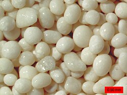
The Joulter Cays are small uninhabited islands to the north of Andros Island in the Bahamas. Oolitic sand dominates the intertidal zone around the small islands that are covered with vegetation.

The Joulter Cays were designated as an Important Bird Area for the endangered piping plover and short-billed dowitcher in 2012. The National Audubon Society's International Alliances Program and the Bahamas National Trust was working together to establish, in 2015, the Joulter Cays as a national park. [1] [2] The islands are known as a flyfishing destination for bonefish and permit. [3] [4]

Matt Jeffery, Deputy Director of Audubon's International Alliances Program, called Joulter Cays a true paradise and treasure of the Bahamas, rich in birds, fisheries, and other wildlife. [1] However, some local residents are concerned that a national park status would prohibit their bonefish guiding service to tourists. [5]

Related Research Articles

Piping plover Species of bird

The piping plover is a small sand-colored, sparrow-sized shorebird that nests and feeds along coastal sand and gravel beaches in North America. The adult has yellow-orange-red legs, a black band across the forehead from eye to eye, and a black stripe running along the breast line. This chest band is usually thicker in males during the breeding season, and it is the only reliable way to tell the sexes apart. The bird is difficult to see when it is standing still, as it blends well with open, sandy beach habitats. It typically runs in short spurts and stops.

Andros, Bahamas

Andros Island is an archipelago within the Bahamas, the largest of the Bahamian Islands. Politically considered a single island, Andros in total has an area greater than all the other 700 Bahamian islands combined. The land area of Andros consists of hundreds of small islets and cays connected by mangrove estuaries and tidal swamplands, together with three major islands: North Andros, Mangrove Cay, and South Andros. The three main islands are separated by "bights", estuaries that trifurcate the island, connecting the island's east and west coasts. It is 167 kilometres (104 mi) long by 64 km (40 mi) wide at the widest point.

Abaco Islands Group of islands in the Bahamas

The Abaco Islands lie in the northern Bahamas, 180 miles off the South Florida coast. They comprise the main islands of Great Abaco and Little Abaco, along with smaller barrier cays. The northernmost are Walker's Cay, and its sister island Grand Cay. To the south, the next inhabited islands are Spanish Cay and Green Turtle Cay, with its settlement of New Plymouth, Great Guana Cay, private Scotland Cay, Man-O-War Cay, and Elbow Cay, with its settlement of Hope Town. Southernmost are Tilloo Cay and Lubbers Quarters. Another of note off Abaco's western shore is onetime Gorda Cay, now a Disney Island and cruise ship stop and renamed Castaway Cay. Also in the vicinity is Moore's Island. On the Big Island of Abaco is Marsh Harbour, the Abacos' commercial hub and the Bahamas' third largest city, plus the resort area of Treasure Cay. Both have airports. A few mainland settlements of significance are Coopers Town and Fox Town in the north and Cherokee and Sandy Point in the south. Administratively, the Abaco Islands constitute seven of the 31 Local Government Districts of the Bahamas: Grand Cay, North Abaco, Green Turtle Cay, Central Abaco, South Abaco, Moore's Island, and Hope Town.

Exuma Place in Bahamas

Exuma is a district of the Bahamas, consisting of over 365 islands, also called cays.

South Andros Place in Andros, Bahamas

South Andros is a district of the nation of the Bahamas.

<i>Cyclura cychlura inornata</i> Subspecies of lizard

Cyclura cychlura inornata, the Allen Cays rock iguana or Allen Cays iguana, is a subspecies of the northern Bahamian rock iguana that is found on Allen's Cay and adjacent islands in the Bahamas. Its status in the IUCN Red List is critically endangered, with an estimated wild population of 482–632 animals.

Outline of the Bahamas Overview of and topical guide to The Bahamas

The following outline is provided as an overview of and topical guide to The Bahamas:

Walkers Cay

Walker's Cay is the northernmost island in the Bahamas, part of the North Abaco district. Once a popular sport fishing location, the island has been deserted since 2004, following severe hurricane damage. The island is currently undergoing renovation under new ownership.

The Bahamas National Trust is a non-profit organisation in the Bahamas that manages the country's 32 national parks. Its headquarters is located in New Providence at The Retreat Gardens on Village Road. The Bahamas National Trust was created by an Act of Parliament in 1959, through the efforts of two groups of conservationists.

Whitefish Point Bird Observatory

The Whitefish Point Bird Observatory (WPBO) is located in Chippewa County, Michigan, USA, adjacent to the Whitefish Point Unit of the Seney National Wildlife Refuge. It operates as a non-profit, affiliate education and research facility of the Michigan Audubon Society. The Society and the WPBO together have recorded over 300 species of birds at Whitefish Point. As one of a network of bird observatories in the Canadian Migration Monitoring Network, the WPBO documents the bird population of the Great Lakes region through bird banding, data collection, and research studies.

Index of Bahamas-related articles

The following is an alphabetical list of topics related to the Commonwealth of The Bahamas.

Exuma Cays Land and Sea Park

The Exuma Cays Land and Sea Park is a protected area in the Exuma Cays of the Bahamas. The protected area extends from Shroud Cay in the north to Bell Cay in the south. The vegetation consists of mangrove communities, with the east sides being clad in low scrub and the western sides with taller scrub. There are many epiphytic orchids and bromeliads.

Inagua National Park National park on the island of Great Inagua in The Bahamas

Inagua National Park is a national park on the island of Great Inagua in The Bahamas. It was established in 1965 and has an area of 220,000 acres (890 km2).

Quicksand Pond

Quicksand Pond is a pond in Little Compton, Rhode Island.

Staniel Cay

Staniel Cay is an island located in The Exuma Cays, a district of The Bahamas.

Conception Island National Park

The Conception Island National Park is a protected area in the Bahamas. The island lies between Cat Island to the north and Rum Cay to the south. The vegetation consists of mangrove communities, with typical strand vegetation, and the island is visited by green turtles, sea birds and migrating birds.

West Side National Park

West Side National Park is a national park covering the western half of Andros, the Bahamas, and the surrounding waters. The park was established in 2002 and, after being expanded in 2012, has an area of 1,500,000 acres (6,070 km2), being one of the largest protected areas in the region. The park is regarded as a marine protected area, which includes tidal creeks and coastal mangrove forest, as well as an expansive coastal zone.

Black Sound Cay National Reserve

Black Sound Cay National Reserve is a national park on Green Turtle Cay in North Abaco, the Bahamas. The park was established in 1988 and has an area of 2 acres (0.81 ha).

North and South Marine Parks

The North and South Marine Parks are national parks off the eastern coast of Andros, the Bahamas. The parks were established in 2002 and have an area of 5,000 acres.

Moriah Harbour Cay National Park

Moriah Harbour Cay National Park is a national park in Exuma, the Bahamas. The reserve was established in 2002 and, after expansion in 2015, has an area of 16,800 acres (68 km2).

References

Oolitic sand grains from Joulter Cays Ooids, Joulter Cays, Bahamas.jpg
Oolitic sand grains from Joulter Cays
  1. 1 2 Anadon, Veronica (June 11, 2013). "Establishing Joulter Cays IBA as a National Park in the Bahamas". birdlife.org. Bird Life International . Retrieved March 20, 2015.
  2. "Joulter Cays National Park in Bahamas". Protected Planet. Retrieved 2 January 2019.CS1 maint: discouraged parameter (link)
  3. "Fly Fishing Andros Island in the Bahamas". flyfishingconnection.com. Copyright ©1998-2007, The Flyfishing Connection. Retrieved March 20, 2015.
  4. "Joulter Cays Proposed Park". The Bahamas National Trust. Retrieved 2 January 2019.CS1 maint: discouraged parameter (link)
  5. Wise, Cat (February 17, 2015). "Why scientists want to protect the piping plover's winter home". PBS.org. © 1996 - 2015 NewsHour Productions LLC. Retrieved March 20, 2015.