
Erosion is the action of surface processes that removes soil, rock, or dissolved material from one location on the Earth's crust and then transports it to another location where it is deposited. Erosion is distinct from weathering which involves no movement. Removal of rock or soil as clastic sediment is referred to as physical or mechanical erosion; this contrasts with chemical erosion, where soil or rock material is removed from an area by dissolution. Eroded sediment or solutes may be transported just a few millimetres, or for thousands of kilometres.
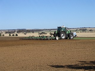
Tillage is the agricultural preparation of soil by mechanical agitation of various types, such as digging, stirring, and overturning. Examples of human-powered tilling methods using hand tools include shoveling, picking, mattock work, hoeing, and raking. Examples of draft-animal-powered or mechanized work include ploughing, rototilling, rolling with cultipackers or other rollers, harrowing, and cultivating with cultivator shanks (teeth).

Crop rotation is the practice of growing a series of different types of crops in the same area across a sequence of growing seasons. This practice reduces the reliance of crops on one set of nutrients, pest and weed pressure, along with the probability of developing resistant pests and weeds.
Soil erosion is the denudation or wearing away of the upper layer of soil. It is a form of soil degradation. This natural process is caused by the dynamic activity of erosive agents, that is, water, ice (glaciers), snow, air (wind), plants, and animals. In accordance with these agents, erosion is sometimes divided into water erosion, glacial erosion, snow erosion, wind (aeolean) erosion, zoogenic erosion and anthropogenic erosion such as tillage erosion. Soil erosion may be a slow process that continues relatively unnoticed, or it may occur at an alarming rate causing a serious loss of topsoil. The loss of soil from farmland may be reflected in reduced crop production potential, lower surface water quality and damaged drainage networks. Soil erosion could also cause sinkholes.
Conservation agriculture (CA) can be defined by a statement given by the Food and Agriculture Organization of the United Nations as "Conservation Agriculture (CA) is a farming system that can prevent losses of arable land while regenerating degraded lands.It promotes minimum soil disturbance, maintenance of a permanent soil cover, and diversification of plant species. It enhances biodiversity and natural biological processes above and below the ground surface, which contribute to increased water and nutrient use efficiency and to improved and sustained crop production."
In geotechnical engineering, soil structure describes the arrangement of the solid parts of the soil and of the pore space located between them. It is determined by how individual soil granules clump, bind together, and aggregate, resulting in the arrangement of soil pores between them. Soil has a major influence on water and air movement, biological activity, root growth and seedling emergence. There are several different types of soil structure. It is inherently a dynamic and complex system that is affected by different factors.
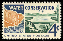
Water conservation includes all the policies, strategies and activities to sustainably manage the natural resource of fresh water, to protect the hydrosphere, and to meet the current and future human demand. Population, household size and growth and affluence all affect how much water is used. Factors such as climate change have increased pressures on natural water resources especially in manufacturing and agricultural irrigation. Many countries have already implemented policies aimed at water conservation, with much success. The key activities to conserve water are as follows: any beneficial reduction in water loss, use and waste of resources, avoiding any damage to water quality; and improving water management practices that reduce the use or enhance the beneficial use of water. Technology solutions exist for households, commercial and agricultural applications. Water conservation programs involved in social solutions are typically initiated at the local level, by either municipal water utilities or regional governments.
A buffer zone is a neutral zonal area that lies between two or more bodies of land, usually pertaining to countries. Depending on the type of buffer zone, it may serve to separate regions or conjoin them. Common types of buffer zones are demilitarized zones, border zones and certain restrictive easement zones and green belts. Such zones may be comprised by a sovereign state, forming a buffer state.

No-till farming is an agricultural technique for growing crops or pasture without disturbing the soil through tillage. No-till farming decreases the amount of soil erosion tillage causes in certain soils, especially in sandy and dry soils on sloping terrain. Other possible benefits include an increase in the amount of water that infiltrates into the soil, soil retention of organic matter, and nutrient cycling. These methods may increase the amount and variety of life in and on the soil. While conventional no-tillage systems use herbicides to control weeds, organic systems use a combination of strategies, such as planting cover crops as mulch to suppress weeds.
Natural Resources Conservation Service (NRCS), formerly known as the Soil Conservation Service (SCS), is an agency of the United States Department of Agriculture (USDA) that provides technical assistance to farmers and other private landowners and managers.

Forestation is a vital ecological process where forests are established and grown through afforestation and reforestation efforts. Afforestation involves planting trees on previously non-forested lands, while reforestation focuses on replanting trees in areas that were once deforested. This process plays an important role in restoring degraded forests, enhancing ecosystems, promoting carbon sequestration, and biodiversity conservation.

Agricultural wastewater treatment is a farm management agenda for controlling pollution from confined animal operations and from surface runoff that may be contaminated by chemicals in fertilizer, pesticides, animal slurry, crop residues or irrigation water. Agricultural wastewater treatment is required for continuous confined animal operations like milk and egg production. It may be performed in plants using mechanized treatment units similar to those used for industrial wastewater. Where land is available for ponds, settling basins and facultative lagoons may have lower operational costs for seasonal use conditions from breeding or harvest cycles. Animal slurries are usually treated by containment in anaerobic lagoons before disposal by spray or trickle application to grassland. Constructed wetlands are sometimes used to facilitate treatment of animal wastes.
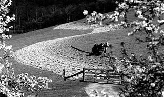
Contour bunding or contour farming or Contour ploughing is the farming practice of plowing and/or planting across a slope following its elevation contour lines. These contour lines create a water break which reduces the formation of rills and gullies during times of heavy precipitation, allowing more time for the water to settle into the soil. In contour plowing, the ruts made by the plow run perpendicular rather than parallel to the slopes, generally furrows that curve around the land and are level. This method is also known for preventing tillage erosion. Tillage erosion is the soil movement and erosion by tilling a given plot of land. A similar practice is contour bunding where stones are placed around the contours of slopes. Contour ploughing has been proved to reduce fertilizer loss, power and time consumption, and wear on machines, as well as to increase crop yields and reduces soil erosion.

Soil conservation is the prevention of loss of the topmost layer of the soil from erosion or prevention of reduced fertility caused by over usage, acidification, salinization or other chemical soil contamination.

Prime farmland is a designation assigned by U.S. Department of Agriculture defining land that has the best combination of physical and chemical characteristics for producing food, feed, forage, fiber, and oilseed crops and is also available for these land uses.

Mallee, also known as Roe Botanical District, is a biogeographic region in southern Western Australia. Located between the Esperance Plains, Avon Wheatbelt and Coolgardie bioregions, it has a low, gently undulating topography, a semi-arid mediterranean climate, and extensive Eucalyptus mallee vegetation. It has an area of 73,975.59 square kilometres (28,562.13 sq mi). About half of the region has been cleared for intensive agriculture. Recognised as a region under the Interim Biogeographic Regionalisation for Australia (IBRA), it was first defined by John Stanley Beard in 1980.

The Green Party of Virginia(GPVA) is a state-level political party in Virginia founded in 1993. It is the state affiliate of the Green Party of the United States.
The Universal Soil Loss Equation (USLE) is a widely used mathematical model that describes soil erosion processes.
The Soil and Water Conservation Society (SWCS) is a professional and scientific membership society. The mission of the organization is to foster the science and art of natural resource management for sustainability. The society was formed in 1945 and changed its name from the Soil Conservation Society of America (SCSA) to the Soil and Water Conservation Society in 1987. The SWCS publishes the bimonthly peer-reviewed Journal of Soil and Water Conservation.

The New York State Department of Agriculture and Markets is the department of the New York state government that enforces laws relating to agriculture, weights and measures, and the production, processing, transportation, storage, marketing and distributing of food. It principally investigates animal and plant diseases, regulates food safety and labeling, promotes state agriculture, and administers the New York State Fair. Its regulations are compiled in title 1 of the New York Codes, Rules and Regulations.