Juniyan (Junia)

Last updated

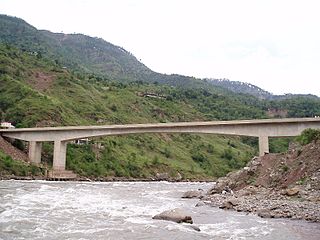
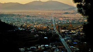
Junia is located in the Abbottabad district of Khyber Pakhtunkhwa. The expansive valley of Junia spreads over 180,037 canals, which is the highest area occupied by any village in Tanawal. It is located at an average elevation of 849 meters. It is located on the north-west side of Abbottabad bordering Mansehra.
Abbottabad Place in Khyber Pakhtunkhwa, Pakistan

Abbottabad is the capital city of Abbottabad District in the Hazara region of eastern Khyber Pakhtunkhwa, Pakistan. It is about 120 kilometres (75 mi) north of Islamabad and Rawalpindi, and 150 kilometres (93 mi) east of Peshawar, at an altitude of 1,260 metres (4,134 ft). Kashmir lies to the east.

Khyber Pakhtunkhwa Province in Pakistan

Khyber Pakhtunkhwa is one of the four administrative provinces of Pakistan, located in the northwestern region of the country along the international border with Afghanistan. It was previously known as the North-West Frontier Province (NWFP) until 2010 when the name was changed to Khyber Pakhtunkhwa by the 18th Amendment to Pakistan's Constitution, and is known colloquially by various other names. Khyber Pakhtunkhwa is the third-largest province of Pakistan by the size of both population and economy, though it is geographically the smallest of four. Within Pakistan, Khyber Pakhtunkhwa shares a border with Punjab, Balochistan, Azad Kashmir, Gilgit-Baltistan, and Islamabad. It is home to 17.9% of Pakistan's total population, with the majority of the province's inhabitants being Pashtuns. The province is the site of the ancient kingdom Gandhara, including the ruins of its capital Pushkalavati near modern-day Charsadda. Originally a stronghold of Buddhism, the history of the region was characterized by frequent invasions under various Empires due to its geographical proximity to the Khyber Pass.

Mansehra District Headquarter / City in Khyber Pakhtunkhwa, Pakistan

Mansehra is capital city of Mansehra District in the eastern part of Khyber Pakhtunkhwa province in Pakistan. Mansehra is one of the largest cities of Khyber Pakhtunkhwa. Kashmir lies to the east.

The village is almost entirely populated by Tanolis. The main tribes are: Tanoli (95%), Awan (2.7%), Sulmani (2.1%) and Turk (1%). It has a population of over 5,000 with a literacy rate of 99%. The village hosts 5 PhD's, 4 MBBS, 10 engineers, accountants as well as postgraduates. Chamhatti village is close to it as well as other villages near Junia:

Population All the organisms of a given species that live in the specified region

In biology, a population is all the organisms of the same group or species, which live in a particular geographical area, and have the capability of interbreeding. The area of a sexual population is the area where inter-breeding is potentially possible between any pair within the area, and where the probability of interbreeding is greater than the probability of cross-breeding with individuals from other areas.

Kotla (1.6 nm) Kotla (1.6 nm) Jhokan (1.8 nm) Kamila (1.0 nm) Chikar Bahian Kalan (1.3 nm) Thathi (1.3 nm) Barila Khurd (2.0 nm) Barila Kalan (2.0 nm) Kharper (0.8 nm) Numshera (1.0 nm) Naich (1.2 nm) Beri (1.7 nm) Khalabat (1.0 nm) Kangar Bala (1.3 nm) Kangar Pain (1.3 nm) Ahmedabad (1.3 nm) Kot (1.6 nm) Rattian (2.0 nm).

Related Research Articles

Haripur District District in Khyber Pakhtunkhwa, Pakistan

Haripur District is a district in Hazara Division of Khyber Pakhtunkhwa province in Pakistan with an altitude of around 610 metres (2,000 ft) above sea level. As of 2015, Haripur District has a High level of Human Development. Before becoming a district in 1991, Haripur had the status of a tehsil in Abbottabad District.

Kohala Bridge bridge in Pakistan

The Kohala Bridge across the Jhelum River, a tributary of the Indus River, forms part of one of the land routes from the Azad Kashmir to Pakistan.

Bal Dheri Union Council Union Council in Khyber Pakhtunkhwa, Pakistan

Bal Dheri is one of the 51 union councils of Abbottabad District in Khyber-Pakhtunkhwa province of Pakistan, the union council of Baldheri is named after the main village of the area. The population of Baldheri Union Council is 14,796.

Sherwan Union council in Khyber-Pakhtunkhwa, Pakistan

Sherwan is a Union council of Abbottabad District in Khyber-Pakhtunkhwa province of Pakistan, located 35 km west of Abbottabad. Sherwan.—A village, or rather a couple of villages almost adjoining each other,' and known, the northern as Sherwan Kalan, and the southern as Sherwan Khurd, on a ridge some 5,000 feet high in the centre of Lower Tanawal Sherwan is located in a beautiful valley which is surrounded by large, forested mountains on three sides. These forests host a number of wild animals, such as jackals, wolves, pigs, porcupines, fox and occasionally leopards.Sherwan is divided into two parts Sherwan Khurd (small) and Sherwan Kalan (wide). Sherwan Kalan covers a much larger area than Sherwan Khurd. In the North-East of Sherwan Union Council there is another village called Patheel. On the south of the valley there is a stream called Mangal, home to a number of fish such as Trout, eels and soles etc.

Langra, Khyber Pakhtunkhwa Union council in Khyber Pakhtunkhwa, Pakistan

Langra is one of the 51 union councils of Abbottabad District in the Khyber Pakhtunkhwa province of Pakistan.

Birot Kalan Union Council Union Council in Khyber Pakhtunkhwa, Pakistan

Birot Kalan is one of the 51 union councils of Abbottabad District in the Khyber-Pakhtunkhwa province of Pakistan.

Chamhati Union Council Union Council in Khyber Pakhtunkhwa, Pakistan

Chamhati is one of the 57 Union Councils of Abbottabad District in Khyber Pakhtunkhwa province of Pakistan.

Kuthwal Union council in Khyber-Pakhtunkhwa, Pakistan

Kuthwal is one of the 51 union councils of Abbottabad District in the Khyber-Pakhtunkhwa province of Pakistan. It is located to the north west of Abbottabad city.

Pattan Kalan Union council in Khyber-Pakhtunkhwa, Pakistan

Pattan Kalan is one of twenty-nine union councils of the Abbottabad District, in the Khyber-Pakhtunkhwa province of Pakistan. It lies within an area that was affected by the 2005 earthquake, after which a total of 27 small camps were set up in the area.

Pind Kargoo Khan Union Council Union council in Khyber-Pakhtunkhwa, Pakistan

Pind Kargoo Khan is one of the 51 union councils of Abbottabad District in Khyber-Pakhtunkhwa province of Pakistan. It is located 30 km from Abbottabad city.

Mir Pur Union council in Khyber Pakhtunkhwa, Pakistan

Mir Pur is one of the 51 union councils of Abbottabad District in the Khyber Pakhtunkhwa Province of Pakistan. It is located at an altitude of 1251 metres and lies in the west of the district.The population of the union council Mirpur was 46,206 in the 2017 census. Now the government have established this union council into three village councils .These are VC1,VC2 and VC3. Majority of the residents of Mirpur are jadoon (pashtuns)

Manwan Ni Hel is the lowest point in Union Council Berote Kalan located on the right bank of the Jhelum River of Abbottabad District, Khyber Pakhtunkhwa, Pakistan. It serves as a tripoint for the internal provincial borders of Khyber Pakhtunkhwa, Punjab and Azad Jammu & Kashmir.

Amirabad is a village of the Union Council of Sherwan in the Abbottabad District of Khyber Pakhtunkhwa, province, Pakistan, it is located 24 km north west of the city of Abbottabad and 5 km east of Sherwan.

Sarai Niamat Khan is one of the 44 union councils, administrative subdivisions, of Haripur District in the Khyber Pakhtunkhwa province of Pakistan. Serai Niamat Khan is located at 34°4'60N 73°1'60E and lies to the east of the district capital Haripur where it borders Abbottabad District.

Bahali is a village and union council of the Mansehra District in Khyber-Pakhtunkhwa province of Pakistan. Bahali is part of Mansehra Tehsil and is located at the boundary area of the Mansehra district and the Abbottabad district, west from the Karakurram highway at Qalanderabad. It is a valley surrounded by mountains. It is inhabited by Pathans Turks, Awan, Gujjar, Syeds, and a few other smaller tribes.

Lassan Thakral is a village and union council of Mansehra District in Khyber-Pakhtunkhwa province of Pakistan. It is located in the south of Mansehra district where it borders Abbottabad District.

Abbottabad Tehsil Tehsil in Khyber Pakhtunkhwa, Pakistan

Abbottabad Tehsil is an administrative subdivision (tehsil) of Abbottabad District in Khyber Pakhtunkhwa province of Pakistan.

Bain Gojri Place in Khyber Pakhtunkhwa, Pakistan

Bain Gojri is a village of Abbottabad District in Khyber Pakhtunkhwa province of Pakistan. It is located at 34°8'0N 73°7'0E with an elevation of either 1,093 metres (3,586 ft) or 3,589 feet. Neighbouring settlements include Patian, Bagwal Bandi and Saliot.

Khinger Kalan is a small village located in Rawalpindi District in Pakistan. It is 34 km to the southwest of Rawalpindi in the Punjab province of Pakistan. Khinger Kalan is in the Union Council of Jhatta Hathial. It is located on the Chak Beli Khan Road, which links it to the Nakrrali/Bagh Sangra Road.

Seri Sher Shah is a patwar circle within the Pind Kargoo Khan Union Council, Abbottabad District in Khyber-Pakhtunkhwa province of Pakistan. According to the 2017 Census of Pakistan, the population is 4,433.

References

    Coordinates: 34°23′33″N73°03′33″E / 34.39250°N 73.05917°E / 34.39250; 73.05917

    Geographic coordinate system Coordinate system

    A geographic coordinate system is a coordinate system that enables every location on Earth to be specified by a set of numbers, letters or symbols. The coordinates are often chosen such that one of the numbers represents a vertical position and two or three of the numbers represent a horizontal position; alternatively, a geographic position may be expressed in a combined three-dimensional Cartesian vector. A common choice of coordinates is latitude, longitude and elevation. To specify a location on a plane requires a map projection.