Tomata is a district located in Okayama Prefecture, Japan.

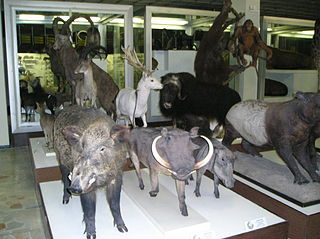
The Tadas Ivanauskas Zoological Museum was established in Kaunas, Lithuania, in 1919 by Tadas Ivanauskas (1882–1970).
Hermsdorf is a Verwaltungsgemeinschaft in the district Saale-Holzland, in Thuringia, Germany. The seat of the Verwaltungsgemeinschaft is in Hermsdorf.

Gacka is a river located in the Lika region in central Croatia. Because for a large part of its course it is a subterranean river, estimates on its length vary. The overground part has undergone substantial human intervention - before it was 32 kilometres long; now it is only 11 kilometres long. It has been regulated by man to flow into an aqueduct in Gusić polje and then into the Adriatic Sea through a hydroelectric installation HE Senj near Sveti Juraj. HE Senj takes inflow from Gacka and Lika, since it was built in 1965. The river passes through karst fields and most notably the town Otočac, and its headwaters are known as a superb spot for trout fishing.
North Eastern Subregion is a subregion in the central Maekel region of Eritrea.

Werski Most is a village in the administrative district of Gmina Więcbork, within Sępólno County, Kuyavian-Pomeranian Voivodeship, in north-central Poland. It lies approximately 15 kilometres (9 mi) north-west of Więcbork, 17 km (11 mi) west of Sępólno Krajeńskie, and 58 km (36 mi) north-west of Bydgoszcz.
Apolonka is a village in the administrative district of Gmina Wolbórz, within Piotrków County, Łódź Voivodeship, in central Poland.

Szczawin Kościelny is a village in the administrative district of Gmina Zgierz, within Zgierz County, Łódź Voivodeship, in central Poland. It lies approximately 8 kilometres (5 mi) north-east of Zgierz and 13 km (8 mi) north of the regional capital Łódź.

Rączki is a village in the administrative district of Gmina Kluczewsko, within Włoszczowa County, Świętokrzyskie Voivodeship, in south-central Poland. It lies approximately 11 kilometres (7 mi) north of Kluczewsko, 20 km (12 mi) north of Włoszczowa, and 53 km (33 mi) west of the regional capital Kielce.
Kozilas is a village in the administrative district of Gmina Lubowidz, within Żuromin County, Masovian Voivodeship, in east-central Poland.

Gradzanowo Kościelne is a village in the administrative district of Gmina Siemiątkowo, within Żuromin County, Masovian Voivodeship, in east-central Poland. It lies approximately 5 kilometres (3 mi) north-east of Siemiątkowo, 23 km (14 mi) south-east of Żuromin, and 98 km (61 mi) north-west of Warsaw.
Sierakowice-Wybudowanie is a settlement in the administrative district of Gmina Sierakowice, within Kartuzy County, Pomeranian Voivodeship, in northern Poland.

Klukowa Huta is a village in the administrative district of Gmina Stężyca, within Kartuzy County, Pomeranian Voivodeship, in northern Poland. It lies approximately 6 kilometres (4 mi) north-west of Stężyca, 23 km (14 mi) south-west of Kartuzy, and 50 km (31 mi) west of the regional capital Gdańsk.

Białki is a village in the administrative district of Gmina Sadlinki, within Kwidzyn County, Pomeranian Voivodeship, in northern Poland. It lies approximately 2 kilometres (1 mi) north-east of Sadlinki, 7 km (4 mi) south of Kwidzyn, and 79 km (49 mi) south of the regional capital Gdańsk.

Nowy Targ is a village in the administrative district of Gmina Stary Targ, within Sztum County, Pomeranian Voivodeship, in northern Poland. It lies approximately 4 kilometres (2 mi) south-east of Stary Targ, 11 km (7 mi) east of Sztum, and 64 km (40 mi) south-east of the regional capital Gdańsk.

Dury is a village in the administrative district of Gmina Morąg, within Ostróda County, Warmian-Masurian Voivodeship, in northern Poland. It lies approximately 3 kilometres (2 mi) south-east of Morąg, 22 km (14 mi) north of Ostróda, and 38 km (24 mi) west of the regional capital Olsztyn.
Wierzbówek is a village in the administrative district of Gmina Myślibórz, within Myślibórz County, West Pomeranian Voivodeship, in north-western Poland.

Bordj Ghedir District is a district of Bordj Bou Arréridj Province, Algeria.
Burgwallen Oude Zijde is a neighborhood of Amsterdam, Netherlands.
Vainu, Pärnu County is a village in Sauga Parish, Pärnu County in southwestern Estonia.


