Kabala, Artuklu

Last updated
Kabala
Qubala.JPG
Turkey adm location map.svg
Red pog.svg
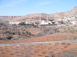
Kabala
Location in Turkey
Coordinates: 37°21′18″N40°48′32″E / 37.355°N 40.809°E / 37.355; 40.809
Country Turkey
Province Mardin
District Artuklu
Population
 (2022)
8,217
Time zone UTC+3 (TRT)

Kabala (Arabic : Kebele, Kurdish : Qebala) is a neighbourhood of the municipality and district of Artuklu, Mardin Province, Turkey. [1] Its population is 8,217 (2022). [2] Before the 2013 reorganisation, it was a town ( belde ). [3] [4]

It is populated by Arabs, Kurds and the Mhallami. [5]

History

Kabala is a former Jewish settlement which today is predominately Arab with moreover a Kurdish population. Kurdish tribes in the village are the Hesinan and the Omerkan. [5]

References

  1. Mahalle Archived 2015-07-06 at the Wayback Machine , Turkey Civil Administration Departments Inventory. Retrieved 19 September 2023.
  2. "Address-based population registration system (ADNKS) results dated 31 December 2022, Favorite Reports" (XLS). TÜİK . Retrieved 19 September 2023.
  3. "Law No. 6360". Official Gazette (in Turkish). 6 December 2012.
  4. "Classification tables of municipalities and their affiliates and local administrative units" (DOC). Official Gazette (in Turkish). 12 September 2010.
  5. 1 2 Tan, Altan (2018). Turabidin'den Berriye'ye. Aşiretler - Dinler - Diller - Kültürler (in Turkish). pp. 298–299. ISBN   9789944360944.