Related Research Articles
There are a number of systems of transport in Burundi, including road and water-based infrastructure, the latter of which makes use of Lake Tanganyika. Furthermore, there are also some airports in Burundi.

Ground transport in the Democratic Republic of the Congo (DRC) has always been difficult. The terrain and climate of the Congo Basin present serious barriers to road and rail construction, and the distances are enormous across this vast country. Furthermore, chronic economic mismanagement and internal conflict has led to serious under-investment over many years.

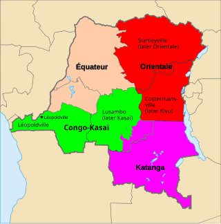
Katanga was one of the four large provinces created in the Belgian Congo in 1914. It was one of the eleven provinces of the Democratic Republic of the Congo between 1966 and 2015, when it was split into the Tanganyika, Haut-Lomami, Lualaba, and Haut-Katanga provinces. Between 1971 and 1997, its official name was Shaba Province.

The Rural City of Swan Hill is a local government area in Victoria, Australia, located in the north-western part of the state. It covers an area of 6,115 square kilometres (2,361 sq mi) and, in June 2018, had a population of 20,759. It includes the towns of Swan Hill, Lake Boga, Manangatang, Nyah, Nyah West, Piangil, Robinvale, Ultima and Woorinen South. It was formed in 1995 from the amalgamation of the City of Swan Hill, Shire of Swan Hill and part of the Shire of Kerang.

An inland port is a port on an inland waterway, such as a river, lake, or canal, which may or may not be connected to the sea. The term "inland port" is also used to refer to a dry port.

Boma is a port town on the Congo River, some 100 kilometres (62 mi) upstream from the Atlantic Ocean, in the Kongo Central province of the Democratic Republic of the Congo, adjacent to the border with Angola. It had an estimated population of 162,521 in 2012.

The Ruzizi is a river, 117 kilometres (73 mi) long, that flows from Lake Kivu to Lake Tanganyika in Central Africa, descending from about 1,500 metres (4,900 ft) to about 770 metres (2,530 ft) above sea level over its length. The steepest gradients occur over the first 40 kilometres (25 mi), where hydroelectric dams have been built. Further downstream, the Ruzizi Plain, the floor of the Western Rift Valley, has gentle hills, and the river flows into Lake Tanganyika through a delta, with one or two small channels splitting off from the main channel.

The Lukuga River is a tributary of the Lualaba River in the Democratic Republic of the Congo (DRC) that drains Lake Tanganyika. It is unusual in that its flow varies not just seasonally but also due to longer term climate fluctuations.

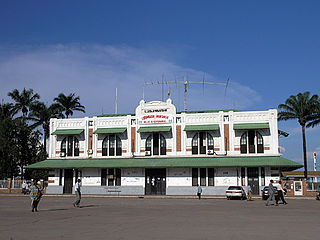
Kalemie, formerly Albertville or Albertstad, is a town on the western shore of Lake Tanganyika in the Democratic Republic of the Congo. The town is next to the outflow of the Lukuga River from Lake Tanganyika to the Lualaba River.

The Société Nationale des chemins de fer du Congo is the national railway company for the inland railways of the Democratic Republic of the Congo.

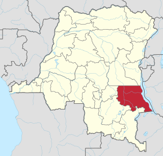
Tanganyika is one of the 21 new provinces of the Democratic Republic of the Congo created in the 2015 repartitioning. Tanganyika, Haut-Katanga, Haut-Lomami and Lualaba provinces are the result of the splitting up of the former Katanga province. Tanganyika was formed from the Tanganyika district whose town of Kalemie was elevated to capital city of the new province.
Kongolo is a town in Tanganyika Province in the Democratic Republic of the Congo. It is located on the west bank of the Lualaba River, the largest headstream of the Congo River. It has 62,455 inhabitants.
For other places with the same name, see Kazumba.
Maduda is a village in Bas-Congo province, Democratic Republic of the Congo. The town lies at an altitude of 1059 ft above sea level, and is northeast of the larger town of Tshela, to which it is connected by road. There are waterfalls to the north and southeast of the village.

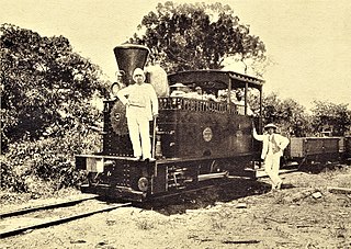
The Société Nationale des Chemins de Fer Zaïrois (SNCZ) was the state railway company in Zaire formed in 1974 by combining several privately owned railways. It suffered from lack of maintenance of the tracks and rolling stock, weak management, and external factors such as the Angolan Civil War and the collapse of the economy of Zaire under President Mobutu Sese Seko. Despite two projects funded by the World Bank, it had virtually ceased to function by the 1990s. It was replaced in 1995 by the short-lived private company SIZARAIL, which in turn was replaced by the present Société nationale des chemins de fer du Congo.
The Lake Chad replenishment project is a proposed major water diversion scheme to divert water from the Congo River basin to Lake Chad to prevent it drying up. Various versions have been proposed. Most would involve damming some of the right tributaries of the Congo River and channeling some of the water to Lake Chad via a canal to the Chari River basin.
Kabalo Airport is an airport serving the town of Kabalo, in the Tanganyika Province of Democratic Republic of the Congo.
The Uganda Standard Gauge Railway is a planned railway system linking the country to the neighboring countries of Kenya, Rwanda, Democratic Republic of the Congo and South Sudan, as part of East African Railway Master Plan. The new Standard Gauge Railway (SGR), is intended to replace the old, inefficient metre-gauge railway system.

The Compagnie du chemin de fer du Congo supérieur aux Grands Lacs africains was a Belgian railway company established in 1902 in the Congo Free State, later the Belgian Congo, now the Democratic Republic of the Congo. It provided service in the eastern part of the colony south of Stanleyville (Kisangani) to serve the settlers and mining operations in Katanga. It operated a combination of river steamer service along the Lualaba River and railway links where the river was not navigable, including a link to Lake Tanganyika. In 1960 it became the Société congolaise des chemins de fer des Grands Lacs.
References
Coordinates: 06°03′00″S26°55′00″E / 6.05000°S 26.91667°E