
Kaberamaido is a district in Eastern Uganda. Like most other Ugandan districts, it is named after its 'chief town', Kaberamaido, where the district headquarters are located.

Soroti is a city in Eastern Region of Uganda. It is the main city, commercial, and administrative center in Soroti District, one of the nine administrative districts in the Teso sub-region. Soroti city was immediately approved for operationalization ahead of schedule by the Parliament of Uganda in the Financial Year 2020/2021.

Moroto is a town in Moroto District in the Northern Region of Uganda. The town serves as the location of the district headquarters.
Budaka is a town in the Eastern Region of Uganda. It is the chief town of Budaka District, and the district headquarters are located there.
Bugiri is a town in the Eastern Region of Uganda. It is the chief town of Bugiri District, and the district headquarters are located there. The town was elevated to Municipal Council status in 2019.
Katakwi is a town in the Eastern Region of Uganda. It is the main municipal, administrative, and commercial center of Katakwi District and the site of the district headquarters.
Kapchorwa is a town in the Eastern Region of Uganda. It is the main municipal, commercial, and administrative center of Kapchorwa District. Initially, the town of Kapchorwa was known as the Sebei Region.
Nakapiripirit is a town in the Nakapiripirit District of the Northern Region of Uganda. It is the seat of the district headquarters. As an administrative unit of the district, it is one of the eight sub-counties in the district.
Amuria is a town in the Eastern Region of Uganda. It is the chief municipal, administrative, and commercial center of Amuria District, in the Teso sub-region.
Butaleja is a town in Eastern Region of Uganda. It is the district headquarters and the main municipal, administrative and commercial center of Butaleja District. The district is named after the town.
Serere is a town in Eastern Uganda. It is the chief political, administrative and commercial town in Serere District, and the district headquarters are located there. The district is named after the town.

Kumi Town, commonly called Kumi, is a town in the Eastern Region of Uganda. It is the main municipal, administrative, and commercial center in Kumi District and the site of the district headquarters.

Busolwe is a town in the Eastern Region of Uganda. It is one of the two municipalities in Butaleja District, the other being Butaleja.
Bukedea is a town in the Eastern Region of Uganda. It is the chief municipal, administrative, and commercial center of Bukedea District, and the district headquarters are located there.
Serere District is a district in Eastern Uganda. It is named after its 'chief town', Serere, which serves as the district headquarters.

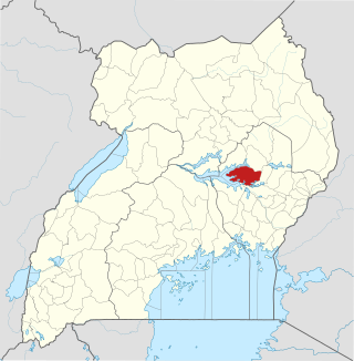
Ngora District is a district in the Eastern Region of Uganda. The town of Ngora is the site of the district headquarters.
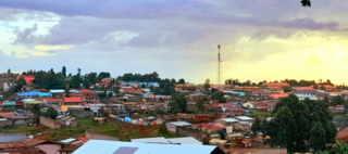
Ngora is a town in the Eastern Region of Uganda. It is the main political, administrative, and commercial centre of Ngora District.
Napak is a town in Northern Uganda. It is the commercial, administrative and municipal headquarters of Napak District. The district is named after the town.
Lwakhakha is a town in the Eastern Region of Uganda. It is one of the municipal centers in Manafwa District. The town lies across the international border from Lwakhakha, Kenya.
Muyembe is a town in the Eastern Region of Uganda.

