Related Research Articles

The Zambezi River is the fourth-longest river in Africa, the longest east-flowing river in Africa and the largest flowing into the Indian Ocean from Africa. Its drainage basin covers 1,390,000 km2 (540,000 sq mi), slightly less than half of the Nile's. The 2,574-kilometre-long (1,599 mi) river rises in Zambia and flows through eastern Angola, along the north-eastern border of Namibia and the northern border of Botswana, then along the border between Zambia and Zimbabwe to Mozambique, where it crosses the country to empty into the Indian Ocean.

Western Province is one of the 10 provinces in Zambia and encompasses most of the area formerly known as Barotseland. The capital is Mongu, and together with the neighbouring town of Limulunga, Mongu is treated as the capital of Barotseland.

Chinyingi is a Capuchin mission and hospital in the sparsely populated North-Western Province of Zambia, on the west bank of the Zambezi River. An estimated 6000 people live within a seven kilometer radius of the Chinyingi mission. The mission's hospital, Chinyingi Mission Hospital, serves the local community with a 52-bed hospital and several health outreach programs, providing everything from first aid to services for people with HIV/AIDS AIDS, which affects some 25% of Zambia's population. The mission also operates a school.

The Kabompo River is one of the main tributaries of the upper Zambezi River. It flows entirely in Zambia, rising to the east of the source of the Zambezi, in North-Western Province along the watershed between the Zambezi and Congo river basins which also forms the border between Zambia and DR Congo. It is the second deepest river in Africa and one of the top five in the world.
Lukulu is a market town in the Western Province of Zambia, on the Zambezi River, and headquarters of a district of the same name. Access to the town is limited to only a few graded roads with traffic running through it from Kaoma town to Watopa town. Fish from the river provide most of the local diet, and some are exported to other parts of Zambia away from the river. The town has very beautiful Zambezi River water front and sandy beaches.
Mwinilunga is a town in the North-Western Province of Zambia. It is the headquarters of Mwinilunga District, one of the province's eleven districts.
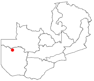
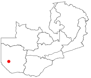
Kabompo is a town in north-western Zambia, lying on the Kabompo River with a population over 88,000 people. It is surrounded by teak forest and is home to a Roman Catholic mission.
Kalabo is an urban centre and the seat of Kalabo District, in the Western Province of Zambia.

Zambezi is a town in the North-Western Province of Zambia, lying on the Zambezi River and the M8 road, west of Kabompo. It is known for the palaces of the chiefs of the Lunda and Lovale people. Until about 1966 it was called Balovale after the dominant chief but the name was changed in an attempt to defuse tensions between the main groups and the government of the newly independent country.
Senanga is the capital of the Senanga District, which is located in the Western Province of Zambia. The town is situated on the eastern bank of the Zambezi River, at the southern end of the Barotse Floodplain. It lies on the main road running parallel to the river from Livingstone and Sesheke to Mongu, which crosses the river by a pontoon ferry about 15 km (9 mi) south of Senanga. Recently the Kaunga Lyeti Bridge was completed to cross the Kaunga Lyeti River near the junction to Sioma, traveling from Sesheke and Katima Mulilo. On top of the bridgework, recent road projects have improved travel conditions and inspired economic confidence and growth.
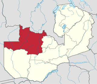
North-Western Province is one of ten Provinces of Zambia. It covers an area of 125,826 km2 (48,582 sq mi), has a population of 727,044 and a population density was 5.80 per square kilometre as of 2010. It is the most sparsely populated province in the country. The provincial capital is Solwezi. The literacy rate stood at 63 per cent against a national average of 70.2 per cent. The rural population constituted 77.45%, while the urban population was 22.55%. North-Western Province is bordered along Angola in the west, the Democratic Republic of Congo in the north, Copperbelt Province in the east, Central in the south-east, and Western Province in the south-west.
This article gives lists of the National Monuments and other historic sites of Zambia, with a one- or two-line description providing links to details given on other pages.
Water transport and the many navigable inland waterways in Zambia have a long tradition of practical use except in parts of the south. Since draught animals such as oxen were not heavily used, water transport was usually the only alternative to going on foot until the 19th Century. The history and current importance of Zambian waterways, as well as the types of indigenous boats used, provide information on this important aspect of Zambian economy.
The biomes and ecoregions in the ecology of Zambia are described, listed and mapped here, following the World Wildlife Fund's classification scheme for terrestrial ecoregions, and the WWF freshwater ecoregion classification for rivers, lakes and wetlands. Zambia is in the Zambezian region of the Afrotropical biogeographic realm. Three terrestrial biomes are well represented in the country . The distribution of the biomes and ecoregions is governed mainly by the physical environment, especially climate.

The Barotse Floodplain, also known as the Bulozi Plain, Lyondo or the Zambezi Floodplain, is one of Africa's great wetlands, on the Zambezi River in the Western Province of Zambia. It is a designated Ramsar site, regarded as being of high conservation value.
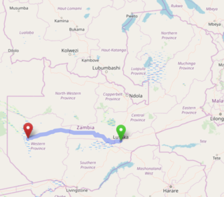
The Lusaka–Mongu Road of Zambia runs 580 km from the capital, Lusaka, to Mongu, capital of the Western Province. It connects that province to the rest of the country, as well as being one of two routes to the south-west extremity of North-Western Province. It also serves as the main highway of the western half of Central Province. The entire route from Lusaka to Mongu is designated as the M9 Road.

The following outline is provided as an overview of and topical guide to Zambia:
Zambia, officially known as the Republic of Zambia, is a landlocked country in Southern Africa. The neighbouring countries are the Democratic Republic of the Congo to the north, Tanzania to the north-east, Malawi to the east, Mozambique, Zimbabwe, Botswana, and Namibia to the south, and Angola to the west. The capital city is Lusaka, located in the southeast of the country. The population is concentrated mainly around the capital and the Copperbelt to the northwest.
The T5 is a trunk road in Zambia. It connects Chingola in the Copperbelt Province with Solwezi and Mwinilunga in the North-Western Province. The Route extends to end at a border with Angola. It is the only other road after the M18 Road that connects the towns of the North-Western and Copperbelt provinces and is currently one of the main routes motorists use to reach Angola from Zambia. The first section of the road is a toll road.
The M8 Road is a road in the North-Western Province of Zambia. It connects Mutanda in Solwezi District with Zambezi Town via Mufumbwe, Manyinga & Kabompo.
References
- Denis Tweddle: "Surveys of the Upper Zambezi River system" in Ichthos, Newsletter of the Friends of the South African Institute for Aquatic Biodiversity, Issue Number 74, June 2004.