
Kitwe is the third largest city in terms of infrastructure development and second largest city in terms of size and population in Zambia. With a population of 517,543 Kitwe is one of the most developed commercial and industrial areas in the nation, alongside Ndola and Lusaka. It has a complex of mines on its north-western and western edges.

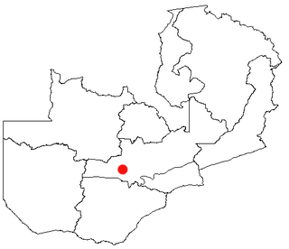
Western Province is one of the 10 provinces in Zambia and encompasses most of the area formerly known as Barotseland. The capital is Mongu, and together with the neighbouring town of Limulunga, Mongu is treated as the capital of Barotseland.
Kasama is a city in the Northern Province of Zambia. It serves as the provincial capital and the headquarters of Kasama District.

Kafue National Park is the largest national park in Zambia, covering an area of about 22,400 km2. It is one of the largest parks in Africa and is home to 152 different species of mammals.
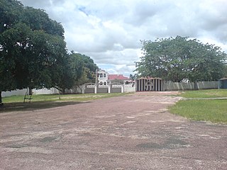
Mongu is the capital of Western Province in Zambia and was the capital of the formerly-named province and historic state of Barotseland. Its population is 179,585, and it is also the headquarters of Mongu District. Mongu is the home of the Litunga, King of the Lozi people.
Kalabo is an urban centre and the seat of Kalabo District, in the Western Province of Zambia.
Mumbwa is a town in the Central Province of Zambia, lying on the M9 Road. Its district covers the western part of the Central Province bordering Kaoma and Western Province to the west, Namwala and Southern Province to the south, Lusaka and Lusaka Province to the east, Kasempa and North-Western Province to the north and Kabwe to the north-east. It is known for its cotton and has a ginnery. The Zambia Air Force has a base in the district. Kafue National Park borders the district to the west. The predominant tribes are the Ila, who speak a dialect known as Sala, mostly to the south and south east and the Kaonde to the north. The Lenje are to the north-east on the border area with Kabwe. There are also relatively large settlement of people from the west and north west such as the Lozi, Nkoya and Luvale, Shona people from the then Southern Rhodesia who settled there as refugees from the civil war in that country and who are now almost integrated and Tonga from the south. A lot of prospecting for minerals such as copper and gold was done in the district and small scale mines operated there. Most are now closed, though the gold mine at Luiri has been revived.
Kasempa is a town located in Kasempa District, North-Western Province, Zambia. It is approximately 550 kilometres (340 mi) by road northwest of Lusaka, the capital. Kasempa is located on the western bank of the Lufupa River as it flows south into the Kafue National Park.

Choma is a town that serves as the capital of the Southern Province of Zambia. It is also the capital of Choma District, one of the 15 administrative districts in the province.

The ten provinces of Zambia are divided into a total of 116 districts as of 2018.
Lower education in Zambia is divided into three levels and these are namely: primary, junior secondary and upper secondary. Higher education in Zambia has improved in the recent years due to the increase of private universities and colleges. The biggest university is the public University of Zambia which is located in the capital city of Lusaka along the great east road and hosts a number of local and international students. The Copperbelt University is the second largest public university and is located in the Copperbelt province of Zambia in Kitwe, and the youngest public university is Mulungushi University, with its main campus 26 km north of Kabwe. There are many other smaller universities, both public and private including the following: Texila American University, Zambia Open University, European University Zambia Zambia Catholic University, Cavendish University, Zambia Adventist University, Northrise University, University of Lusaka, Lusaka Apex Medical University, Woodlands University College, Copperstone University College, University of Barotseland, University of Africa, Information and Communication University, Kwame Nkrumah University of Education, Chalimbana University, Rusangu University, Robert Makasa University, Zambia Centre of Accountancy Studies and there are various Health training Institutes offering Diplomas in clinical medicine Registered Nursing
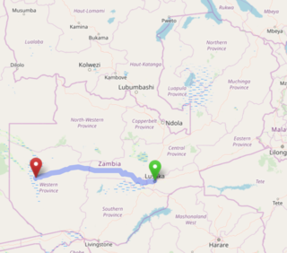
The Lusaka–Mongu Road of Zambia runs 580 km from the capital, Lusaka, to Mongu, capital of the Western Province. It connects that province to the rest of the country, as well as being one of two routes to the south-west extremity of North-Western Province. It also serves as the main highway of the western half of Central Province. The entire route from Lusaka to Mongu is designated as the M9 road.

Lusaka is the capital and largest city of Zambia. It is one of the fastest-developing cities in southern Africa. Lusaka is in the southern part of the central plateau at an elevation of about 1,279 metres (4,196 ft). As of 2019, the city's population was about 3.3 million, while the urban population is estimated at 2.5 million in 2018. Lusaka is the centre of both commerce and government in Zambia and connects to the country's four main highways heading north, south, east, and west. English is the official language of the city administration, while Bemba, Tonga, Lenje, Soli, Lozi, and Nyanja are the commonly spoken street languages.

Shangombo District with headquarters at Shangombo is located in Zambia. As of the 2010 Zambian Census, the district had a population of 84,070 people. This population is a combined figure with the newly created district of Sioma which was created by halving the primary district. The western part of the half retains the name Shangombo while the eastern part is called Sioma District.

Mumbwa District is a district of Zambia, located in Central Province. The capital lies at Mumbwa. As of the 2010 Zambian Census, the district had a population of 218,328 people. It consists of two constituencies, being Mumbwa and Nangoma.
Jethro Mukenge Mutti, was a Zambian politician who between the years 1964 to 1975 served as member of parliament, Ambassador, Minister and Member of the Central Committee under the ruling party UNIP led by Kenneth Kaunda. He died on 18 January 2013 after complications from aspiration pneumonia following a series of mini strokes and poor health in the last few years of his life, linked to his tetraplegic condition.
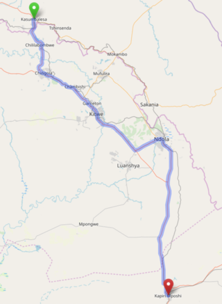
The T3 is a Trunk Road in Zambia. The road runs from Kapiri Mposhi via Ndola, Kitwe and Chingola to Kasumbalesa on the border with DR Congo. The entire route is a toll road.
The M10 road is a road in Zambia. It goes from Livingstone, through Sesheke and Senanga, to Mongu. The road is approximately 508 kilometres and follows the Zambezi River for its entire length.
The M18 road is a road in Zambia that connects Kitwe in the Copperbelt Province with Kasempa in the North-Western Province via Kalulushi and Lufwanyama. It is the only other road after the T5 road that connects the towns of the North-Western and Copperbelt provinces. The section from Kitwe to Kalulushi is designated as the M7 road while the route from Kalulushi westwards to Kasempa District is designated as the M18 road on Zambia's road network.
