Kalabo

Last updated

Kalabo
City
Zambia adm location map.svg
Red pog.svg
Kalabo
Coordinates: 14°59′28″S22°40′44″E / 14.99111°S 22.67889°E / -14.99111; 22.67889
Country Zambia
Province Western Province
District Kalabo District
Elevation
1,019 m (3,343 ft)
Population
 (2020) [1]
  Total7,731
 Estimate
Time zone UTC+2 (CAT)
Climate Cwa

Kalabo is an urban centre and the seat of Kalabo District, in the Western Province of Zambia. [2]

Contents

Location

The town is located on the plains west of the Zambezi River and the Barotse Floodplain, and approximately 58 kilometres (36 mi), by road east of the town of Sikongo, Zambia, close to the border with Angola. [3] This is approximately 660 kilometres (410 mi), by road, west of Lusaka, Zambia's capital and largest city. [4]

The geographical coordinates of Kalabo are:14°59'28.0"S, 22°40'44.0"E (Latitude:-14.991111; Longitude:22.678889). [5] Kalabo sits at an average elevation of 1,019 metres (3,343 ft) above mean sea level. [6]

Climate

Kalabo has a fairly dry tropical savanna climate (Köppen: Aw), [7] characterized by warm to hot temperatures and distinct wet and dry seasons. June and July are the coolest months, while October is the hottest month with average high temperatures exceeding 35 °C (95 °F). The wet season, from November to March, experiences significant rainfall, while the dry season, from May to October, is marked by a lack of precipitation. [8]

Climate data for Kalabo (1991–2020)
MonthJanFebMarAprMayJunJulAugSepOctNovDecYear
Record high °C (°F)39.5
(103.1)
37.6
(99.7)
37.0
(98.6)
38.4
(101.1)
35.0
(95.0)
33.6
(92.5)
33.4
(92.1)
37.5
(99.5)
39.4
(102.9)
40.3
(104.5)
39.8
(103.6)
38.0
(100.4)
40.3
(104.5)
Mean daily maximum °C (°F)30.4
(86.7)
30.6
(87.1)
30.5
(86.9)
30.4
(86.7)
29.3
(84.7)
27.4
(81.3)
27.3
(81.1)
31.0
(87.8)
33.8
(92.8)
35.4
(95.7)
33.1
(91.6)
31.5
(88.7)
29.2
(84.6)
Daily mean °C (°F)24.6
(76.3)
24.9
(76.8)
24.9
(76.8)
24.0
(75.2)
21.3
(70.3)
18.7
(65.7)
18.4
(65.1)
21.6
(70.9)
24.6
(76.3)
26.7
(80.1)
25.8
(78.4)
25.2
(77.4)
23.4
(74.1)
Mean daily minimum °C (°F)18.8
(65.8)
19.2
(66.6)
19.2
(66.6)
17.6
(63.7)
13.3
(55.9)
10.0
(50.0)
9.5
(49.1)
12.1
(53.8)
15.4
(59.7)
18.0
(64.4)
18.4
(65.1)
18.9
(66.0)
14.7
(58.5)
Record low °C (°F)15.6
(60.1)
15.6
(60.1)
13.1
(55.6)
7.7
(45.9)
4.8
(40.6)
2.0
(35.6)
2.8
(37.0)
4.6
(40.3)
7.6
(45.7)
11.0
(51.8)
8.5
(47.3)
14.5
(58.1)
2.0
(35.6)
Average precipitation mm (inches)197.8
(7.79)
149.9
(5.90)
141.7
(5.58)
40.3
(1.59)
0.6
(0.02)
0.1
(0.00)
0.0
(0.0)
0.0
(0.0)
0.8
(0.03)
15.5
(0.61)
70.6
(2.78)
140.0
(5.51)
757.2
(29.81)
Source: NOAA [8]

Overview

It is situated on the bank of the Luanginga River across which a small pontoon ferry connects to a dirt track going north-west to the Angolan border. Kalabo is the base for the Liuwa Plain National Park which can be reached by off-road vehicles about 20 kilometres (12 mi), north of the pontoon. Zambia's Western Province was formerly known as Barotseland, and Liuwa Plain was the Barotse king's hunting grounds which Lewanika made into a game reserve in the 19th century. [9]

Population

In 2010, the national population census and household survey enumerated the population of Kalabo Town at 2,178 people. [10] In 2020, the town's population was estimated at 7,731 inhabitants. [1]

Transport

Access to Kalabo by road was difficult but now after the completion of the road between Kalabo and Mongu, it is now easier. The section crossing the floodplain is called the Barotse Floodplain Causeway and is counted as an extension of the Lusaka-Mongu Road. The Mongu-Kalabo Road measures 70 kilometres (43 mi) in length. [11] The city of Mongu is the provincial capital of Zambia's Western Province. [12]

Before the construction of the road, Kalabo was usually cut off by road in the rainy season. The dirt tracks across the floodplain from Mongu become flooded, and frequently in poor condition at other times. The tracks go to two ferries across the main channel of the Zambezi, a northern one near Libonda accessed from Mongu via Limulunga, and a southern one at Sandaula accessed via Lealui. In recent years dirt roads on raised earth embankments have been constructed from Mongu to Lealui and from Kalabo to Sandaula. This is part of an ambitious long-term regional plan to provide the first ever major link between the road networks of Zambia and Angola via a paved causeway across the floodplain and a bridge over the Zambezi, replacing the ferry. A paved highway would then be built from Kalabo north-west to the Angolan border and beyond. Although originally intended for completion in 2006, construction has proved more difficult than anticipated and large sections were washed away in floods in 2003/2004, resulting in funding shortfalls. [13]

Kalabo is also served by Kalabo Airport, approximately 4 kilometres (2 mi), west of the town. [14]

See also

Related Research Articles

This article is about the Transport in Zambia.

<span class="mw-page-title-main">Zambezi</span> Major river in southern Africa

The Zambezi is the fourth-longest river in Africa, the longest east-flowing river in Africa and the largest flowing into the Indian Ocean from Africa. Its drainage basin covers 1,390,000 km2 (540,000 sq mi), slightly less than half of the Nile's. The 2,574-kilometre-long (1,599 mi) river rises in Zambia and flows through eastern Angola, along the north-eastern border of Namibia and the northern border of Botswana, then along the border between Zambia and Zimbabwe to Mozambique, where it crosses the country to empty into the Indian Ocean.

<span class="mw-page-title-main">Western Province, Zambia</span> Province of Zambia

Western Province is one of the 10 provinces in Zambia and encompasses most of the area formerly known as Barotseland. The capital is Mongu, and together with the neighbouring town of Limulunga, Mongu is treated as the capital of Barotseland.

<span class="mw-page-title-main">Lozi people</span> Ethnic group in Zambia and Zimbabwe

Lozi people, or Barotse, are a southern African ethnic group who speak Lozi and Silozi, a Sotho–Tswana language. The Lozi people consist of more than 46 different ethnic groups and are primarily situated between Namibia, Angola, Botswana, Zimbabwe including half of the north-Western and western provinces of Zambia inhabiting the region of Barotseland.

<span class="mw-page-title-main">Barotseland</span> Place in southern Africa

Barotseland is a region between Namibia, Angola, Botswana, Zimbabwe including half of north-western and southern provinces of Zambia and the whole of Democratic Republic of Congo's Katanga Province. It is the homeland of the Lozi people or Barotse, or Malozi, who are a unified group of over 46 individual formerly diverse tribes related through kinship, whose original branch are the Luyi (Maluyi), and also assimilated Southern Sotho tribe of South Africa known as the Makololo.

Lealui or Lialui is the dry season residence on the Barotse Floodplain of the Litunga, king of the Lozi people of western Zambia. It is located about 14 km west of the town of Mongu and about 10 km east of the river's main channel. At the end of the rainy season, generally in March as the Upper Zambezi flood waters encroach on the compound, the Litunga moves to Limulunga on higher ground. The move is celebrated in the Kuomboka festival, one of Zambia's most important and popular.

<span class="mw-page-title-main">Mongu</span> City in Western Province, Zambia

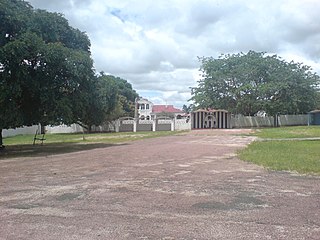
Mongu is the capital of Western Province in Zambia and was the capital of the formerly-named province and historic state of Barotseland. Its population is 179,585, and it is also the headquarters of Mongu District. Mongu is the home of the Litunga, King of the Lozi people.

<span class="mw-page-title-main">Mwinilunga</span> Zambian town

Mwinilunga is a town in the North-Western Province of Zambia. It is the headquarters of Mwinilunga District, one of the province's eleven districts.

Limulunga is one of the two compounds of the Litunga, king of the Lozi people of western Zambia. It lies on high ground at the edge of the Barotse Floodplain of the Zambezi river, about 15 km north of the town of Mongu and 21 km east of the main channel of the river. The Litunga's other compound at Lealui is used during the dry season, with Limulunga being used during the rainy season. The annual move between the two compounds is celebrated in the Kuomboka festival.

<span class="mw-page-title-main">Lewanika</span>

Lewanika was the Lozi Litunga (King) of Barotseland from 1878 to 1916 . A detailed, although biased, description of King 'Lubossi' can be found in the Portuguese explorer Alexandre de Serpa Pinto's 1878–1879 travel narrative Como eu atravessei a África.

<span class="mw-page-title-main">Liuwa Plain National Park</span> National park in Zambia

Liuwa Plain National Park is a 3,369-square-kilometre (1,301 sq mi) national park in Zambia's Western Province. "Liuwa" means "plain" in the local Liuwa language, a dialect of Lozi language, and the plains originally served as a hunting ground for Lubosi Lewanika, the Litunga of the Lozi people. The area was designated as a protected area by Lubosi Lewanika in the early 1880s, and as a national park in 1972, when Zambia's government took over management. The nonprofit conservation organization African Parks has managed Liuwa in partnership with the Department of National Parks and Wildlife and the Barotse Royal Establishment since 2003.

The Litunga of Barotseland is the Paramount Chief of the Barotse people. The Litunga resides near the Zambezi River and the town of Mongu, at Lealui on the floodplain in the dry season, and on higher ground at Limulunga on the edge of the floodplain in the wet season. The Litunga moves between these locations in what is known as the Kuomboka ceremony.

<span class="mw-page-title-main">Beira–Lobito Highway</span> Road in Africa

The Beira–Lobito Highway or TAH 9 is Trans-African Highway 9 in the transcontinental road network being developed by the United Nations Economic Commission for Africa (UNECA), the African Development Bank (ADB), and the African Union. The route has a length of 3,523 km (2,189 mi) crossing Angola, the most southerly part of the Democratic Republic of the Congo, Zambia, Zimbabwe, and central Mozambique.

<span class="mw-page-title-main">Barotse Floodplain</span> Major floodplain in Central Africa

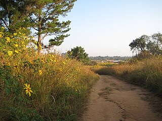
The Barotse Floodplain, also known as the Bulozi Plain, Lyondo or the Zambezi Floodplain, is one of Africa's great wetlands, on the Zambezi River in the Western Province of Zambia. It is a designated Ramsar site, regarded as being of high conservation value.

<span class="mw-page-title-main">Lusaka–Mongu Road</span> Road in Zambia

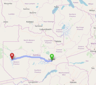
The Lusaka–Mongu Road of Zambia runs 580 km from the capital, Lusaka, to Mongu, capital of the Western Province. It connects that province to the rest of the country, as well as being one of two routes to the south-west extremity of North-Western Province. It also serves as the main highway of the western half of Central Province. The entire route from Lusaka to Mongu is designated as the M9 road.

<span class="mw-page-title-main">Lusaka–Livingstone Road</span> Road in Zambia

The T1 or Lusaka–Livingstone Road is the main highway of the Southern Province of Zambia. It begins 55 kilometres south of the city of Lusaka and heads south-west to the principal tourist destination, Victoria Falls in Livingstone, via Mazabuka, Monze, Choma and Kalomo, measuring approximately 430 kilometres (267 mi). The entire route is part of Trans-African Highway network number 4 or Cairo-Cape Town Highway between Cairo and Cape Town.

<span class="mw-page-title-main">Shangombo District</span> District in Western Province, Zambia

Shangombo District with headquarters at Shangombo is located in Zambia. As of the 2010 Zambian Census, the district had a population of 84,070 people. This population is a combined figure with the newly created district of Sioma which was created by halving the primary district. The western part of the half retains the name Shangombo while the eastern part is called Sioma District.

Sioma is a town on the west bank of the Zambezi River in the Western Province of Zambia. Since 2012 it has been the capital of the Sioma District.

Kalabo Airport is an airport serving the town of Kalabo, in Kalabo District and surrounding communities in the Western Province of Zambia.

The M10 road is a road in Zambia. It goes from Livingstone, through Sesheke and Senanga, to Mongu. The road is approximately 508 kilometres and follows the Zambezi River for its entire length.

References

  1. 1 2 World Population Review (2020). "Population of Cities in Zambia". World Population Review. Retrieved 10 June 2020.
  2. Comboni Missionary Sisters (2020). "Profile of Kalabo Town and Kalabo District". Rome: Comboniane.org. Retrieved 10 June 2020.
  3. Google. "Distance Between Kalabo, Zambia and Sikongo, Zambia" (Map). Google Maps . Google.
  4. Google (10 June 2020). "Road Distance Between Lusaka and Kalabo" (Map). Google Maps . Google. Retrieved 10 June 2020.
  5. Google (10 June 2020). "Location of Kalabo, Zambia" (Map). Google Maps . Google. Retrieved 10 June 2020.
  6. Flood Map (10 June 2020). "Elevation of Kalabo, Zamba". Floodmap.net. Retrieved 10 June 2020.
  7. "Table 1 Overview of the Köppen-Geiger climate classes including the defining criteria". Nature: Scientific Data. 23 October 2023.
  8. 1 2 "World Meteorological Organization Climate Normals for 1991-2020 — Kalabo". National Oceanic and Atmospheric Administration. Retrieved 23 January 2024.
  9. Hugh Macmillan (2020). "Oxford Dictionary of National Biography: Lewanika (c.1842–1916)". Oxford, United Kingdom: Oxford University Press . Retrieved 10 June 2020.
  10. Central Statistical Office Zambia (14 July 2019). "Urban Population of Kalabo District in 2010". Citypopulation.de. Retrieved 10 June 2020.
  11. Google (11 June 2020). "Road Distance Between Kalabo and Mongu" (Map). Google Maps . Google. Retrieved 11 June 2020.
  12. Benedict Tembo (29 January 2018). "Mongu feels ripe for city status". Zambia Daily Mail . Lusaka. Retrieved 13 June 2020.
  13. Chris McIntyre (2004). "The Bradt Zambia Travel Guide: "The Western Provinces :Barotseland, Mongu: Getting There & Away"". Zambia Travel Guide. Retrieved 11 June 2020.
  14. Google (11 June 2020). "Road Distance Between Kalabo and Kalabo Airport" (Map). Google Maps . Google. Retrieved 11 June 2020.