Western Province is one of the 10 provinces in Zambia and encompasses most of the area formerly known as Barotseland. The capital is Mongu, and together with the neighbouring town of Limulunga, Mongu is treated as the capital of Barotseland.

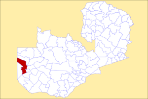
Kalabo is an urban centre and the seat of Kalabo District, in the Western Province of Zambia.

Liuwa Plain National Park is a 3,369-square-kilometre (1,301 sq mi) national park in Zambia's Western Province. "Liuwa" means "plain" in the local Liuwa language, a dialect of Lozi language, and the plains originally served as a hunting ground for Lubosi Lewanika, the Litunga of the Lozi people. The area was designated as a protected area by Lubosi Lewanika in the early 1880s, and as a national park in 1972, when Zambia's government took over management. The nonprofit conservation organization African Parks has managed Liuwa in partnership with the Department of National Parks and Wildlife and the Barotse Royal Establishment since 2003.

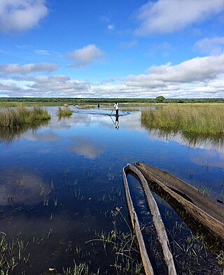
The Barotse Floodplain, also known as the Bulozi Plain, Lyondo or the Zambezi Floodplain, is one of Africa's great wetlands, on the Zambezi River in the Western Province of Zambia. It is a designated Ramsar site, regarded as being of high conservation value.
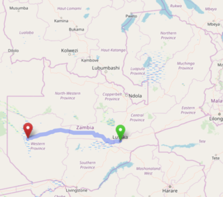
The Lusaka–Mongu Road of Zambia runs 580 km from the capital, Lusaka, to Mongu, capital of the Western Province. It connects that province to the rest of the country, as well as being one of two routes to the south-west extremity of North-Western Province. It also serves as the main highway of the western half of Central Province. The entire route from Lusaka to Mongu is designated as the M9 road.

Shangombo District with headquarters at Shangombo is located in Zambia. As of the 2022 Zambian Census, the district had a population of 73,822 people.

Mansa District with headquarters at Mansa is a district located in Luapula Province. As of the 2022 Zambian Census, the district had a population of 327,063 people. It consists of two constituencies, namely Mansa Central and Bahati.

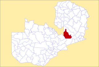
Mkushi District is a district of Zambia, located in Central Province. The capital lies at Mkushi. As of the 2022 Zambian Census, the district had a population of 208,635 people. The Great North Road and TAZARA railway run through Mkushi district, connecting Kapiri Mposhi with Serenje, Mpika, Kasama & Tanzania. The area is largely undeveloped and home to numerous natural attractions including Lunsemfwa Wonder Gorge, Changwena Falls, and historic Fort Elwes.

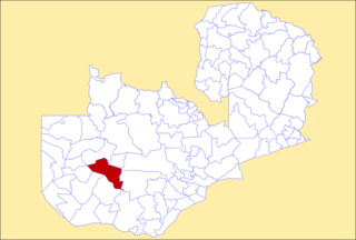
Mumbwa District is a district of Zambia, located in Central Province. The capital lies at Mumbwa. As of the 2022 Zambian Census, the district had a population of 332,237 people. It consists of two constituencies, being Mumbwa and Nangoma.
Serenje District is a district of Zambia, located in Central Province. The capital lies at Serenje. As of the 2022 Zambian Census, the district had a population of 158,192 people. It consists of two constituencies, namely Serenje and Muchinga. The district contains Lake Lusiwasi.

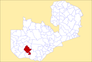
Gwembe District is a district of Zambia, located in Southern Province. The capital now lies at Munyumbwe. As of the 2022 Zambian Census, the district had a population of 79,273 people.

Limulunga District is a district of Zambia, located in Western Province. The seat of the district is Limulunga. It was made independent from Mongu District in 2012. As of the 2022 Zambian Census, the district had a population of 61,102 people.
Luampa District is a district of Zambia, located in Western Province. It was separated from Kaoma District in 2012. As of the 2022 Zambian Census, the district had a population of 61,023 people.

Mitete District is a district of Zambia, located in Western Province. It was separated from Lukulu District in 2012. As of the 2022 Zambian Census, the district had a population of 39,641 people.
Mulobezi District is a district of Zambia, located in Western Province. It was separated from Sesheke District in 2013. As of the 2022 Zambian Census, the district had a population of 45,326 people.
Mwandi District is a district of Zambia in the Western Province. The capital is at Mwandi. It was separated from Sesheke District in 2012. As of the 2022 Zambian census, it has a population of 40,418.

Nalolo District is a district of Zambia, located in Western Province. It was separated from Senanga District in 2012. As of the 2022 Zambian Census, the district had a population of 73,645 people.

Sikongo District is a district of Zambia, located in Western Province. It was separated from Kalabo District in 2012. As of the 2022 Zambian Census, the district had a population of 59,670 people.

Sioma District is a district of Zambia, located in Western Province on the west bank of the Zambezi River. The capital lies at Sioma. As of the 2022 Zambian Census, the district had a population of 65,539 people.

Liuwa is a constituency of the National Assembly of Zambia. It covers part of Kalabo District in Western Province.