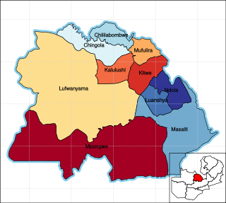
Copperbelt Province is a province in Zambia which covers the mineral-rich Copperbelt, and farming and bush areas to the south. It was the backbone of the Northern Rhodesian economy during British colonial rule and fuelled the hopes of the immediate post-independence period, but its economic importance was severely damaged by a crash in global copper prices in 1973. The province adjoins the Haut-Katanga province of the Democratic Republic of the Congo, which is similarly mineral-rich.
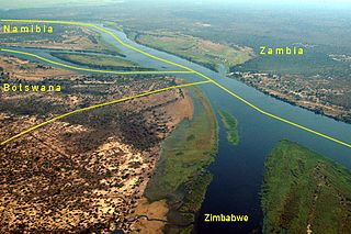
Kazungula is a small border town in Zambia, lying on the north bank of the Zambezi River about 70 kilometres (45 mi) west of Livingstone on the M10 Road.

Southern Province is one of Zambia's ten provinces. It is home to Zambia's premier tourist attraction, Mosi-oa-Tunya, shared with Zimbabwe. The centre of the province, the Southern Plateau, has the largest area of commercial farmland of any Zambian province, and produces most of the maize crop.
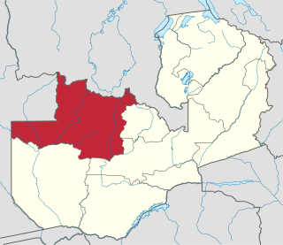
North-Western Province is one of ten Provinces of Zambia. It covers an area of 125,826 km2 (48,582 sq mi), has a population of 1,278,357 and a population density of 20 per square kilometre as of 2021. It is the most sparsely populated province in the country. The provincial capital is Solwezi. The literacy rate stood at 63 per cent in 2010 against a national average of 70.2 per cent. The rural population constituted 77.45%, while the urban population was 22.55%. North-Western Province is bordered along Angola in the west, the Democratic Republic of Congo in the north, Copperbelt Province in the east, Central in the south-east, and Western Province in the south-west.

Chobe District is an administrative district in the northern part of Botswana, with the headquarters in Kasane. In 2001 it was merged with Ngamiland, and until 2006 it shared with Ngamiland the North-West District Council as local government. Chobe National Park is in the Chobe District. As of 2011, the total population of the district was 23,347 compared to 18,258 in 2001. The growth rate of population during the decade was 2.49. The total number of workers constituted 12,059 with 6,113 males and 5,947 females, with majority of them working in public administration.

Chadiza District with the headquarters at Chadiza lies in the extreme south-east corner of Zambia, bordering Mozambique to its south. The eastern half of the district is characterised by wooded rocky hills rising to 1330 m while the western half has the same character as the land around Chadiza town. This part of the district has been almost completely deforested and suffers soil erosion. In 2012, most of the eastern part of the district was declared its own district, namely Vubwi District.

Mkushi District is a district of Zambia, located in Central Province. The capital lies at Mkushi. As of the 2022 Zambian Census, the district had a population of 208,635 people. The Great North Road and TAZARA railway run through Mkushi district, connecting Kapiri Mposhi with Serenje, Mpika, Kasama & Tanzania. The area is largely undeveloped and home to numerous natural attractions including Lunsemfwa Wonder Gorge, Changwena Falls, and historic Fort Elwes.

Mumbwa District is a district of Zambia, located in Central Province. The capital lies at Mumbwa. As of the 2022 Zambian Census, the district had a population of 332,237 people. It consists of two constituencies, being Mumbwa and Nangoma.
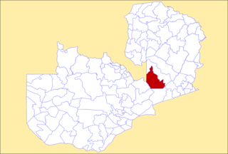
Serenje District is a district of Zambia, located in Central Province. The capital lies at Serenje. As of the 2022 Zambian Census, the district had a population of 158,192 people. It consists of two constituencies, namely Serenje and Muchinga. The district contains Lake Lusiwasi.

Lusaka District is a district of Zambia, located in Lusaka Province. The capital lies at Lusaka. As of the 2022 Zambian Census, the district had a population of 2,204,059 people.

Solwezi District is a district of Zambia, located in North-Western Province. The capital lies at Solwezi. As of the 2000 Zambian Census, the district had a population of 203,797 people.

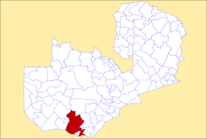
Gwembe District is a district of Zambia, located in Southern Province. The capital now lies at Munyumbwe. As of the 2022 Zambian Census, the district had a population of 79,273 people.

Kalomo District is a district of Zambia, located in Southern Province. The capital lies at Kalomo. As of the 2022 Zambian census, the district had a population of 274,640 people.

Livingstone District is a district of Zambia, located in Southern Province. The capital lies at Livingstone. As of the 2022 Zambian Census, the district had a population of 177,393 people. Its border with Zimbabwe is formed by the Zambezi River and Victoria Falls. Although most people live in Livingstone, other villages include Jinga Jinga in the north and Simonga in the southwest.

Mazabuka District is a district of Zambia, located in Southern Province. The capital lies at Mazabuka. As of the 2000 Zambian Census, the district had a population of 232,045 people.

Monze District is a district of Zambia, located in Southern Province. The capital lies at Monze. As of the 2022 Zambian Census, the district had a population of 268,432 people.

Mwense District is a district of Zambia, located in Luapula Province. The capital lies at Mwense. As of the 2000 Zambian Census, the district had a population of 105,759 people. It consists of two constituencies, namely Mwense and Mambilima.

Isoka District is a district of Zambia, located in Muchinga Province. The capital lies at Isoka. As of the 2000 Zambian Census, the district had a population of 99,319 people.

Mbala District is a district of Zambia, located in Northern Province. The capital lies at Mbala. As of the 2000 Zambian Census, the district had a population of 149,634 people.

Muchinga Province is one of the ten provinces of Zambia. It is located in the northeast of the country and borders with Tanzania in the north, Malawi in the east, Eastern Province in the south, Central Province in the southwest, Luapula Province in the west, and Northern Province in the northwest. The administrative center of the province is Chinsali.
