
Copperbelt Province is a province in Zambia which covers the mineral-rich Copperbelt, and farming and bush areas to the south. It was the backbone of the Northern Rhodesian economy during British colonial rule and fuelled the hopes of the immediate post-independence period, but its economic importance was severely damaged by a crash in global copper prices in 1973. The province adjoins the Haut-Katanga province of the Democratic Republic of the Congo, which is similarly mineral-rich.
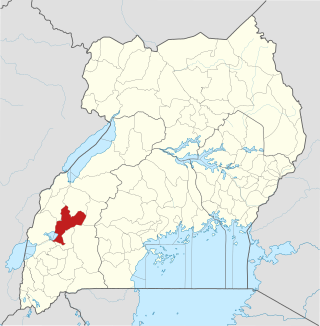
Kamwenge District is a district in Western Uganda. It is named after its 'chief town', Kamwenge, where the district headquarters are located. Kamwenge District is part of the Kingdom of Toro, one of the ancient traditional monarchies in Uganda. The kingdom is coterminous with Toro sub-region. The districts that constitute the sub-region are: (a) Bunyangabu District (b) Kabarole District (c) Kamwenge District (d) Kyegegwa District (e) Kitagwenda District and (f) Kyenjojo District.

Kanungu District is a district in the Western Region of Uganda. The town of Kanungu is the site of the district headquarters. The Bwindi Impenetrable Forest in Kanungu District is among the sites shown in aerial footage in the movie Black Panther.

Northern Province is one of Zambia's ten provinces. It covers approximately one-sixth of Zambia in land area. The provincial capital is Kasama. The province is made up of 12 districts, namely Kasama District, Chilubi District, Kaputa District, Luwingu District, Mbala District, Mporokoso District, Mpulungu District, Mungwi District, Nsama District, Lupososhi District, Lunte District and Senga Hill District. Currently, only Kasama and Mbala have attained municipal council status, while the rest are still district councils. It is widely considered to be the heartland of the Bemba, one of the largest tribes in Zambia.
Mwinilunga is a town in the North-Western Province of Zambia. It is the headquarters of Mwinilunga District, one of the province's eleven districts.

Mbeya Region is one of Tanzania's 31 administrative regions. The region covers an area of 35,954 km2 (13,882 sq mi). The region is comparable in size to the combined land area of the nation state of Guinea Bissau. Mbeya Region is bordered to the east by Singida Region, Iringa Region and Njombe Region. The region is bordered to the south by Malawi and Lake Nyasa. To the north the region borders southern Tabora Region. Lastly, Mbeya is bordered to the west by Songwe Region. The regional capital is the city of Mbeya. According to the 2022 national census, the region had a population of 2,343,754.

Serenje is a town in Serenje District, Central Province, Zambia, lying just off the Great North Road and TAZARA Railway. Serenje has a railway station on the TAZARA railway. Serenje is approximately 191 km from Kapiri Mposhi on the Great North Road. Mkushi is the district west of Serenje. The Mulembo Falls lie near the town.

Petauke is a town and seat of Petauke District located in the Eastern Province of Zambia.

Central Province is one of Zambia's ten provinces. The provincial capital is Kabwe, which is the home of the Mulungushi Rock of Authority. Central Province has an area of 94,394 km (58,654 mi). It borders eight other provinces and has eleven districts. The total area of forest in the province is 9,095,566 ha, and it has a national park and three game management areas. The first mine in the region was opened up in 1905 making the then Broken Hill town the first mining town. In 1966, the town's name was reverted to its indigenous name - Kabwe meaning 'ore' or 'smelting'.

Luapula Province is one of Zambia's ten provinces located in the northern part of the country. Luapula Province is named after the Luapula River and its capital is Mansa. As per the 2022 Zambian census, the Province had a population of 1,519,478, which accounted for 7.72 per cent of the total Zambian population.

Southern Province is one of Zambia's ten provinces. It is home to Zambia's premier tourist attraction, Mosi-oa-Tunya, shared with Zimbabwe. The centre of the province, the Southern Plateau, has the largest area of commercial farmland of any Zambian province, and produces most of the maize crop.

The primary form of agriculture in Sri Lanka is rice production. Rice is cultivated during Maha and Yala seasons. Tea is cultivated in the central highlands and is a major source of foreign exchange. Vegetables, fruits and oilseed crops are also cultivated in the country. There are two Agriculture Parks abbreviated as A. Parks established by the Department of Agriculture. Out of the total population in Sri Lanka, 27.1% engages in agricultural activities. Agriculture accounted for 7.4% of the GDP in 2020.

Nyabihu is a district (akarere) in Western Province, Rwanda. Its capital is Mukamira. Nyabihu district is divided into 12 sectors (imirenge): Bigogwe, Jenda, Jomba, Kabatwa, Karago, Kintobo, Mukamira, Muringa, Rambura, Rugera, Rurembo and Shyira.These sectors are themselves separated in 73 cells and 474 villages also called “imidugudu".

Benin is predominantly a rural society, and agriculture in Benin supports more than 70% of the population. Agriculture contributes around 35% of the country's gross domestic product (GDP) and 80% of export income. While the Government of Benin (GOB) aims to diversify its agricultural production, Benin remains underdeveloped, and its economy is underpinned by subsistence agriculture. Approximately 93% of total agricultural production goes into food production. The proportion of the population living in poverty is about 35.2%, with more rural households in poverty (38.4%) than urban households (29.8%). 36% of households depend solely upon agricultural (crop) production for income, and another 30% depend on crop production, livestock, or fishing for income.

Throughout its history, agriculture in Paraguay has been the mainstay of the economy. This trend has continued today and in the late 1980s the agricultural sector generally accounted for 48 percent of the nation's employment, 23 percent of GDP, and 98 percent of export earnings. The sector comprised a strong food and cash crop base, a large livestock subsector including cattle ranching and beef production, and a vibrant timber industry.

Farming systems in India are strategically utilized, according to the locations where they are most suitable. The farming systems that significantly contribute to the agriculture of India are subsistence farming, organic farming, industrial farming. Regions throughout India differ in types of farming they use; some are based on horticulture, ley farming, agroforestry, and many more. Due to India's geographical location, certain parts experience different climates, thus affecting each region's agricultural productivity differently. India is very dependent on its monsoon cycle for large crop yields. India's agriculture has an extensive background which goes back to at least 9 thousand years. In India, in the alluvial plains of the Indus River in Pakistan, the old cities of Mohenjo-Daro and Harappa experienced an apparent establishment of an organized farming urban culture. That society, known as the Harappan or Indus civilization, flourished until shortly after 4000 BP; it was much more comprehensive than those of Egypt or Babylonia and appeared earlier than analogous societies in northern China. Currently, the country holds the second position in agricultural production in the world. In 2007, agriculture and other industries made up more than 16% of India's GDP. Despite the steady decline in agriculture's contribution to the country's GDP, agriculture is the biggest industry in the country and plays a key role in the socio-economic growth of the country. India is the second-largest producer of wheat, rice, cotton, sugarcane, silk, groundnuts, and dozens more. It is also the second biggest harvester of vegetables and fruit, representing 8.6% and 10.9% of overall production, respectively. The major fruits produced by India are mangoes, papayas, sapota, and bananas. India also has the biggest number of livestock in the world, holding 281 million. In 2008, the country housed the second largest number of cattle in the world with 175 million.

Songwe Region is one of Tanzania's 31 administrative regions. The region covers a land area of 27,656 km2 (10,678 sq mi). The region is comparable in size to the combined land area of the nation state of Haiti. Songwe Region borders the countries of Zambia and Malawi to the south: Tunduma is the main entry point into Zambia while Isongole is the main entry point into Malawi. Songwe also borders the Tanzanian regions of Rukwa and Katavi in the west, Tabora in the north, and Mbeya in the east. Lake Rukwa is a major body of water in the western part of the region. The region was created on 29 January 2016 from the western half of Mbeya Region. The regional capital is Vwawa. According to the 2022 national census, the region had a population of 1,344,687.
Benguet coffee, also known as Benguet arabica, is a single-origin coffee varietal grown in the Cordillera highlands of the northern Philippines since the 19th century. It belongs to the species Coffea arabica, of the Typica variety. It is one of the main crops of farmers in the province of Benguet, which has a climate highly suitable for arabica cultivation. Benguet coffee is listed in the Ark of Taste international catalogue of endangered heritage foods by the Slow Food movement.

Chisamba District is a district of Central Province, Zambia. It covers a total surface area of 5,204.5 sq km and is known for its agricultural activities with over 32,000 small scale farming families and 256 commercial farmers, the majority of whom are white Zambians. It shares borders with Lusaka, Chongwe, Chibombo, Kabwe, Kapiri Mposhi and Luano Districts. As of the 2022 Zambian Census, the district had a population of 160,828 people.
The Lala people are a Bantu ethnic group found in the Serenje District of the Central Province of Zambia.
