Nyimba District

Last updated
Nyimba District
Nyimba District, Zambia 2022.png
Location in Zambia
Coordinates: 14°21′S30°35′E / 14.350°S 30.583°E / -14.350; 30.583 Coordinates: 14°21′S30°35′E / 14.350°S 30.583°E / -14.350; 30.583
CountryFlag of Zambia.svg  Zambia
Province Eastern Province
Capital Nyimba
Population
 (2010)
  Total99,159
Time zone UTC+2 (CAT)

The Nyimba District is a district of Zambia, located in the Eastern Province. The capital lies at Nyimba. As of the 2010 Zambian Census, the district currently has a population of 99,159 people. [1]

Related Research Articles

<span class="mw-page-title-main">Zambia</span> Landlocked country at the crossroads of Southern, Central, and East Africa

Zambia, officially the Republic of Zambia, is a landlocked country at the crossroads of Central, Southern and East Africa, although it is typically referred to as being in Southern Africa. Its neighbors are the Democratic Republic of the Congo to the north, Tanzania to the northeast, Malawi to the east, Mozambique to the southeast, Zimbabwe and Botswana to the south, Namibia to the southwest, and Angola to the west. The capital city of Zambia is Lusaka, located in the south-central part of Zambia. The nation's population of around 19.5 million, is concentrated mainly around Lusaka in the south and the Copperbelt Province to the north, the core economic hubs of the country.

<span class="mw-page-title-main">Provinces of Zambia</span> First-level administrative divisions of Zambia

Zambia is divided into 10 provinces for administrative purposes. Each province is headed by a minister appointed by the President and there are ministries of central government for each province. The administrative head of each province is the Permanent Secretary, appointed by the President. There are Deputy Permanent Secretary, heads of government departments and civil servants at the provincial level.

<span class="mw-page-title-main">Copperbelt Province</span> Province of Zambia

Copperbelt Province is a province in Zambia which covers the mineral-rich Copperbelt, and farming and bush areas to the south. It was the backbone of the Northern Rhodesian economy during British colonial rule and fuelled the hopes of the immediate post-independence period, but its economic importance was severely damaged by a crash in global copper prices in 1973. The province adjoins the Haut-Katanga province of the Democratic Republic of the Congo, which is similarly mineral-rich.

The city of Chipata is the administrative centre of the Eastern Province of Zambia and Chipata District. It was declared the 5th city of the country, after Lusaka, Ndola, Kitwe and Livingstone, by President Edgar Lungu on 24 February 2017. The city has undergone rapid economic and infrastructure growth in the years, leading up to city status.

Rukidi IV of Toro Omukama of Toro

Rukirabasaija Omukama Oyo Nyimba Kabamba Iguru Rukidi IV, King Oyo, is the reigning Omukama of Tooro, in Uganda. He was born on 16 April 1992 to King Patrick David Mathew Kaboyo Olimi III and Queen Best Kemigisa Kaboyo. Three and half years later in 1995, Oyo ascended the throne and succeeded his father to become the 12th ruler of the 180-year-old Kingdom of Tooro.

<span class="mw-page-title-main">Central Province, Zambia</span> Province of Zambia

Central Province is one of Zambia's ten provinces. The provincial capital is Kabwe, which is the home of the Mulungushi Rock of Authority. Central Province has an area of 94,394 km (58,654 mi). It borders eight other provinces and has eleven districts. The total area of forest in the province is 9,095,566 ha, and it has a national park and three game management areas. The first mine in the region was opened up in 1905 making the then Broken Hill town the first mining town. In 1966, he town's name was reverted to its indigenous name - Kabwe meaning 'ore' or 'smelting'.

<span class="mw-page-title-main">Eastern Province, Zambia</span> Province of Zambia

Eastern Province is one of Zambia's ten provinces. The province lies between the Luangwa River and borders with Malawi to the east and Mozambique to the south, from Isoka in the northeast to the north of Luangwa in the south. The provincial capital is Chipata. Eastern province has an area of 51,476 km2 (19,875 sq mi), locally shares border with three other provinces of the country and is divided into eleven districts.

<span class="mw-page-title-main">Luapula Province</span> Province of Zambia

Luapula Province is one of Zambia's ten provinces located in the northern part of the country. Luapula Province is named after the Luapula River and its capital is Mansa. As per the 2010 Zambian census, the Province had a population of 991,927, which accounted for 7.57 per cent of the total Zambian population.

<span class="mw-page-title-main">Lusaka Province</span> Province of Zambia

Lusaka Province is one of the ten provinces of Zambia. Its capital is Lusaka, which is also the national capital. It is the smallest province in Zambia, with an area of 21,896 km2. Lusaka is also Zambia's most populated and most densely populated province, with a population of 2,191,225 and density of 100 persons per km2 as of 2010. It is the most urban province, with the most doctors and fewest malaria-related incidents. The province is bordered by Zimbabwe and Mozambique, and separated by the Lower Zambezi National Park.

<span class="mw-page-title-main">Southern Province, Zambia</span> Province of Zambia

Southern Province is one of Zambia's ten provinces, and home to Zambia's premier tourist attraction, Mosi-oa-Tunya, shared with Zimbabwe. The centre of the province, the Southern Plateau, has the largest area of commercial farmland of any Zambian province, and produces most of the maize crop.

<span class="mw-page-title-main">North-Western Province, Zambia</span> Province of Zambia

North-Western Province is one of ten Provinces of Zambia. It covers an area of 125,826 km2 (48,582 sq mi), has a population of 727,044 and a population density was 5.80 per square kilometre as of 2010. It is the most sparsely populated province in the country. The provincial capital is Solwezi. The literacy rate stood at 63 per cent against a national average of 70.2 per cent. The rural population constituted 77.45%, while the urban population was 22.55%. North-Western Province is bordered along Angola in the west, the Democratic Republic of Congo in the north, Copperbelt Province in the east, Central in the south-east, and Western Province in the south-west.

Mwanga, or Namwanga (Nyamwanga), is a Bantu language spoken by the Mwanga people in the Northern Province of Zambia and in Mbeya Region, Tanzania. The 2010 Zambian census found 140,000 speakers. The current number in Tanzania is unknown; Ethnologue cites a figure from 1987 of 87,000.

<span class="mw-page-title-main">Lusaka</span> Capital of Zambia

Lusaka is the capital and largest city of Zambia. It is one of the fastest-developing cities in southern Africa. Lusaka is in the southern part of the central plateau at an elevation of about 1,279 metres (4,196 ft). As of 2019, the city's population was about 3.3 million, while the urban population is estimated at 2.5 million in 2018. Lusaka is the centre of both commerce and government in Zambia and connects to the country's four main highways heading north, south, east and west. English is the official language of the city administration, while Nyanja and Bemba are the commonly spoken street languages.

<span class="mw-page-title-main">Lufwanyama District</span> District in Copperbelt Province, Zambia

Lufwanyama District with headquarters at Lufwanyama is a large rural undeveloped district in the west of Copperbelt Province. On a number of maps it is mixed up with Mpongwe District and Masaiti District. At one time these three districts were known as 'Ndola Rural'. As of the 2010 Zambian Census, the district had a population of 78,503 people.

<span class="mw-page-title-main">Kapiri Mposhi District</span> District in Central Province, Zambia

Kapiri Mposhi District is a district of Zambia, located in Central Province. The capital lies at Kapiri Mposhi. As of the 2010 Zambian Census, the district had a population of 240,638 people.

<span class="mw-page-title-main">Serenje District</span> District in Central Province, Zambia

Serenje District is a district of Zambia, located in Central Province. The capital lies at Serenje. As of the 2010 Zambian Census, the district had a population of 158,255 people. The district contains Lake Lusiwasi.

<span class="mw-page-title-main">Solwezi District</span> District in North-Western Province, Zambia

Solwezi District is a district of Zambia, located in North-Western Province. The capital lies at Solwezi. As of the 2000 Zambian Census, the district had a population of 203,797 people.

<span class="mw-page-title-main">Chipata District</span> District in Eastern Province, Zambia

Chipata District is a district of Zambia, located in Eastern Province. The capital lies at Chipata. As of the 2010 Zambian Census, the district had a population of 455,783 people.

Nyimba (constituency)

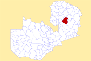
Nyimba is a constituency of the National Assembly of Zambia. It covers Chitizauwe, Chiwowa, Kacholola, Mayawa and Nyimba in Nyimba District of Eastern Province.

References

  1. "Districts of Zambia". Statoids. Retrieved February 12, 2010.