Copperbelt Province is a province in Zambia which covers the mineral-rich Copperbelt, and farming and bush areas to the south. It was the backbone of the Northern Rhodesian economy during British colonial rule and fuelled the hopes of the immediate post-independence period, but its economic importance was severely damaged by a crash in global copper prices in 1973. The province adjoins the Haut-Katanga province of the Democratic Republic of the Congo, which is similarly mineral-rich.

Mazabuka is a town in the Southern Province of Zambia. It is the capital of Mazabuka District, one of the thirteen administrative units in the Southern Province.

Southern Province is one of Zambia's ten provinces. It is home to Zambia's premier tourist attraction, Mosi-oa-Tunya, shared with Zimbabwe. The centre of the province, the Southern Plateau, has the largest area of commercial farmland of any Zambian province, and produces most of the maize crop.
Serenje District is a district of Zambia, located in Central Province. The capital lies at Serenje. As of the 2022 Zambian Census, the district had a population of 158,192 people. It consists of two constituencies, namely Serenje and Muchinga. The district contains Lake Lusiwasi.
Kalulushi District is a district of Zambia, located in Copperbelt Province. The capital lies at Kalulushi. As of the 2000 Zambian Census, the district had a population of 75,806 people.

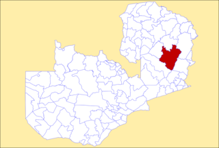
Luanshya District is a district of Zambia, located in Copperbelt Province. The capital lies at Luanshya. As of the 2000 Zambian census, the district had a population of 147,908 people.

Lusaka District is a district of Zambia, located in Lusaka Province. The capital lies at Lusaka. As of the 2022 Zambian Census, the district had a population of 2,204,059 people.

Kasempa District is a district of Zambia, located in North-Western Province. The capital lies at Kasempa. As of the 2000 Zambian Census, the district had a population of 44,002 people.

Mwinilunga District is a district of Zambia, located in North-Western Province. The capital lies at Mwinilunga. As of the 2000 Zambian Census, the district had a population of 117,505 people.

Solwezi District is a district of Zambia, located in North-Western Province. The capital lies at Solwezi. As of the 2000 Zambian Census, the district had a population of 203,797 people.

Gwembe District is a district of Zambia, located in Southern Province. The capital now lies at Munyumbwe. As of the 2022 Zambian Census, the district had a population of 79,273 people.

Kalomo District is a district of Zambia, located in Southern Province. The capital lies at Kalomo. As of the 2022 Zambian census, the district had a population of 274,640 people.

Kazungula District is a district of Zambia, located in Southern Province. The capital lies at Kazungula. As of the 2022 Zambian Census, the district had a population of 173,002 people.

Monze District is a district of Zambia, located in Southern Province. The capital lies at Monze. As of the 2022 Zambian Census, the district had a population of 268,432 people.
Petauke District is a district of Zambia, located in Eastern Province. The capital lies at Petauke. As of the 2000 Zambian Census, the district had a population of 235,879 people. It consists of two constituencies, namely Petauke Central and Kaumbwe.

Isoka District is a district of Zambia, located in Muchinga Province. The capital lies at Isoka. As of the 2000 Zambian Census, the district had a population of 99,319 people.

Luwingu District is a district of Zambia, located in Northern Province. The capital lies at Luwingu. As of the 2000 Zambian Census, the district had a population of 80,758 people.

Mbala District is a district of Zambia, located in Northern Province. The capital lies at Mbala. As of the 2000 Zambian Census, the district had a population of 149,634 people.
Mpika District is a district of Zambia, located in Muchinga Province. The capital lies at Mpika. As of the 2000 Zambian Census, the district had a population of 146,196 people. With the Luangwa River forming its eastern border, it has most of the South Luangwa National Park within its boundaries. It also contains the North Luangwa National Park.

Chikankata District is a district of Southern Province, Zambia. It was separated from Mazabuka District in December 2011.