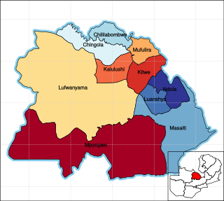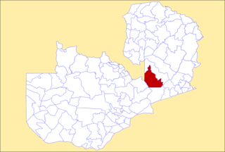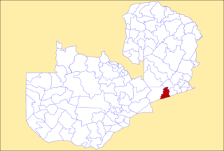
Copperbelt Province is a province in Zambia which covers the mineral-rich Copperbelt, and farming and bush areas to the south. It was the backbone of the Northern Rhodesian economy during British colonial rule and fuelled the hopes of the immediate post-independence period, but its economic importance was severely damaged by a crash in global copper prices in 1973. The province adjoins the Haut-Katanga province of the Democratic Republic of the Congo, which is similarly mineral-rich.
Nkhotakota is a district in the Central Region of Malawi. The capital is Nkhotakota. The district covers an area of 4,259 km² and has a population of 395,897. The word Nkhotakota means "zig-zag" in Chichewa. It is located along the shore of Lake Malawi.

Southern Province is one of Zambia's ten provinces. It is home to Zambia's premier tourist attraction, Mosi-oa-Tunya, shared with Zimbabwe. The centre of the province, the Southern Plateau, has the largest area of commercial farmland of any Zambian province, and produces most of the maize crop.

Katete District with headquarters at Katete in Eastern Province, Zambia, includes woodland in the north sloping down into the Luangwa Valley, good farmland amid rocky hills in the centre, and deforested plateau exposed to soil erosion and degradation in the south along the border with Mozambique. As of the 2000 Zambian Census, the district had a population of 189,250 people. It consists of two constituencies, namely Mkaika and Milanzi.

Mansa District with headquarters at Mansa is a district located in Luapula Province. As of the 2000 Zambian Census, the district had a population of 179,749 people. It consists of two constituencies, namely Mansa Central and Bahati.

Kalabo District is a district of Zambia, located in Western Province. The capital lies at Kalabo. As of the 2000 Zambian Census, the district had a population of 114,806 people. The district has 3 Secondary Schools namely Kalabo Secondary School, Nalionwa Day School and Lukona Secondary School, of which Kalabo Secondary School is the main school established in 1966. The district has attractive places that attract tourists, places like the Liuwa Plain National Park, and Yuka Seventh-day Adventist Hospital. The main Hospital in the district is Kalabo District Hospital seconded by Yuka Seventh-day Adventist Hospital, Yuka is sometimes referred to as UK.

Kabwe District is a district of Zambia, located in Central Province. The capital lies at Kabwe. As of the 2010 Zambian Census, the district had a population of 299,206 people. It consists of two constituencies, namely Kabwe Central and Bwacha.

Kapiri Mposhi District is a district of Zambia, located in Central Province. The capital lies at Kapiri Mposhi. As of the 2022 Zambian Census, the district had a population of 371,068 people.

Mkushi District is a district of Zambia, located in Central Province. The capital lies at Mkushi. As of the 2022 Zambian Census, the district had a population of 208,635 people. The Great North Road and TAZARA railway run through Mkushi district, connecting Kapiri Mposhi with Serenje, Mpika, Kasama & Tanzania. The area is largely undeveloped and home to numerous natural attractions including Lunsemfwa Wonder Gorge, Changwena Falls, and historic Fort Elwes.

Mumbwa District is a district of Zambia, located in Central Province. The capital lies at Mumbwa. As of the 2022 Zambian Census, the district had a population of 332,237 people. It consists of two constituencies, being Mumbwa and Nangoma.

Serenje District is a district of Zambia, located in Central Province. The capital lies at Serenje. As of the 2022 Zambian Census, the district had a population of 158,192 people. It consists of two constituencies, namely Serenje and Muchinga. The district contains Lake Lusiwasi.

Lusaka District is a district of Zambia, located in Lusaka Province. The capital lies at Lusaka. As of the 2022 Zambian Census, the district had a population of 2,204,059 people.

Solwezi District is a district of Zambia, located in North-Western Province. The capital lies at Solwezi. As of the 2000 Zambian Census, the district had a population of 203,797 people.

Kazungula District is a district of Zambia, located in Southern Province. The capital lies at Kazungula. As of the 2022 Zambian Census, the district had a population of 173,002 people.

Monze District is a district of Zambia, located in Southern Province. The capital lies at Monze. As of the 2022 Zambian Census, the district had a population of 268,432 people.

Petauke District is a district of Zambia, located in Eastern Province. The capital lies at Petauke. As of the 2000 Zambian Census, the district had a population of 235,879 people. It consists of two constituencies, namely Petauke Central and Kaumbwe.

Mwense District is a district of Zambia, located in Luapula Province. The capital lies at Mwense. As of the 2000 Zambian Census, the district had a population of 105,759 people. It consists of two constituencies, namely Mwense and Mambilima.

Muchinga Province is one of the ten provinces of Zambia. It is located in the northeast of the country and borders with Tanzania in the north, Malawi in the east, Eastern Province in the south, Central Province in the southwest, Luapula Province in the west, and Northern Province in the northwest. The administrative center of the province is Chinsali.

Zimba District is a district of Southern Province, Zambia. Its capital lies at Zimba. It was separated from Kalomo District in 2012.

Kalomo Central is a constituency of the National Assembly of Zambia. It covers Kalomo and surrounding areas in Kalomo District of Southern Province.


