Copperbelt Province is a province in Zambia which covers the mineral-rich Copperbelt, and farming and bush areas to the south. It was the backbone of the Northern Rhodesian economy during British colonial rule and fuelled the hopes of the immediate post-independence period, but its economic importance was severely damaged by a crash in global copper prices in 1973. The province adjoins the Haut-Katanga province of the Democratic Republic of the Congo, which is similarly mineral-rich.
Kasempa is a town located in Kasempa District, North-Western Province, Zambia. It is approximately 550 kilometres (340 mi) by road northwest of Lusaka, the capital. Kasempa is located on the western bank of the Lufupa River as it flows south into the Kafue National Park.
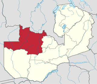
North-Western Province is one of ten Provinces of Zambia. It covers an area of 125,826 km2 (48,582 sq mi), has a population of 1,278,357 and a population density of 20 per square kilometre as of 2021. It is the most sparsely populated province in the country. The provincial capital is Solwezi. The literacy rate stood at 63 per cent in 2010 against a national average of 70.2 per cent. The rural population constituted 77.45%, while the urban population was 22.55%. North-Western Province is bordered along Angola in the west, the Democratic Republic of Congo in the north, Copperbelt Province in the east, Central in the south-east, and Western Province in the south-west.

Chibombo District is a district of Central Province, Zambia. As of the 2022 Zambian Census, the district had a population of 421,315 people. It consists of two constituencies, namely Keembe and Katuba.

Mumbwa District is a district of Zambia, located in Central Province. The capital lies at Mumbwa. As of the 2022 Zambian Census, the district had a population of 332,237 people. It consists of two constituencies, being Mumbwa and Nangoma.
Serenje District is a district of Zambia, located in Central Province. The capital lies at Serenje. As of the 2022 Zambian Census, the district had a population of 158,192 people. It consists of two constituencies, namely Serenje and Muchinga. The district contains Lake Lusiwasi.

Chililabombwe District is a district of Zambia, located in Copperbelt Province. The capital is Chililabombwe. At the 2022 Zambian Census, the district had a population of 141,899.
Kalulushi District is a district of Zambia, located in Copperbelt Province. The capital lies at Kalulushi. As of the 2022 Zambian Census, the district had a population of 170,701 people.

Luanshya District is a district of Zambia, located in Copperbelt Province. The capital lies at Luanshya. As of the 2022 Zambian census, the district had a population of 211,966 people.

Ndola District is a district of Zambia, located in Copperbelt Province. The capital lies at Ndola. As of the 2022 Zambian Census, the district had a population of 624,579 people.

Mwinilunga District is a district of Zambia, located in North-Western Province. The capital lies at Mwinilunga. As of the 2022 Zambian Census, the district had a population of 136,770 people.

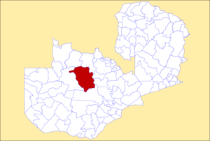
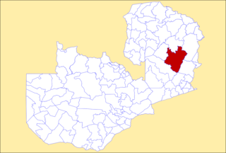
Solwezi District is a district of Zambia, located in North-Western Province. The capital lies at Solwezi. As of the 2022 Zambian Census, the district had a population of 332,623 people.

Kalomo District is a district of Zambia, located in Southern Province. The capital lies at Kalomo. As of the 2022 Zambian census, the district had a population of 274,640 people.

Kazungula District is a district of Zambia, located in Southern Province. The capital lies at Kazungula. As of the 2022 Zambian Census, the district had a population of 173,002 people.

Livingstone District is a district of Zambia, located in Southern Province. The capital lies at Livingstone. As of the 2022 Zambian Census, the district had a population of 177,393 people. Its border with Zimbabwe is formed by the Zambezi River and Victoria Falls. Although most people live in Livingstone, other villages include Jinga Jinga in the north and Simonga in the southwest.

Mazabuka District is a district of Zambia, located in Southern Province. The capital lies at Mazabuka. As of the 2000 Zambian Census, the district had a population of 232,045 people.

Isoka District is a district of Zambia, located in Muchinga Province. The capital lies at Isoka. As of the 2022 Zambian Census, the district had a population of 111,599 people.

Kaputa District is a district of Zambia, located in Northern Province. The capital lies at Kaputa. As of the 2000 Zambian Census, the district had a population of 87,233 people.

Luwingu District is a district of Zambia, located in Northern Province. The capital lies at Luwingu. As of the 2000 Zambian Census, the district had a population of 80,758 people.
Mpika District is a district of Zambia, located in Muchinga Province. The capital lies at Mpika. As of the 2022 Zambian Census, the district had a population of 149,063 people. With the Luangwa River forming its eastern border, it has most of the South Luangwa National Park within its boundaries. It also contains the North Luangwa National Park.