
Manicaland is a province in eastern Zimbabwe. After Harare Province, it is the country's second-most populous province, with a population of 2.037 million, as of the 2022 census. Making it the third most densely populated province after Harare and Bulawayo provinces. Manicaland was one of five original provinces established in Southern Rhodesia in the early colonial period. The province endowed with country's major tourist attractions, the likes of Mutarazi Falls, Nyanga National Park and Zimbabwe's top three highest peaks. The province is divided into ten administrative subdivisions of seven rural districts and three towns/councils, including the provincial capital, Mutare. The name Manicaland is derived from one of the province's largest ethnic groups, the Manyika, who originate from the area north of the Manicaland province and as well as western Mozambique, who speak a distinct language called ChiManyika in Shona.

Kafue is a town on the T2 road in the Lusaka Province of Zambia and it lies on the north bank of the Kafue River, after which it is named. It is the southern gateway to the central Zambian plateau on which Lusaka and the mining towns of Kabwe and the Copperbelt are located.

Dodoma Region is one of Tanzania's 31 administrative regions. The regional capital is the city of Dodoma. Dodoma is located in central Tanzania, bordered by Singida region to the west, Manyara region to the north, Iringa region to the south, and Morogoro region to the east. Dodoma region hosts the nation's capital city, where the legislative assembly of Bunge is based. Dodoma region also hosts one of the largest universities in Tanzania: University of Dodoma. The region is the home of the Tanzanian wine industry, which is the second largest wine industry on the continent after South Africa. According to the 2022 national census, the region had a population of 3,085,625; in the 2012 national census, the population was 2,083,588.

Western Province is one of the 10 provinces in Zambia and encompasses most of the area formerly known as Barotseland. The capital is Mongu, and together with the neighbouring town of Limulunga, Mongu is treated as the capital of Barotseland.

The Sukuma are a Bantu ethnic group from the southeastern African Great Lakes region. They are the largest ethnic group in Tanzania, with an estimated 10 million members or 16 percent of the country's total population. Sukuma means "north" and refers to "people of the north." The Sukuma refer to themselves as Basukuma (plural) and Nsukuma (singular).
Mumbwa is a town in the Central Province of Zambia, lying on the M9 Road. Its district covers the western part of the Central Province bordering Kaoma and Western Province to the west, Namwala and Southern Province to the south, Lusaka and Lusaka Province to the east, Kasempa and North-Western Province to the north and Kabwe to the north-east. It is known for its cotton and has a ginnery. The Zambia Air Force has a base in the district. Kafue National Park borders the district to the west. The predominant tribes are the Ila, who speak a dialect known as Sala, mostly to the south and south east and the Kaonde to the north. The Lenje are to the north-east on the border area with Kabwe. There are also relatively large settlement of people from the west and north west such as the Lozi, Nkoya and Luvale, Shona people from the then Southern Rhodesia who settled there as refugees from the civil war in that country and who are now almost integrated and Tonga from the south. A lot of prospecting for minerals such as copper and gold was done in the district and small scale mines operated there. Most are now closed, though the gold mine at Luiri has been revived.

Central Province is one of Zambia's ten provinces. The provincial capital is Kabwe, which is the home of the Mulungushi Rock of Authority. Central Province has an area of 94,394 km (58,654 mi). It borders eight other provinces and has eleven districts. The total area of forest in the province is 9,095,566 ha, and it has a national park and three game management areas. The first mine in the region was opened up in 1905 making the then Broken Hill town the first mining town. In 1966, the town's name was reverted to its indigenous name - Kabwe meaning 'ore' or 'smelting'.

Eastern Province is one of Zambia's ten provinces. The province lies between the Luangwa River and borders with Malawi to the east and Mozambique to the south, from Isoka in the northeast to the north of Luangwa in the south. The provincial capital is Chipata. Eastern province has an area of 51,476 km2 (19,875 sq mi), locally shares border with three other provinces of the country and is divided into fifteen districts.

Lusaka Province is one of the ten provinces of Zambia. It is the smallest in terms of land area, covering 21,896 km2. However, it is the most populated and densely populated province in Zambia, with a population of 3,079,964 as of 2022 and a population density of 140 persons per km2.

Southern Province is one of Zambia's ten provinces. It is home to Zambia's premier tourist attraction, Mosi-oa-Tunya, shared with Zimbabwe. The centre of the province, the Southern Plateau, has the largest area of commercial farmland of any Zambian province, and produces most of the maize crop.

Lupane ( luːpɑːnɛ) District is located in the Matabeleland North Province of Zimbabwe, and it is also the Provincial Capital. The District is situated at an elevation of 976 m with a population of 107,000 inhabitants by 2022. Lupane Town is the main center of the district located 172 km from Bulawayo along the A8 Victoria Falls Road. The Government Provincial Administrative offices are located at the Town Centre. A new university near the Town has been established under the name Lupane State University, which caters for the region and beyond. The word Lupane is thought to be a Kalanga or Lozwi word.
The Kafue Flats are a vast area of swamp, open lagoon and seasonally inundated flood-plain on the Kafue River in the Southern, Central and Lusaka provinces of Zambia. They are a shallow flood plain 240 km (150 mi) long and about 50 km (31 mi) wide, flooded to a depth of less than a meter in the rainy season, and drying out to a clayey black soil in the dry season.

The wildlife of Zambia refers to the natural flora and fauna of Zambia. This article provides an overview, and outline of the main wildlife areas or regions, and compact lists of animals focusing on prevalence and distribution in the country rather than on taxonomy. More specialized articles on particular groups are linked from here.
Namwala is a town and the seat of Namwala District in Southern Province of Zambia. It is on the M11 Road. Namwala town has a population of over 5,000 people. It lies on the southern bank of the Kafue River at 996 metres above sea level. It houses the administrative offices of Namwala District and is the principal town of the Ila people who inhabit the district.
Itezhi-Tezhi is a small town in the Southern Province of Zambia. It is the seat of the Itezhi-Tezhi District. It lies west of the town of Namwala on the border of the Kafue National Park.
Shimunenga is a ceremony of the Ba-Ila people of Maala in Namwala District, Zambia. It is celebrated on the weekend of the full moon in September or October. It is named after the legendary warrior Shimunenga, who won a battle for the people's territory against his brother.

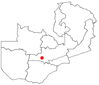
Mumbwa District is a district of Zambia, located in Central Province. The capital lies at Mumbwa. As of the 2022 Zambian Census, the district had a population of 332,237 people. It consists of two constituencies, being Mumbwa and Nangoma.

South Sudan is home to around 60 indigenous ethnic groups and 80 linguistic partitions among a 2021 population of around 11 million. Historically, most ethnic groups were lacking in formal Western political institutions, with land held by the community and elders acting as problem solvers and adjudicators. Today, most ethnic groups still embrace a cattle culture in which livestock is the main measure of wealth and used for bride wealth.
The Ila people are an ethnic group in The Republic of Zambia who make up 0.8 percent of the total population.

Chisamba District is a district of Central Province, Zambia. It covers a total surface area of 5,204.5 sq km and is known for its agricultural activities with over 32,000 small scale farming families and 256 commercial farmers, the majority of whom are white Zambians. It shares borders with Lusaka, Chongwe, Chibombo, Kabwe, Kapiri Mposhi and Luano Districts. The District has a total population of 160,828.
