
 The Big Tree National Monument, a large fig tree ( Ficus sycomorus ) historically used as a meeting place and now converted into a park (1974)
 The Great North Road (T2) in Kabwe, just east of its intersection with Buntungwa Street
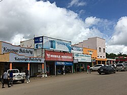 Buntungwa Street, Kabwe, near intersection with the Great North Road (T2)
 Classroom building at the Kabwe Town Campus of Mulungushi University
 Aerial view of the Mulungushi Rock of Authority, birthplace of the Zambian independence movement
Kabwe | |
|---|---|
 Downtown Kabwe, looking down Freedom Way, with the Big Tree National Monument in the distance | |
 Kabwe Location in Zambia | |
| Coordinates: 14°26′S28°27′E / 14.433°S 28.450°E | |
| Country | |
| Province | Central Province |
| District | Kabwe District |
| Government | |
| Elevation | 1,182 m (3,878 ft) |
| Population (2022 census) | |
• Total | 288,598 |
| Time zone | UTC+2 (CAT) |
| Climate | Cwa |
Kabwe is the capital of the Zambian Central Province and the Kabwe District, with a population estimated at 288,598 at the 2022 census. [1] Named Broken Hill until 1966, it was founded when lead and zinc deposits were discovered in 1902. Kabwe also has a claim to being the birthplace of Zambian politics as it was an important political centre during the colonial period. [2] [3]
Contents
- History
- Headquarters of Zambia Railways
- Independence protest
- Demographics
- Districts
- Makululu
- Environmental issues
- Mine pollution
- Transportation
- Accidents and incidents
- Industries and agriculture
- Mine
- Climate
- Institutions and attractions
- Notable people
- References
- External links
Kabwe is an important transportation, farming and university centre. Kabwe is becoming a major agricultural hub for the country is the headquarters for Zambia Railways and prison services. Additionally the mining industry has been important to the economic development of the region. However, because of the exceptional contamination of the city with lead and other toxins, and the effects of these on local children's health, a March 2022 report by the UN Special Rapporteur on Human Rights and the Environment identified the town as a sacrifice zone for industry. [4]


