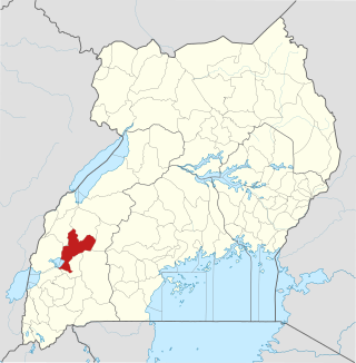
Kamwenge District is a district in Western Uganda. It is named after its 'chief town', Kamwenge, where the district headquarters are located. Kamwenge District is part of the Kingdom of Toro, one of the ancient traditional monarchies in Uganda. The kingdom is coterminous with Toro sub-region. The districts that constitute the sub-region are: (a) Bunyangabu District (b) Kabarole District (c) Kamwenge District (d) Kyegegwa District (e) Kitagwenda District and (f) Kyenjojo District.

Kasese District is a district in Western Uganda. Like most other Ugandan districts, it is named after its chief town and district headquarters, the town of Kasese.
Kamwenge is a town in the Western Region of Uganda. It is the site of the Kamwenge District headquarters.

Ibanda District is a district in the Western Region of Uganda. The town of Ibanda is the site of the district headquarters.

Uganda Martyrs University (UMU) is a private University affiliated with the Roman Catholic Church in Uganda. The University is owned by the Episcopal Conference of the Catholic Bishops of Uganda. It is licensed by the Uganda National Council for Higher Education. UMU consists of seven Faculties, two Institute, six Campuses, nine Departments, and three schools. As of March 2022, total student enrollment is 4,632. Of these, about 1,500 students were residential, while nearly 3,000 students were enrolled in UMU's distance learning programs. The number of staff members was over 400.
Ibanda is a town in the Western Region of Uganda. It is the main political, administrative, and commercial centre of Ibanda District and the site of the district headquarters. It started way back in the 1990s and was elevated from a trading centre to a town board, town council and in 2016 it was granted the municipality status. The Municipal Council has three Divisions of Kagongo, Bisheshe and Bufunda with 21 wards of Kyaruhanga, Bufunda, Nyamirima, Nsasi, Kayenje, Kashangura, Rwenshuri, Kigarama, Rugazi, Rwobuzizi, Kakatsi, Bugarama, Karangara, Kabaare, Kanyansheko, Nyakatookye, Kyeikucu, Kikoni, Kagongo, Ruyonza and Katongore ward. Ibanda Municipal Council has over 230 villages. Ibanda Municipal council commenced its operations on 1 July 2016 after being elevated from a Town Council and other sub counties that were annexed to..
The Kampala–Jinja Highway is a road in Uganda, connecting the cities of Kampala and Jinja. Sometimes referred to as Kampala–Jinja Road, it is a busy road, with several towns, trading centers and other points of interest along the way. As of October 2016, a new, wider, four-lane dual carriageway expressway, the Kampala–Jinja Expressway, is proposed to be constructed south of the present highway to relieve traffic and complement existing transport infrastructure between Kampala and Jinja.
Mweya is a location in the Western Region of Uganda.
Mpanga Power Station is an 18 megawatts (24,000 hp) mini hydroelectric power project located across River Mpanga, in Kitagwenda County, Kitagwenda District in Western Uganda.
Lweeza, also Lweza, is a neighborhood in the Buganda Region of Uganda. The correct phonetic spelling consistent with the local Ganda language is Lweeza.
Nsiika is a town in Buhweju District, in Western Uganda. It is the main municipal, administrative and commercial center in Buhweju District, and is the location of the district headquarters.
Mpanga is a location on River Mpanga in Kitagwenda county, Kitagwenda District in Western Uganda.
Nyakahita is a sparsely populated settlement in the Western Region of Uganda.
Kazo is a town in the Western Region of Uganda. It is the capital of Kazo District.
Kilembe is a community in Kasese District, in the Western Region of Uganda.
Bunyangabu District is a district in the Western Region of Uganda. The town of Kibiito is the political and administrative center of the district. However, the town of Rwimi, is the largest and main commercial center of Bunyangabu.
Kibiito is a town in the Western Region of Uganda. It is the chief administrative center of Bunyangabu District, and the district headquarters are located there.
Bihanga is a settlement in Ibanda District in the Western Region of Uganda. It is the location of the headquarters of Bihanga Parish, Nyamarebe sub-county.
Kitagwenda District is a district in Western Uganda. The district is named after Kitagwenda County, which is coterminous with the district.
Ntara is a settlement in Kitagwenda District, in Western Uganda. It is the political, administrative and commercial headquarters of the district. Ntara is one of the two municipalities in the newly-created Kitagwenda District, the other being Kabujogera Town Council.
