Kachi Mayu | |
River | |
Name origin: Quechua | |
Country | Bolivia |
---|---|
Region | Oruro Department |
Tributaries | |
- left | Pupusa Pallqa, Waylla Wint'u, Phaq'u Q'awa |
- right | Castilla Chita, Qullpa Jawira |
Source | Andes |
- location | Condo "C" Canton, Oruro Department |
- elevation | 4,600 m (15,092 ft) |
- coordinates | 19°20′S66°20′W / 19.333°S 66.333°W |
Mouth | Pillku Mayu |
- location | Potosí Department, Urmiri Municipality |
Kachi Mayu (Quechua kachi salt, mayu river, [1] "salt river", hispanicized spelling Cachi Mayu) is a Bolivian river east of Poopó Lake in the Oruro Department, Challapata Province, Challapata Municipality. Its source, the Jach'a Juqhu River, is considered the origin of the Pillku Mayu. [2]
Bolivia, officially the Plurinational State of Bolivia is a landlocked country located in western-central South America. The capital is Sucre while the seat of government and financial center is located in La Paz. The largest city and principal industrial center is Santa Cruz de la Sierra, located on the Llanos Orientales a mostly flat region in the east of Bolivia.
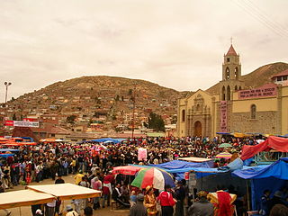
Oruro is a department in Bolivia, with an area of 53,588 km2 (20,690 sq mi). Its capital is the city of Oruro. According to the 2012 census, the Oruro department had a population of 494,178.
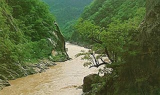
Pilcomayo is a river in central South America. At 1,100 kilometres (680 mi) long, it is the longest western tributary of the Paraguay River. Its drainage basin is 270,000 square kilometres (100,000 sq mi) in area, and its mean discharge is 200 cubic metres per second (7,100 cu ft/s).
The Jach'a Juqhu River (Aymara jach'a big, great, juqhu muddy place, [1] "great muddy place", hispanicized Jachcha Jokho) originates in the Sebastián Pagador Province (which is identical to the Santiago de Huari Municipality), Condo "C" Canton [3] [4] at a height of 4,600 m south west of the mountain Wila Qullu. It flows in a northeastern direction. Southwest of the village of T'ula Pallqa the Jach'a Juqhu River meets Pupusa Pallqa River. Now the river successively receives the names T'ula Pallqa, Aguas Calientes and Kachi Mayu. From the point of the confluence with the Ch'illawa River, already in the Potosí Department, Urmiri Municipality, the river gets the name Pillku Mayu.
Aymara is an Aymaran language spoken by the Aymara people of the Andes. It is one of only a handful of Native American languages with over one million speakers. Aymara, along with Spanish, is one of the official languages of Bolivia and parts of Peru. It is also spoken, to a much lesser extent, by some communities in northern Chile, where it is a recognized minority language.
Sebastián Pagador is a province in the southeastern parts of the Bolivian department of Oruro. Its seat is Santiago de Huari.
Wila Qullu is a mountain in the Andes in Bolivia, about 5,144 metres (16,877 ft) high. It is located in the Oruro Department, Challapata Province, Challapata Municipality. Wila Qullu is situated south of Jach'a River and north of Nacional Route 1. It lies north-west of the mountain Wila Quta which reaches the same height.
There is another river of the same name, Kachi Mayu in the Oropeza Province of the Chuquisaca Department, which is a left tributary of the Pillku Mayu.
Kachi Mayu is a Bolivian river in the Chuquisaca Department, Oropeza Province, in the Sucre and Yotalla Municipalities. It is a left tributary of the Pillku Mayu, not to be confused with the Kachi Mayu in the Oruro Department which is the headwater of the Pillku Mayu. The confluence is on the border of the Yotalla Municipality and the Potosí Department, west of the village of Tasapampa.
Oropeza is a province in the Chuquisaca Department, Bolivia. Its seat is Sucre which is also the constitutional capital of Bolivia and the capital of the Chuquisaca Department.
Chuquisaca is a department of Bolivia located in the center south. It borders on the departments of Cochabamba, Tarija, Potosí, and Santa Cruz. The departmental capital is Sucre, which is also the constitutional capital of Bolivia.
Omasuyos or Uma Suyu is a province in the La Paz Department in Bolivia. Its capital is Achacachi.
The Ch'iyar Juqhu River is a Bolivian river east of Lake Titicaca in the La Paz Department. It originates in the Cordillera Real near the peaks of the 6,127 m high Ch'iyar Juqhu which is probably named after the river or the region around it and the 5,871 m high Qalsata and flows down towards the Altiplano.
Jach'a Jawira which downstream is named Japha Jawira is a Bolivian river east of Lake Titicaca in the La Paz Department, Los Andes Province, Batallas Municipality and in the Omasuyos Province, Achacachi Municipality. Its waters flow to Lake Titicaca via the Qiqa Jawira.
Ch'aki Mayu, also Kachi Mayu, is a Bolivian river in the Potosí Department. It flows towards the Pillku Mayu.
Qullpa Jawira is a Bolivian river east of Poopó Lake in the Oruro Department, Challapata Province, Challapata Municipality, and in the Santiago de Huari Municipality. It originates near Ch'iyar Jaqhi northeast of Jatun Wila Qullu and flows in a north-eastern direction. South of Wila Qullu it meets the T'ula Pallqa River whose source, the Jach'a Juqhu River, is considered the origin of the Pillku Mayu.
Ch'iyar Jaqhi is a 4,937-metre-high (16,198 ft) mountain located in the Andes in Bolivia. It is situated in the Oruro Department, Sebastián Pagador Province, in the south of the Condo "C" Canton. It lies between the mountains Jatun Wila Qullu in the south-west and Wila Qullu in the north-east. One of the nearest mountains is Jach'a Jaqhi (Jachcha Jakke) north-east of it. The river Qullpa Jawira originates near Ch'iyar Jaqhi.
Jach'a Juqhu is a mountain in the Cordillera Real in the Andes of Bolivia, about 5,192 metres (17,034 ft) high. It lies in the La Paz Department, Los Andes Province, Batallas Municipality. Jach'a Juqhu is situated south of the mountain Wari Umaña, south-west of Jisk'a Pata, north-west of Wila Lluxi and Warawarani, north of Qala T'uxu and north-east of Jach'a Qullu.
Wari Sipitaña is a 5,314-metre-high (17,434 ft) mountain in the Cordillera Real in the Andes of Bolivia. It lies in the La Paz Department, Los Andes Province, Batallas Municipality. Wari Sipitaña is situated south of Patapatani and Jach'a T'uxu, southwest of Wari Umaña, northwest of Jach'a Qullu and Jach'a Juqhu and southeast of Wila Wilani.
Jach'a Q'awa is a 4,718-metre-high (15,479 ft) mountain in the Cordillera de los Frailes in the Andes of Bolivia. It is situated in the Potosí Department, Tomás Frías Province, Tinguipaya Municipality, north of the Pillku Mayu. It lies southeast of the village of Janq'u Laqaya (Jankho Lacaya) and the mountain named Janq'u Laqaya (Jhanco Lacaya) and northwest of Pari Chata.
Wari Umaña is a 5,264-metre-high (17,270 ft) mountain in the Cordillera Real in the Andes of Bolivia. It lies in the La Paz Department, Los Andes Province, Batallas Municipality. Wari Umaña is situated at the Chachakumani River, north of the mountain Jach'a Juqhu.
Janq'u Quta is a lake in the Cordillera Real in the Andes of Bolivia. It is located in the La Paz Department, Larecaja Province, in the south-west of the Guanay Municipality. Janq'u Quta lies near the mountain Ch'iyar Juqhu.
Waylla Tira is a 4,324-metre-high (14,186 ft) mountain in the Andes of Bolivia. It is located in the Potosí Department, Tomás Frías Province, Potosí Municipality. Waylla Tira lies east of the Challwiri River, an affluent of the Pillku Mayu.
Wila Quta is a mountain in the Andes in Bolivia reaching up to 5,144 metres (16,877 ft) above sea level. It is located in the Oruro Department, Challapata Province, in the south-east of the Challapata Municipality. Wila Quta is situated south of the Jach'a River and north of Nacional Route 1. It lies next to the mountain Wila Qullu, northwest of it, which reaches the same height.
Sirk'i is a 4,962-metre-high (16,280 ft) mountain in the Andes of Bolivia east of Poopó Lake. It is located in the Oruro Department, Sebastián Pagador Province, which is identical to the Santiago de Huari Municipality. Sirk'i lies northwest of Chullpiri and east of Wila Sirka.
Wawachani is a 5,136-metre-high (16,850 ft) mountain in the Andes in Bolivia. It is sistuated in the Oruro Department, Challapata Province, Challapata Municipality. It lies north-west of the mountains Wichhu Qullu and Wila Qullu and east of Thuru.
Wila Qullu is a mountain in the Andes in Bolivia, about 5,060 metres (16,601 ft) high. It is situated in the Oruro Department, Challapata Province, Challapata Municipality, Challapata Canton. Wila Qullu lies south-east of the mountains Thuru and Wawachani and north-west of Wichhu Qullu. It is situated north of Chunkara Lake.
The Llallawa Jawira which upstream successively is named Patu Uma, Ch'alla Jawira, Jach'a Qura, Lupipi and Chuqi Phuju is a river in the La Paz Department in Bolivia. It is a left tributary of the Desaguadero River.
Jaqhi Qala is a mountain in the Andes of Bolivia which reaches a height of approximately 5,000 m (16,000 ft). It is located in the Oruro Department, at the border of the Challapata Province, Challapata Municipality, and the Sebastián Pagador Province which is identical to the Santiago de Huari Municipality. Jaqhi Qala lies southwest of Phullu Qiri, northwest of Sirk'i and south of Chumpiri. The Jach'a Qala River originates at the mountain. It flows to the south.
This Oruro Department location article is a stub. You can help Wikipedia by expanding it. |
This article related to a river in Bolivia is a stub. You can help Wikipedia by expanding it. |