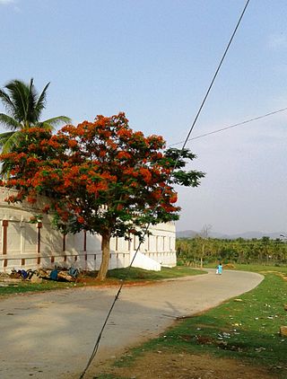
Kalaburagi, formerly known as Gulbarga, is a city in the Indian state of Karnataka. It is the administrative headquarters of the Kalaburagi district and is the largest city in the region of North Karnataka (Kalyana-Karnataka). Kalaburagi is 568 km north of the state capital city of Bangalore. It was incorporated into the newly formed Mysore State through the States Reorganisation Act in 1956.

Arsikere is a city and taluka in the Hassan district in the state of Karnataka, India. It is the second largest city in Hassan district, demographically. Arsikere city municipal council consists of 31 wards. This region is known for its coconut production and is also called Kalpataru Nadu. Arsikere is the taluk headquarters, a major railway junction in the South Western Railway which links Mangalore and Mysore to North Karnataka and a central place for tourists who visit nearby places that do not have rail access, such as Belur, Halebidu and Shravanabelagola, Harnahalli, and Kodimata.

Kalaburagi district, formerly known as Gulbarga district, is one of the 31 districts of Karnataka state in southern India. Kalaburagi city is the administrative headquarters of the district. The district is the headquarters of Kalaburagi division.
Wadi is a census town in Kalaburagi district in the Indian state of Karnataka.The Wadi Town Has a 23 Municipal Ward. The Wadi Junction railway station is an important railway junction on the Indian railways. Gulbarga, which is around 37 km via rail route and 40 km via roadway from Wadi The railway line from Secunderabad to Wadi was started in 1874.
Yalaburga also called Yelburga is a panchayat town in Koppal district in the Indian state of Karnataka.
Aland is a City & Talaku in Kalaburagi district in the state of Karnataka, India. It is the headquarters of Aland Taluk. Aland was formed in 1952 as a town municipal council. It is 683 km from the state capital Bengaluru, 43 km from district headquarters Kalaburagi. It shares border with Maharashtra state and also 85.3 km away from Solapur.
Babaleshwar is a taluka place in the southern state of Karnataka, India. It is located in the Bijapur Taluka of Bijapur district in Karnataka. It is 22 km from the district headquarters, the city of Bijapur.
Huvina Hipparagi also Huvin Hipparagi is a Town in the southern state of Karnataka, India. It is located in the Basavana Bagevadi taluk of Vijayapura district in Karnataka.
Madan Hipperga is a village in the southern state of Karnataka, India. It is located in the Aland taluk of Kalaburagi district in Karnataka.
Nelogi is a village in the southern state of Karnataka, India, It is located in the Jevargi taluk of Kalaburagi district in Karnataka, India,
Nelogi is the famous for Sri Hanuman temple Every year Hanuman Jayanthi and Ashada chaturthi are celebrated very well in this temple. Nelogi is the birthplace of sri neelakanthappa sahu devaramani ex MLA jewargi afterwords CM Dharmasingh, Few Rajput people are staying in Nelogi and their culture belongs to Rajasthan. Shri Kalyan Singh Thakur is Famous person and social worker, He having long mustache and wearing always petha.
Sulepeth is a town in the southern state of Karnataka, India. It is located in the Chincholi taluk of Kalaburagi district in Karnataka. It is 73 km distance from its Headquarter Gulbarga And Extends same Distance to another District Bidar. Sulepeth is famous for Lord Veerbhadreshwar. The Jatra (Festival) starts on Ugadi and ends after 28-30 Days of celebration. Jatra is very special and famous in surroundings.Thousands of people come to visit the celebration on its final day from surrounding places. It is the one of the main business hubs in the taluka.

Yadgir District is one of the 31 districts of Karnataka state in southern India.This district was carved out of Kalaburagi district as the 30th district of Karnataka on 10 April 2010. Yadgir town is the administrative headquarters of the district. The district occupies an area of 5,160.88 km2 (1,992.63 sq mi).
Chamakeri is a village in the Belgaum district of Athani Taluk in the southern Indian state of Karnataka.

Hanamasagar (Halasagar) is a village in the southern state of Karnataka, India. It is located in Vijayapur taluk, of Vijayapur district, Karnataka and is nearly 40 km from the district headquarter Vijayapur. It is a small village which is a pilgrim, having the post office at Kambagi and Babaleshwar hobli.
Gunadal is a panchayat village in the state of Karnataka, India. Administratively it is under Bijapur Taluka of Bijapur district, Karnataka. Located in the far southwestern corner of the district, Gunadal is nearly 45 km by road from the district headquarters, the city of Bijapur. In Gunadal there is a Government Ayurvedic Hospital, Government Veterinary Hospital, Post Office, Police Station and gram panchayat headquarters.
Kambagi is a panchayat village in the southern state of Karnataka, India. Administratively it is under Vijayapur Taluk of Vijayapur District, Karnataka. It is nearly 40 kilometres (25 mi) from district headquarters, the city of Vijayapur, Karnataka. Kambagi has Government Primary HealthCare Center, Post Office, Bank of India and Gram Panchayat offices.
Katakanahalli or Katnalli is a village in the southern state of Karnataka, India. Administratively it is under the panchayat village of Hegadihal, in Bijapur Taluka of Bijapur District, Karnataka. It is nearly 15 km from the district headquarters in the city of Bijapur. It's one of the small villages near to Bijapur city.
Babalad or Muttyna Babalad is a village in the southern state of Karnataka, India. It is located in Bijapur taluk of Bijapur district, Karnataka. It is nearly 25 km from the district headquarters, Bijapur. It's one of several small villages near Bijapur.
Yaragalla is a village in the southern state of Karnataka, India.
Bolachikkalaki village in the southern state of Karnataka, India. Administratively it is under Vijayapur Taluka of Vijayapur district, Karnataka. It is located nearly 45 kilometres from district headquarter Vijayapur.


