Kadamangudi

Last updated

Kadamangudi
village
CountryFlag of India.svg  India
State Tamil Nadu
District Thanjavur
Languages
  Official Tamil
Time zone UTC+5:30 (IST)
PIN
612504
Telephone code0435
Nearest cityKumbakonam
Lok Sabha constituency Mayiladuthurai
Vidhan Sabha constituency Thiruvidaimarudur

Kadamangudi [1] is a village in Thanjavur district of the Indian state of Tamil Nadu, situated along the river Kollidam. It consists of just over 100 families. It is surrounded by the river Kollidam which flows through here in north, village of Veerakkan in the south, village of Koothanur to the east and village of Ayyanallur to the west.

Thanjavur district District in Tamil Nadu, India

Thanjavur District is one of the 37 districts of the state of Tamil Nadu, in southeastern India. Its headquarters is Thanjavur. The district is located in the delta of the Cauvery River and is mostly agrarian. As of 2011, Thanjavur district had a population of 2,405,890 with a sex-ratio of 1,035 females for every 1,000 males.

India Country in South Asia

India, officially the Republic of India, is a country in South Asia. It is the seventh-largest country by area, the second-most populous country, and the most populous democracy in the world. Bounded by the Indian Ocean on the south, the Arabian Sea on the southwest, and the Bay of Bengal on the southeast, it shares land borders with Pakistan to the west; China, Nepal, and Bhutan to the north; and Bangladesh and Myanmar to the east. In the Indian Ocean, India is in the vicinity of Sri Lanka and the Maldives; its Andaman and Nicobar Islands share a maritime border with Thailand and Indonesia.

Tamil Nadu State in Southern India

Tamil Nadu, is one of the 28 states of India. Its capital and largest city is Chennai. Tamil Nadu lies in the southernmost part of the Indian subcontinent and is bordered by the union territory of Puducherry and the South Indian states of Kerala, Karnataka, and Andhra Pradesh. It is bounded by the Eastern Ghats on the north, by the Nilgiri Mountains, the Meghamalai Hills, and Kerala on the west, by the Bay of Bengal in the east, by the Gulf of Mannar and the Palk Strait on the southeast, and by the Indian Ocean on the south. The state shares a maritime border with the nation of Sri Lanka.

It is situated 300 km from the state capital Chennai and 18 km from the nearest big town Kumbakonam. To approach this village you have alight at Thirupanandal or Senganoor on the Chennai-Kumbakonam state highway.

Chennai Megacity in Tamil Nadu, India

Chennai, also known as Madras, is the capital of the Indian state of Tamil Nadu. Located on the Coromandel Coast off the Bay of Bengal, it is the biggest cultural, economic and educational centre of south India. According to the 2011 Indian census, it is the sixth-most populous city and fourth-most populous urban agglomeration in India. The city together with the adjoining regions constitute the Chennai Metropolitan Area, which is the 36th-largest urban area by population in the world. Chennai is among the most-visited Indian cities by foreign tourists. It was ranked the 43rd-most visited city in the world for the year 2015. The Quality of Living Survey rated Chennai as the safest city in India. Chennai attracts 45 percent of health tourists visiting India, and 30 to 40 percent of domestic health tourists. As such, it is termed "India's health capital". As a growing metropolitan city in a developing country, Chennai confronts substantial pollution, as well as other logistical and socio-economic problems.
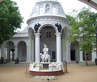
Kumbakonam Town in Tamil Nadu, India

Kumbakonam, is a town and a special grade municipality in the Thanjavur district. It is located 40 km (25 mi) from Thanjavur and 273 km (170 mi) from Chennai. Kumbakonam is known as a "temple city" due to the prevalence of a number of temples here and is noted for its Mahamaham festival which attracts people from all over the country.

Though it has agrarian background like any other village in India, it has distinguished itself from other villages by producing minimum one graduate per family. Also, it has created many teachers and Government employees.

The Thanjavur district ends here and the other side of river Kollidam is in Trichy district.

In 2009 General Elections, it was shifted to Mayiladuturai (Lok Sabha constituency) from Thanjavur district.

Mayiladuturai (Lok Sabha constituency) Lok Sabha Constituency in Tamil Nadu

Mayiladuthurai is a Lok Sabha constituency in Tamil Nadu.

Related Research Articles

Mayiladuthurai DELTA DISTRICT in Tamil Nadu, India

Mayiladuthurai is a major town in Nagapattinam district in Tamil Nadu, India. It is the headquarters of the Mayiladuthurai taluk. The town is located at a distance of 60 km (37 mi) from the district headquarters of Nagapattinam and 281 km (175 mi) from the state capital, Chennai. Mayiladuthurai is known for the Mayuranathaswami Temple, a prominent Shaivite shrine. It is well connected by road and rail transport. Mayiladuthurai serves as a major junction in main line connecting Chennai with Trichy.

Thiruvaiyaru Panchayat Town in Tamil Nadu, India

Thiruvaiyaru is a panchayat town in Thanjavur District in the Indian state of Tamil Nadu. Thiruvaiyaru is situated on the banks of the river Kaveri, 11 km from Thanjavur. Thiruvaaiyaru has an old Siva temple dedicated to Aiyarappar or Panchanatheeswar. Though pilgrims flock to this temple throughout the year, Thiruvaiyaru is more renowned for its association with Saint Thyagaraja, who, along with Muthuswami Dikshitar and Shyama Sastri, comprised the Trinity of Carnatic music. Thiruvaiyaru means Five Rivers around the city. The Five Rivers are Arisilaaru, Vennaaru, Vettaaru, Kudamuruttiyaaru and Kaveriaaru.

Madukkur Town in Tamil Nadu, India

Madukkur is a Panchayat town in Thanjavur District in the Indian state of Tamil Nadu. It is a small town (city) situated in southern part of Tamil Nadu. It is 11 km from Pattukkottai and 15 km from Adirampattinam It is surrounded with number of villages. Being in the Cauvery River Delta Area the inhabitants’ main occupation is agriculture. Classifieds, events, business directory concerning this town are available at madukkur.com

Papanasam Panchayat Town/Sub urban in Tamil Nadu, India

Papanasam is a panchayat town in Thanjavur district in the Indian state of Tamil Nadu. It is located 25 kilometres (16 mi) from Thanjavur and 15 kilometres (9.3 mi) from Kumbakonam. The name literally translates to "Destruction of Sins" in the Tamil language. It is the suburban region of business city of Kumbakonam.

Sethiathoppu panchayat town in Tamil Nadu, India

Sethiathoppu is a panchayat town in Bhuvanagiri Taluk, Cuddalore district in the Indian state of Tamil Nadu. It is situated on the crossroads of Chennai - Tanjore (NH-45C) Highway. Sethiyathope was established as a civilian town by the Cholas in the 11th century C.E. According to Tamil scholars, Sethiyathope was formed as a settlement when the famous Chola King Rajendra moved his capital from Thanjavur to Gangaikondacholapuram which lies 20 km south.

Thiruvidaimarudur Town panchayat in Tamil Nadu, India

Thiruvidaimarudur is a panchayat town in Thanjavur district, in the Indian state of Tamil Nadu. The town is notable for its Mahalingeshwarar Temple, a Hindu shrine for Lord Shiva.

Ayyampettai, Thanjavur Panchayat in Tamil Nadu, India

Ayyampettai is a panchayat town in Thanjavur district in the state of Tamil Nadu, India. It is located 15 km from Thanjavur and 24 km from Kumbakonam. The river Kudamuruthi passes through this town. Chakkarappalli, Pasupathikovil, Valuthoor, Agaramangudi, Vadakumangudi, Iluppakkorai villages are near to the ayyampet town. Roadways are the major means of transportation, while the town also has rail connectivity inbetween Thiruchirapalli - Mayiladuthurai via Thanjavur and Kumbakonam. The nearest airport is Tiruchirapalli International Airport, located 64.3 km away from the town. The nearest seaport is Karaikal Port, which is 81.1 km away from Ayyampettai.

Valuthoor village in Tamil Nadu, India

Valuthoor is a small panchayat village located at papanasam taluk in Thanjavur district in the Indian state of Tamil Nadu. It is 18 km from Tanjore and 22 km from Kumbakonam. The river Kudamurutti passes through this village.

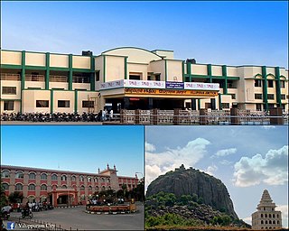
Viluppuram Town in Tamil Nadu, India

Viluppuram(pronunciation ) is a Municipality and the administrative headquarters of Viluppuram district, the largest district in the state of Tamil Nadu, India.

Ammachatram is a village situated 6 km from Kumbakonam to Mayiladuthurai route on [State Highway ] and 277 km away from Chennai. The village is called Mela Ammachatram (West) and Ammachatram (East) that's centered in between UmaMaheswarapuram, Thirunageswaram(Famous for Rahu and Oppiliappan temple), Kumbakonam and Mayiladuthurai which is nearby the panchayat of Thepperumalnallur and comes under Kumbakonam and Thiruvidaimarudur Taluk in Thanjavur District. Ammachatram is a village in Kumbakonam taluk, Thanjavur district, Tamil Nadu.

Devanancheri village in Tamil Nadu, India

Devanancheri is a village in the Kumbakonam taluk of Thanjavur district, Tamil Nadu. It is located 42 km north of the district headquarters in Thanjavur, 8 km from Kumbakonam, and 286 km from the state capital, Chennai. The local language is Tamil.

Sengipatti village in Tamil Nadu, India

Sengipatti is a village in Budalur taluk on the Tanjore–Trichy National Highway of Tanjore district, Tamil Nadu. It is located 23 kilometers from Thanjavur 33 kilometers from Tiruchirapalli 46 kilometers from Pudukkottai 65 kilometers from Ariyalur and 66 kilometers from kumbakonam.

Marungulam is a village in the Thanjavur taluk of Thanjavur district, Tamil Nadu, India.

Umayalpuram is a village in the Papanasam taluk of Thanjavur district, Tamil Nadu, India. Pin-614203; Umayalpuram Sivarama Sastrigal, a famous upanyasagar was born here.

Pattukudi is a small village near Ayyampettai in Thanjavur district in the Indian state of Tamil Nadu. The village is administered by the Puthur Panchayat Board of Papanasam taluk, Tamil Nadu.

Lower Anaicut

The Lower Anaicut or Anaikkarai is a dam and bridge built on the Kollidam in the Indian state of Tamil Nadu.

Rajagiri is a panchayat village in the Papanasam taluk of Thanjavur district, Tamil Nadu, India.

Palaiyur is a village within the Indian state of Tamil Nadu. Palaiyur is located 282 kilometers from Chennai, in Kuttalam Taluk, which is in the Nagapattinam district and shares close border with the Thanjavur district. The current population is just under 2,000. Nearby villages include: Peravoor, Nakkambadi,S.Pudur, Kokkur, and Srikandapuram.

References

  1. Primary Census Abstract Data of Tamil Nadu Archived 2009-08-29 at the Wayback Machine

Coordinates: 11°05′27″N79°25′40″E / 11.090819°N 79.427709°E / 11.090819; 79.427709

Geographic coordinate system Coordinate system

A geographic coordinate system is a coordinate system that enables every location on Earth to be specified by a set of numbers, letters or symbols. The coordinates are often chosen such that one of the numbers represents a vertical position and two or three of the numbers represent a horizontal position; alternatively, a geographic position may be expressed in a combined three-dimensional Cartesian vector. A common choice of coordinates is latitude, longitude and elevation. To specify a location on a plane requires a map projection.