This article needs additional citations for verification .(January 2017) |
Kaffrine | |
|---|---|
 | |
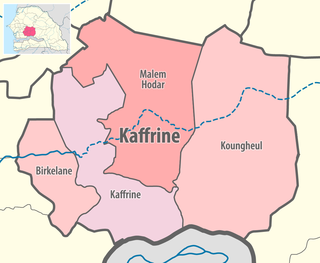 Location in the Kaffrine Region | |
| Country | |
| Region | Kaffrine Region |
| Capital | Kaffrine |
| Area | |
• Total | 11,102 km2 (4,287 sq mi) |
| Population (2023 census) [1] | |
• Total | 280,969 |
| • Density | 25/km2 (66/sq mi) |
| Time zone | UTC+0 (GMT) |
Kaffrine department is one of the 46 departments of Senegal, and is located in the Kaffrine Region, formerly part of the Kaolack Region.
The main settlements are the communes of Kaffrine and Nganda. In addition there are the rural communities (Communautés rurales) of Boulel , Diamagadio , Diokoul Mbelbouck , Gniby , Kahi , Kathiotte and Médinatoul Salam . [2]