The Shag River is located in Otago in the South Island of New Zealand. It rises in the Kakanui Range, flowing southeast for 50 kilometres (31 mi) before reaching the Pacific Ocean on the south side of Shag Point east of Palmerston. The Dunback Branch railway that operated from the 1880s to 1989 largely followed the route of the river from its junction with the Main South Line near Shag Point township to its terminus in Dunback.

The Maniototo Plain, usually simply known as The Maniototo, is an elevated inland region in Otago, New Zealand. The region roughly surrounds the upper reaches of the Taieri River and the Manuherikia River. It is bounded by the Kakanui Range to the north and the Rock and Pillar Range to the southeast. It has a harsh, dry climate, ranging from over 30 °C in mid-summer to -15 °C in mid-winter.
Often incorrectly called The Maungatuas or The Maungatua Range, Maungatua is a prominent ridge which dominates the skyline of the Taieri Plains in Otago, New Zealand. Rising 900 metres above the floodplain of the Taieri River, directly to the west of Dunedin's airport at Momona, it can be clearly seen from much of Dunedin's urban area, 35 kilometres to the east, and from as far south as the outskirts of Balclutha, 65 kilometres to the southwest. Lake Mahinerangi is located on the western side of Maungatua.

Hampden, a rural township in North Otago, New Zealand, lies close to the North Otago coast, 35 kilometres south of Oamaru and 80 kilometres north of the city of Dunedin, to both of which it is connected by State Highway 1.
The small town of Kakanui lies on the coast of Otago, in New Zealand, fourteen kilometres to the south of Oamaru. The Kakanui River and its estuary divide the township in two. The part of the settlement south of the river, also known as Kakanui South, formerly "Campbells Bay", was developed as a collection of cribs. A recent increase in the development of subdivisions has increased the density of dwellings within South Kakanui. The population was 414 people in the 2006 New Zealand census, unchanged from 2001.
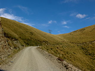
Danseys Pass is a mountain pass located in the Kakanui Mountains, between Central Otago and North Otago, in the South Island of New Zealand.

Outram is a rural suburb of Dunedin, New Zealand, with a population of 642. It is located 28 kilometres west of the central city at the edge of the Taieri Plains, close to the foot of Maungatua. The Taieri River flows close to the southeast of the town. Outram lies on State Highway 87 between Mosgiel and Middlemarch.

Patearoa is a small settlement in inland Otago in New Zealand's South Island. It is located 20 kilometres southwest of Ranfurly, in the Maniototo and was originally known as Sowburn. Andrew Buchanan was an early runholder in Patearoa.
Dunback, formerly Waihemo, is a small town in the Otago region of New Zealand. It is located between Palmerston and Ranfurly on Highway 85. It has a population of about 200 people. Most of these people live in the rural areas near the town. The only remaining buildings now that still stand are the church, the Highwayman Hotel, the coronation hall and the Dunback school. All of these buildings are over 100 years old. There is also the domain which includes a cricket field, camping ground and bowling green. Locals and campers both enjoy the facilities that it has to offer. Along Murphy Street also stands the swing bridge which was built in the early 1900s for pupils to cross the Shag River for easier access to the school.

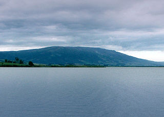
The Kakanui Range is a range of high hills located inland from Oamaru in the South Island of New Zealand. The range forms a boundary between the valley of the Waitaki River to the north and the high plateau known as the Maniototo and the upper watershed of the Taieri River to the southwest. The highest point in the Kakanui Range is Mount Pisgah, at 1643 m (5394 ft).
Fairfield is a suburb of Dunedin, New Zealand.
Maheno is a small North Otago township south of Oamaru in New Zealand. The area has 75 residents. A number of the town's streets are named after places in Tyne and Wear, England, such as Whickham, Felling, Heworth and Jarrow.

Victory Beach is located on the Pacific Ocean coast of the Otago Peninsula, in the South Island of New Zealand, 24 kilometres (15 mi) by road from Dunedin city centre. The longest beach on the peninsula, Victory Beach is located northeast of the entrance to Papanui Inlet and stretches for 3.5 kilometres. The beach's name derives from the wreck of the SS Victory on the beach in 1861.

Burnside is a mainly industrial suburb of the New Zealand city of Dunedin. It is located at the mouth of a long valley, the Kaikorai Valley, through which flows the Kaikorai Stream. This valley stretches to the northeast for 3.5 kilometres (2.2 mi). Burnside is 5.5 kilometres (3.4 mi) to the southwest of the city centre, close to eastern end of the much larger suburb, Green Island. Other suburbs located nearby include Concord, immediately to the southeast and Kenmure further up Kaikorai Valley.
The Kauru River is a river of North Otago, New Zealand. A tributary of the Kakanui River, it rises in the east of the Kakanui Mountains and flows into that river west of Kia Ora.
The Waianakarua River is a river in North Otago, New Zealand, flowing into the Pacific Ocean. It is crossed by Highway 1 at Waianakarua, south of Herbert, by an old historic bridge.
Kia Ora is a small dairy farming locality in North Otago, centred on Kia Ora Hall. It is located 10 kilometres west of Oamaru and a similar distance north of Maheno. The nearest watercourse is Robbs Crossing River, a small tributary of the Kakanui River.

The Wains Hotel Building is a historic hotel building in Dunedin, New Zealand.

Phaulacridium otagoense is an endemic New Zealand grasshopper found at low elevation throughout the central South Island.


