Kakuuto | |
|---|---|
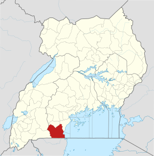
 Kakuuto Location in Uganda | |
| Coordinates: 00°50′24″S31°27′36″E / 0.84000°S 31.46000°E | |
| Country | |
| Region | Central Uganda |
| District | Rakai District |
| Elevation | 3,900 ft (1,200 m) |
Kakuuto is a town in southwestern Central Uganda.
Kakuuto | |
|---|---|
| Kakuuto Location in Uganda | |
| Coordinates: 00°50′24″S31°27′36″E / 0.84000°S 31.46000°E | |
| Country | |
| Region | Central Uganda |
| District | Rakai District |
| Elevation | 3,900 ft (1,200 m) |
Kakuuto is a town in southwestern Central Uganda.
In the middle of February 1979 during the Ugandan-Tanzanian War, the Battle of Simba Hills was fought near the outskirts of Kakuuto by elements of Tanzania People's Defence Force and Ugandan forces loyal to Idi Amin.
Kakuuto is located in Kyotera District, approximately 80 kilometres (50 mi), by road, south of Masaka, the largest city in the sub-region. [1] This location lies immediately west of the highway between Masaka and the border town of Mutukula, at an elevation of 1,200 metres (3,900 ft), above sea level. Mutukula, the border town between Uganda and Tanzania, lies approximately 17 kilometres (11 mi), by road, south of Kakuuto. [2] The coordinates of Kakuuto are:0°50'24.0"S, 31°27'36.0" (Latitude:-0.8400; Longitude:31.4600). [3]
Kakuuto is a small, town in southern Kyotera District. It is the county seat of Kakuuto County. The surrounding area is primarily rural and poor. The population of the area has been greatly adversely affected by the HIV/AIDS epidemic over the past three decades. With the help of charities and NGO's, the town and region is slowly recovering. [4]
The following points of interest lie within the town or close to the town limits:
Rakai District is a district in the Central Region of Uganda. The town of Rakai is the site of the district's headquarters.
Rakai is a town in the Central Region of Uganda. It is the site of the headquarters of Rakai District. Other towns in the district include Kalisizo, Kyotera Kakuuto and Mutukula.
Kyotera is a town in the southern part of the Central Region of Uganda. It is a municipality in Kyotera District. However, the district headquarters are located at Kasaali.
Kalisizo is a town in the southern part of the Central Region of Uganda. Although it is the leading commercial center in Kyotera District, the administrative headquarters of the district are in Kasaali.
Mutukula Airport is an airport serving the town of Mutukula in the Rakai District of the Central Region of Uganda.
Mutukula is a town in the Central Region of Uganda, the third-largest economy in the East African Community. It sits adjacent to Mutukula, Tanzania, directly across the international border between Uganda and Tanzania.
Mutukula, sometimes spelled as Mtukula, is a small town in Missenyi District, Kagera Region, in northwestern Tanzania, at the border with Uganda. Formerly, the settlement on the border was known as Kyebisagazi, and Mutukula was a kilometre to the south on the east side of the Masaka-Bukoba Road (B8).
Masaka Regional Referral Hospital, commonly known as Masaka Hospital is a hospital in the city of Masaka, in south-central Uganda. It is the referral hospital for the districts of Kalangala District, Lyantonde, Masaka and Sembabule, Kalungu, Lwengo, Bukomansimbi and Rakai.
Kakira Sugar Works Limited, often called Kakira Sugar Works, is a leading sugar manufacturer in Uganda, the third-largest economy in the East African Community.
Sango Bay Estates Limited (SBEL), also Sango Bay Estates is a sugar manufacturer in Uganda, the third-largest economy in the East African Community.
Kitovu Hospital is a hospital in Kitovu, a neighborhood within the city of Masaka, Masaka District, Central Uganda. It is a private, community hospital, serving the city of Masaka and surrounding communities. It runs a specialist program to repair obstetric fistulas, that was founded by Dr. Maura Lynch; one of about six centers in the country that can do so.
Sugar & Allied Industries Limited (SAIL), also referred to as Kaliro Sugar Limited is a sugar manufacturer in Uganda.
Sango Bay is a settlement in the southern part of the Central Region of Uganda.
Rakai General Hospital, also known as Rakai District Hospital and Rakai Hospital, is a hospital in the Central Region of Uganda.
Masaka–Mutukula Road is a road in the Central Region of Uganda, connecting the town of Masaka, in Masaka District, to the border town of Mutukula in Rakai District.
Kalisizo General Hospital, also Kalisizo Hospital, is a hospital in the Central Region of Uganda.
Kyotera District is a district in the Central Region of Uganda. Kyotera is the largest town in the district but the district headquarters are located at Kasaali, a suburb of Kyotera.
The Battle of Simba Hills or Battle of Kakuuto was a conflict of the Uganda–Tanzania War that took place over several days in mid-February 1979 around the Simba Hills in southern Uganda, near the town of Kakuuto. Tanzanian troops advanced over the Ugandan border and assaulted the Ugandans' positions, forcing them to retreat.
Kobero–Bugene–Mutukula–Kikagati Road, also Burundi–Tanzania–Uganda Road, is a road in the Kagera Region of Tanzania. The road connects the border towns of Mutukula and Kikagati in Uganda, to the border town of Kobero, in Burundi. The road allows direct access between Uganda and Burundi, promoting exchange of goods and passengers, avoiding routes through Rwanda, where free movement of Ugandan goods and passengers are restricted, since February 2019.
The Isingiro–Ntantamuki–Rakai Road is a road in the Central and Western Regions of Uganda, connecting the towns of Isingiro, in Isingiro District, Western Region and Rakai in Rakai District, Central Region.
Capital: Rakai | ||
| Counties and sub-counties |
|  |
| Towns and villages | ||
| Economy | ||
| Health | ||
| Transport |
| |
| Notable people | ||