The European route E 22 is one of the longest European routes. It has a length of about 5,320 km (3,310 mi). Many of the E-roads have been extended into Asia since the year 2000; the E 22 was extended on 24 June 2002.

Ruthin Castle is a medieval castle fortification in Wales, near the town of Ruthin in the Vale of Clwyd. It was constructed during the late 13th century by Dafydd ap Gruffydd, the brother of Prince Llywelyn ap Gruffudd, on a red sandstone ridge overlooking the valley. Part of the ancient walls still remain and now form part of the Ruthin Castle Hotel.
Zakrzewo is a village in the administrative district of Gmina Lubień Kujawski, within Włocławek County, Kuyavian-Pomeranian Voivodeship, in north-central Poland.
Mićkowa Hać is a village in the administrative district of Gmina Sokółka, within Sokółka County, Podlaskie Voivodeship, in north-eastern Poland, close to the border with Belarus.
Olesin is a village in the administrative district of Gmina Kurów, within Puławy County, Lublin Voivodeship, in eastern Poland.
Żurawce-Osada is a village in the administrative district of Gmina Lubycza Królewska, within Tomaszów Lubelski County, Lublin Voivodeship, in eastern Poland, close to the border with Ukraine.Last known as Zurawce-PGR.

The Reactor Institute Delft, or RID, is a nuclear research institute at Delft University of Technology in Delft, Netherlands.
Franklin High School is the largest high school in Macon County, North Carolina. Franklin High is located in the town of Franklin, next to small shops and residential areas. Attendance is around 900.
Chełchy is a village in the administrative district of Gmina Ełk, within Ełk County, Warmian-Masurian Voivodeship, in northern Poland.
Judziki is a village in the administrative district of Gmina Ełk, within Ełk County, Warmian-Masurian Voivodeship, in northern Poland.
Litwinki is a village in the administrative district of Gmina Nidzica, within Nidzica County, Warmian-Masurian Voivodeship, in northern Poland.

Lạng San is a commune (xã) and village in Na Rì District, Bắc Kạn Province, in Vietnam.

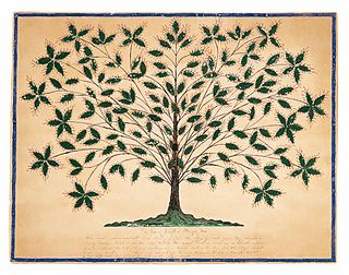
The Mount Lebanon Shaker Village is a historic site associated with the Shakers, a Protestant religious denomination. Founded as a communal group in the 1787, the Shakers located their Central Ministry in New Lebanon, New York, United States, and built a village that eventually covered several thousand acres and housed hundreds of Believers.
Ngọc Lý is a commune (xã) and village in Tân Yên District, Bắc Giang Province, in northeastern Vietnam.
Thanh Hưng is a commune (xã) and village of the Điện Biên District of Điện Biên Province, northwestern Vietnam.

Akhsadan Baba Mausoleum – is a mausoleum of the 14th century, located in Barda, Azerbaijan.
The Leonardo da Vinci University, often simply abbreviated as "Unidav" is a private university founded in 2004 in Torrevecchia Teatina, Italy. It was created and promoted by the D'Annunzio University of Chieti–Pescara.
Kaldbukta is a bay in Van Mijenfjorden in Nordenskiöld Land at Spitsbergen, Svalbard. The bay has a width of about 11.5 kilometers. The large valley Reindalen ends into Kaldbukta. The largest river flowing into the bay is Reindalselva, and also Semmeldalselva and Kalvdalselva ends in Kaldbukta.
Whitebreast Township is a township in Lucas County, Iowa, USA.
Redina is a village in Svoge Municipality, Sofia Province, western Bulgaria.


