
Anantapur, officially Anantapuramu, is a city in Anantapur district of the Indian state of Andhra Pradesh. It is the mandal headquarters of Anantapuru mandal and also the divisional headquarters of Anantapur revenue division. The city is located on National Highway. It was also the headquarters of the Datta Mandalam in 1799. It was also a position of strategic importance for the British Indian Army during the Second World War.
Dharmavaram is a city in Sri Sathya Sai District of the Andhra Pradesh state of Indian country. It is mandal and divisional headquarters of Dharmavaram mandal and Dharmavaram revenue division respectively. The city is known for its handloom silk sarees. The city is renowned for cotton, silk weaving industries and leather puppets. The city is called as Silk city of Andhra Pradesh. Dharmavaram is famous for weavers and it is fully populated by maximum weavers and by developing technology makes changes by producing various types of machine equipment emerging for weavers to weave quickly than the past decades and quality production was happening now and the production was famous for Sarees.

Anantapur district officially: Anantapuramu district is one of the eight districts in the Rayalaseema region of the Indian state of Andhra Pradesh. The district headquarters is located in Anantapur city. It is one of the driest places in South India. As of 2011 census of India, it was the largest district in the state by area and with a population of 2,241,105. Later in the year 2022, as part of re-organisation of districts, Sri Sathya Sai district was carved out and so its area and population reduced by half.

Kurnool district is one of the eight districts in the Rayalaseema region of the Indian state of Andhra Pradesh. It is located in the North western part of the state and is bounded by Nandyal district in the east, Anantapur district in the south, Raichur district of Karnataka in the northwest, Bellary district of Karnataka in the west, and Jogulamba Gadwal district in the north. The city of Kurnool is the headquarters of the district. It has a population of 2,271,686 of which 28.35% were urban as of 2011.

Prakasam (ప్రకాశం)district is one of the thirteen districts in the coastal Andhra region of the Indian state of Andhra Pradesh. It was formed in 1970 and reorganised in 2022 on April 4. The headquarters of the district is Ongole. It is located on the western shore of Bay of Bengal and is bounded by Bapatla district and Palnadu districts on the north, Nandyal district on the west, Kadapa and Nellore districts on the south. A part of north west region also borders with Nagarkurnool district of Telangana. It is the largest district in the state with an area of 14,322 km2 (5,530 sq mi) and had a population of 2,288,026 as per 2011 Census of India.
Rajampet is a Municipality in Annamayya district of the Indian state of Andhra Pradesh, located in the Rayalaseema Region formed on the banks of Cheyyeru River. The town has an average elevation of 139 meters (456 ft). Rajampet is a Grade II Municipality which upgraded in 2019 and has an area of 35.38 square kilometres (13.66 sq mi). It consists of 29 election wards.
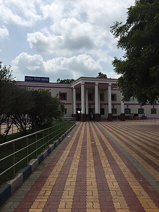
Nandyal is a city and District headquarters of Nandyal district of the Indian state of Andhra Pradesh. It is a municipality and the headquarters of Nandyal mandal in Nandyal revenue division.
Hyderabad district is a most populous district in the state of Telangana in India that contains a part of the metropolitan area of Hyderabad. It is headed by a district collector who is drawn from the IAS cadre and is appointed by the state government. It is the smallest of all the districts in the state, but has the highest human density. Old MCH area, which is central region of Hyderabad city comes under this district.The district share boundaries with Rangareddy and Medhchal districts.
Narasaraopet is a city and district headquarters of Palnadu District of the Indian state of Andhra Pradesh. The town is a municipality and mandal headquarters of Narasaraopet mandal and Headquarters of Narasaraopet revenue division. The town also is the seat of the court of Additional District Judge. Narasaraopet acts as a melting point for the Palnadu and Delta regions of the district. The town is also referred as the 'Gateway of Palnadu'. The main offices of Nagarjuna Sagar Jawahar Canal Operation & Maintenance Lingamguntla Circle are located in this town.
Rayachoti is a town and District headquarters of Annamayya district which is formed after Rajampet of the Indian state of Andhra Pradesh. It is a municipality in Rayachoti Mandal (Tehsil) of the Rayachoti revenue division. It is one of the oldest towns in Andhra Pradesh.

Dhone or Dronachalam is a town in Nandyal district of the Indian state of Andhra Pradesh. It is a municipality located in Dhone mandal. And it is the head quarters of Dhone revenue division.
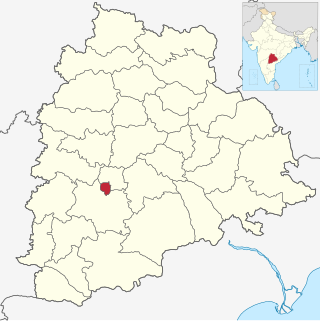
Veldurthi is a mandal in Kurnool district of Andhra Pradesh, India.
Orvakal is a village and a Mandal Head quarter of Orvakal Mandal in Kurnool district in the state of Andhra Pradesh in India. It also part of Kurnool Urban Development Authority.
Chilakaluripet is a city in Palnadu district of the Indian state of Andhra Pradesh. It is the Mandal headquarters of Chilakaluripet Mandal in Narasaraopet Revenue Division.

Guntur Urban mandal was a former mandal in Guntur district of the Indian state of Andhra Pradesh, before it was split into Guntur East and Guntur West mandals in 2018. It was under the administration of Guntur revenue division and its headquarters at Guntur, The mandal was bounded by Medikonduru, Tadikonda, Pedakakani, Edlapadu, Prathipadu, Vatticherukuru and Chebrole mandals.

Penamaluru mandal is one of the 25 mandals in Krishna district of the Indian state of Andhra Pradesh. Penamaluru Mandal is the major suburb of Vijayawada.It is under the administration of Vuyyuru revenue division and its headquarters are located at Penamaluru. The mandal lies on the banks of Krishna River and is bounded by Vijayawada (urban), Vijayawada (rural) and Kankipadu mandals. The mandal is also a part of the Andhra Pradesh Capital Region under the jurisdiction of APCRDA.

Andhra Pradesh Capital Region is the metropolitan region area of Andhra Pradesh state capital, the defacto capital city of Andhra Pradesh. Vijayawada is the headquarters and the largest city of the region. It includes the major ancient cities of Vijayawada, Guntur, and Tenali. Andhra Pradesh Capital Region is one of the largest populated urban areas in the world, with its suburbs Vijayawada, Guntur, and Tenali being the 3rd, 24th, 41st most densely populated cities in the world. Vijayawada is the most densely populated city in India while Guntur is 11th and Tenali is the most populous city of 14th place in Andhra Pradesh. Andhra Pradesh Capital Region is the most populated metropolitan area in the state of Andhra Pradesh and 8th in India. Entire region is under the jurisdiction of Andhra Pradesh Capital Region Development Authority, and covers an area of 8,603 km2 (3,322 sq mi) under 58 mandals, of which 29 are in Krishna district and 29 in Guntur district. The capital region covers 18 mandals fully and 11 mandals partially in Guntur district. In Krishna district, it covers 15 mandals fully and 14 mandals partially under the jurisdiction of APCRDA. The capital city is an Urban Notified Area, and will cover 217.23 km2 (83.87 sq mi), within the Andhra Pradesh Capital Region. As of 1 August 2020, Andhra Pradesh proposed three capitals, which are Visakhapatnam as the executive capital, Amaravati as the legislative capital, and Kurnool as the judicial capital, but the process was cancelled and reverted back to the original 2014 plan of a singular capital city at Amaravati on 22 November 2021.
Kurnool mandal is one of the 54 mandals in Kurnool district of the Indian state of Andhra Pradesh. It is administered under Kurnool revenue division and its headquarters are located at Kurnool. The mandal is situated on the banks of Krishna River and is bounded by C.Belagal, Gudur, Kallur, Orvakal, Midthur and Nandikotkur mandals. As of the 2011 census, it has 406,797 residents.

Annamayya district is one of the twenty-six districts in the Indian state of Andhra Pradesh and one of the eight districts in the Rayalaseema region formed from Rajampeta Parliamentary Constituency. Rayachoti is the district administrative headquarters and Madanapalle is the largest city in the district. The newly formed district has a 64.53% literacy rate, which is lower than the state literacy which stands at 67.35%.
