| Kalteiche | |
|---|---|
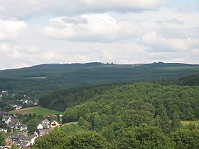
The Kalteiche seen from Wilden (Jun 2007); clearly visible is the windthrow after Hurricane Kyrill (Jan 07) | |
| Highest point | |
| Elevation | 579.9 m above sea level (NHN) (1,903 ft) [1] |
| Coordinates | 50°48′00″N8°08′09″E / 50.800056°N 8.135972°E Coordinates: 50°48′00″N8°08′09″E / 50.800056°N 8.135972°E |
| Geography | |
 Kalteiche | |
| Parent range | Rothaar |
The Kalteiche near Wilgersdorf is a hill, 579.9 m above sea level (NHN) , [1] in the German state of North Rhine-Westphalia. It lies within the county of Siegen-Wittgenstein and is one of the higher summits in the Rothaar Mountains and the highest point in the municipality of Wilnsdorf.

Wilgersdorf is a village in the district Siegen-Wittgenstein in North Rhine-Westphalia, Germany.
Apart from that, it is also the biggest part of the municipality Wilnsdorf.

A hill is a landform that extends above the surrounding terrain. It often has a distinct summit, although in areas with scarp/dip topography a hill may refer to a particular section of flat terrain without a massive summit.

Normalhöhennull or NHN is a vertical datum used in Germany.