History
Wilgersdorf had its first documentary mention in 1377 under the name Vylgirstorff.
In 1491, the villages were completely destroyed by a major fire. In 1563, the plaque killed 10 of the 204 inhabitants, in 1636 45% died of hunger or disease. From 1579 onwards the village belonged to the parish of Haiger, since 1595 to Wilnsdorf. 1716 started with the construction of a Simultaneum in the village. The place fell under the control of John of Nassau in 1621. Wilgersdorf was united to one municipality with Wilnsdorf and Rödgen in 1648 and assigned to the Amt of Wilnsdorf in 1818. Big fires destroyed many houses in 1857 and 1920. Piped water supply was available by 1906 and by 1911 the local mill provided electricity for the village. The fire service was established in 1927. In 1953 a Protestant community house was built. A Catholic church was consecrated in 1957, followed by a Protestant church in the 60's.
In 1963 dwelling and smelting places of the La Tène culture (500 B.C., Iron Age) were found on the territory.
The Amt of Wilnsdorf was disbanded in 1969 and Wilgersdorf was integrated into the new municipality of Wilnsdorf.
Mines
The mine Neue Hoffnung (transl.: new hope) was operated with 300 workers from 1883 to 1913 with a total depth of 440 m (1443 ft). Zinc-, Lead- and Silverores and also Ironore was mined. Other mines were Neues Jerusalem, Viktoria and Bomkutte.
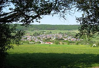
The Westerwald is a low mountain range on the right bank of the river Rhine in the German federal states of Rhineland-Palatinate, Hesse and North Rhine-Westphalia. It is a part of the Rhenish Massif. Its highest elevation, at 657 m above sea level, is the Fuchskaute in the High Westerwald.

The Lahn is a 245.6-kilometer (152.6 mi)-long, right tributary of the Rhine in Germany. Its course passes through the federal states of North Rhine-Westphalia (23.0 km), Hesse (165.6 km), and Rhineland-Palatinate (57.0 km).

Aegidienberg is a district of Bad Honnef in the Rhein-Sieg-Kreis, North Rhine-Westphalia, Germany. It consists of thirteen villages and is located east of the Siebengebirge range in the Niederwesterwald foothills. Until 1969, Aegidienberg was an independent municipality in the former district (Kreis) of Sieg. The name refers to Saint Aegidius, the patron saint of the local Catholic parish church; until the 16th century, the locality was known as Hunferode or Honnefer Rott. Population: 7089 (2013).

Dillenburg, officially Oranienstadt Dillenburg, is a town in Hesse's Gießen region in Germany. The town was formerly the seat of the old Dillkreis district, which is now part of the Lahn-Dill-Kreis.

Ellmau is a municipality in the district of Kufstein in the Austrian region of Sölllandl. It lies 12 km southeast of Kufstein and 9 km west of Sankt Johann in Tirol. It is located at an elevation of 820 m above sea level. It was mentioned for the first time in the records in 1155 and is nowadays part of the Ski Welt skiing area.
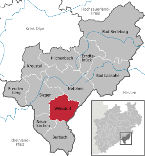
Wilnsdorf is a municipality in the district of Siegen-Wittgenstein, in North Rhine-Westphalia, Germany.
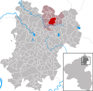
Bad Marienberg (Westerwald) is a town in the Westerwaldkreis in Rhineland-Palatinate, Germany, and also the seat of the like-named Verbandsgemeinde, a kind of collective municipality.

Sankt Andreasberg is a former town in the district of Goslar, in Lower Saxony, Germany. Since 1 November 2011, it is part of the town Braunlage. It is situated in the Harz, approximately 7 km west of Braunlage proper, and 20 km east of Osterode am Harz.

Aßlar is a town near Wetzlar in the Lahn-Dill-Kreis in Hesse, Germany.
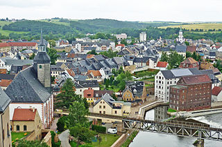
Rochlitz is a major district town in the district of Mittelsachsen, in the Free State of Saxony, Germany. Rochlitz is the head of the "borough partnership Rochlitz" with its other members being the boroughs of Königsfeld, Seelitz und Zettlitz.

Breitscheid is a community in the Lahn-Dill-Kreis in Hesse, Germany.
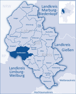
Greifenstein is a community in the Lahn-Dill-Kreis in Hesse, Germany. Its administrative seat is Beilstein. Greifenstein covers 67.43 km² on the eastern slope of the Westerwald range. Its name comes from the castle of the same name in the constituent community of the same name, where the German Bell Museum is to be found, with about 50 bells showing the development of bell pouring.

Böttingen is a municipality in the district of Tuttlingen in Baden-Württemberg in Germany. In recent decades it has developed from an agricultural village to an advanced industrial community.

Lesachtal is a municipality in Hermagor District, in the Austrian state of Carinthia. It comprises the western part of the eponymous valley formed by the upper Gail River, and stretches from the Carinthian border with East Tyrol down to Kötschach-Mauthen in the east.

Going am Wilden Kaiser is a municipality in the district of Kitzbühel in the Austrian region of Sölllandl. It is located 8.5 km northwest of Kitzbühel and 5 km west of Sankt Johann in Tirol. The village has 1849 inhabitants and is divided into 5 sub-districts. Its main source of income is tourism. It is connected to the large Ski Welt skiing area by the Astbergbahn chairlift, which takes skiers rapidly from Going in the valley up to the large expanse of ski terrain on the mountainsides.
The formerly independent municipality of Singlis merged with Borken in 1974 at which time its population was 880. It lies within the county of Schwalm-Eder-Kreis in Hesse, Germany.

The Rothaarsteig is a 154.80 km long hiking trail along the crest of the Rothaargebirge mountain range in Germany in the border region between the states of North Rhine-Westphalia (NW) and Hesse (HE). It was opened in 2001.

Henry I of Nassau-Siegen, German: Heinrich I. von Nassau-Siegen was Count of Nassau-Siegen, a part of the County of Nassau, and ancestor of the House of Nassau-Siegen. He comes from the Ottonian branch of the House of Nassau.
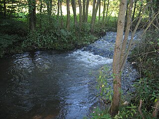
The Weiß is a river of North Rhine-Westphalia, Germany, which is 18.1 kilometers (11.2 mi) in length. Its source is near the mountain Kalteiche, at a height of 493 meters (1,617 ft) above sea level. Then it flows through the villages Wilgersdorf, Rudersdorf, Anzhausen, Niederdielfen, Kaan-Marienborn, and the city Siegen. The Weiß flows into the Sieg in Siegen, at 247 meters elevation.

The Alarmstange, at 545.2 m above sea level (NHN), is the highest point in the Montabaur Heights, a hill ride on the southwestern edge of the Westerwald. It lies near Horressen in the county of Westerwaldkreis in the German state of Rhineland-Palatinate. Together with the Köppel and the Lippersberg, the Alarmstange forms the centre of the ridge, on which is the largest contiguous woodland area in the Westerwald.


