Kameno Municipality

Last updated
Kameno Municipality
Община Камено
Municipality (Obshtina)

Map of Kameno municipality (Burgas Province).png
Location in Burgas province

Location on map of Bulgaria
Obshchina Kameno (B'lgariia).gif
Country Bulgaria
Province (Oblast) Burgas
Seat Kameno
Area
  Total 354.95 km2 (137.05 sq mi)
Population (2011)
  Total 10,393
  Density 29/km2 (76/sq mi)
Time zone EET (UTC+2)
  Summer (DST) EEST (UTC+3)
Website www.kameno.bg

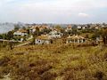
Kameno Municipality (Bulgarian: Община Камено, Obshtina Kameno) is a municipality in Burgas Province, Bulgaria. It includes the towns of Kameno and a number of villages.

Bulgarian language South Slavic language

Bulgarian, is an Indo-European language and a member of the Southern branch of the Slavic language family.

Burgas Province Province in Bulgaria

Burgas Province is a province in southeastern Bulgaria, including southern Bulgarian Black Sea Coast. The province is named after its administrative and industrial centre - the city of Burgas - the fourth biggest town in the country. It is the largest province by area, embracing a territory of 7,748.1 km2 (2,991.6 sq mi) that is divided into 13 municipalities with a total population, as of December 2009, of 422,319 inhabitants.

Kameno Place in Burgas, Bulgaria

Kameno is a small town in southeastern Bulgaria, part of Burgas Province. It is the administrative centre of the homonymous Kameno Municipality, which lies in the central part of the Province. As of December 2009, the town has a population of 4,848 inhabitants.

Related Research Articles

Balgarovo Place in Burgas, Bulgaria

Balgarovo is a small town in southeastern Bulgaria. It is located in Burgas Municipality and is close to the town of Kameno.

Dolna Banya Municipality Municipality in Sofia Province, Bulgaria

Dolna Banya Municipality is a municipality in Sofia Province, Bulgaria. It is best known for hosting Adolf Hitler on his roundabout tour of his captured dominions in 1942.

Krastina is a village in Kameno Municipality, in Burgas Province, in southeastern Bulgaria.

Livada is a village in Kameno Municipality, in Burgas Province, in southeastern Bulgaria.

Polski Izvor is a village in Kameno Municipality, in Burgas Province, in southeastern Bulgaria.

Rusokastro is a village in Kameno Municipality, in Burgas Province, in southeastern Bulgaria.

Svoboda, Burgas Province Village in Burgas Province, Bulgaria

Svoboda is a village in Kameno Municipality, in Burgas Province, in southeastern Bulgaria.

Vinarsko is a village in Kameno Municipality, in Burgas Province, in southeastern Bulgaria.

Vratitsa is a village in Kameno Municipality, in Burgas Province, in southeastern Bulgaria.

Zhelyazovo is a village in Kameno Municipality, in Burgas Province, in southeastern Bulgaria.

Kubadin is a village in Sredets Municipality, in Burgas Province, in southeastern Bulgaria.

Kostino is a village in Kardzhali Municipality, Kardzhali Province, southern Bulgaria.

Zvunche is a village in Kardzhali Municipality, Kardzhali Province, southern Bulgaria.

Babinska Reka is a village in Bobov Dol Municipality, Kyustendil Province, south-western Bulgaria.

Dolistovo is a village in Bobov Dol Municipality, Kyustendil Province, south-western Bulgaria.

Shatrovo is a village in Bobov Dol Municipality, Kyustendil Province, south-western Bulgaria.

Blatino is a village in Dupnitsa Municipality, Kyustendil Province, south-western Bulgaria.

Cherven Breg is a village in Dupnitsa Municipality, Kyustendil Province, south-western Bulgaria.

Dolna Grashtitsa is a village in Kyustendil Municipality, Kyustendil Province, south-western Bulgaria.

References

    Commons-logo.svg Media related to Kameno Municipality at Wikimedia Commons

    Coordinates: 42°34′01″N27°18′00″E / 42.5670°N 27.3000°E / 42.5670; 27.3000

    Geographic coordinate system Coordinate system

    A geographic coordinate system is a coordinate system that enables every location on Earth to be specified by a set of numbers, letters or symbols. The coordinates are often chosen such that one of the numbers represents a vertical position and two or three of the numbers represent a horizontal position; alternatively, a geographic position may be expressed in a combined three-dimensional Cartesian vector. A common choice of coordinates is latitude, longitude and elevation. To specify a location on a plane requires a map projection.