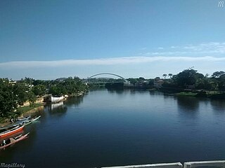
Chazy River is the name of two tributaries of Lake Champlain in Clinton County, New York in the United States.

The Roman Catholic Diocese of Corpus Christi is a Roman Catholic diocese in Texas. It was founded on March 23, 1912, having been the Vicariate Apostolic of Brownsville until then.

European route E 80, also known as Trans-European Motorway or TEM, is an A-Class West-East European route, extending from Lisbon, Portugal to Gürbulak, Turkey, on the border with Iran. The road connects 10 countries and has a length of approximately 6,102 kilometres (3,792 mi). At its eastern end it joins end-on with Asian Highway AH1 which continues all the way to Japan.

Division No. 5 is one of eighteen census divisions in the province of Saskatchewan, Canada, as defined by Statistics Canada. It is located in the east-southeastern part of the province, bordering Manitoba. The most populous community in this division is Melville.
Piper Pass is a mountain pass in the United States Range, Nunavut, Canada.
Vysokogorsk is a rural locality in Kavalerovsky District of Primorsky Krai, Russia, located in the Sikhote-Alin Mountains, 30 kilometers (19 mi) northeast of the district's administrative center of Kavalerovo. Population: 293 (2010 Census); 474 (2002 Census); 888 (1989 Census).

Kije is a village in the administrative district of Gmina Błaszki, within Sieradz County, Łódź Voivodeship, in central Poland. It lies approximately 11 kilometres (7 mi) south of Błaszki, 25 km (16 mi) west of Sieradz, and 78 km (48 mi) west of the regional capital Łódź.

Wólka Grodziska is a village in the administrative district of Gmina Grodzisko Dolne, within Leżajsk County, Subcarpathian Voivodeship, in south-eastern Poland. It lies approximately 6 kilometres (4 mi) north-west of Grodzisko Dolne, 10 km (6 mi) south of Leżajsk, and 34 km (21 mi) north-east of the regional capital Rzeszów.

Marianów Sierakowski is a village in the administrative district of Gmina Gostynin, within Gostynin County, Masovian Voivodeship, in east-central Poland. It lies approximately 8 kilometres (5 mi) south-west of Gostynin and 110 km (68 mi) west of Warsaw.
Stara Huta is a village in the administrative district of Gmina Puszcza Mariańska, within Żyrardów County, Masovian Voivodeship, in east-central Poland.

Burg Kammerstein/ Ehrenfels is a castle in the town of Kammern im Liesingtal in Styria, Austria. Burg Kammerstein is 129 metres (423 ft) above sea level.

São Félix do Coribe is a municipality in the state of Bahia in the North-East region of Brazil.

Twelve Corners is an unincorporated community in the town of Center in Outagamie County, Wisconsin, United States.
Naistevalla is a village in Märjamaa Parish, Rapla County in western Estonia.

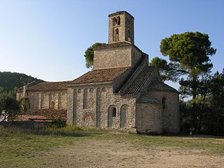
Sant Ponç de Corbera is a Benedictine Priory, located between Cervelló and Corbera de Llobregat in the Province of Barcelona, Catalonia, Spain. It was declared a Bien de Interés Cultural landmark on 3 June 1931.

Needmore is an unincorporated community in Clinton Township, Vermillion County, in the U.S. state of Indiana.
Hisega is an unincorporated community in Pennington County, in the U.S. state of South Dakota.

Kanata Manayunk is an unincorporated community in Turkey Creek Township, Kosciusko County, in the U.S. state of Indiana.

Enchanted Hills is an unincorporated community in Turkey Creek Township, Kosciusko County, in the U.S. state of Indiana.

Stadio Città di Gorgonzola is a multi-use stadium in Gorgonzola, Italy. It is currently used mostly for football matches and is the home ground of Giana Erminio. The stadium holds 3,766.


